Rudy, also known as Rudy Wielkie or Rudy Raciborskie, is a village in the administrative district of Gmina Kuźnia Raciborska, within Racibórz County, Silesian Voivodeship, in southern Poland. It lies approximately 12 kilometres (7 mi) east of Kuźnia Raciborska, 20 km (12 mi) north-east of Racibórz, and 40 km (25 mi) west of the regional capital Katowice. The village has a population of 2,800.

Gmina Krzanowice, German Gemeinde Kranowitz is an urban-rural gmina in Racibórz County, Silesian Voivodeship, in southern Poland, on the Czech border. Its seat is the town of Krzanowice (Kranowitz), which lies approximately 11 kilometres (7 mi) south-west of Racibórz and 68 km (42 mi) west of the regional capital Katowice.

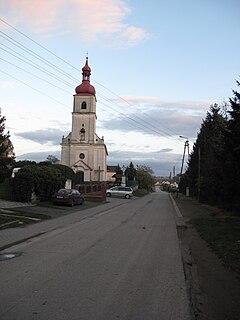
Gmina Rudnik is a rural gmina in Racibórz County, Silesian Voivodeship, in southern Poland. Its seat is the village of Rudnik, which lies approximately 7 kilometres (4 mi) north-west of Racibórz and 60 km (37 mi) west of the regional capital Katowice.

Zadowice is a village in the administrative district of Gmina Godziesze Wielkie, within Kalisz County, Greater Poland Voivodeship, in west-central Poland. It lies approximately 13 kilometres (8 mi) south of Kalisz and 117 km (73 mi) south-east of the regional capital Poznań.
Pogrzebień is a village in the administrative district of Gmina Kornowac, within Racibórz County, Silesian Voivodeship, in southern Poland. It lies approximately 2 kilometres (1 mi) south-west of Kornowac, 6 km (4 mi) east of Racibórz, and 54 km (34 mi) west of the regional capital Katowice.

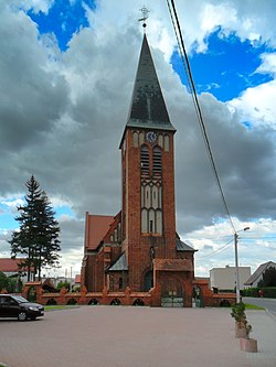
Krzyżanowice is a village in Racibórz County, Silesian Voivodeship, in southern Poland, close to the Czech border. It is the seat of the gmina called Gmina Krzyżanowice. It lies approximately 10 kilometres (6 mi) south of Racibórz and 60 km (37 mi) south-west of the regional capital Katowice.
Amandów is a village in the administrative district of Gmina Pietrowice Wielkie, within Racibórz County, Silesian Voivodeship, in southern Poland, close to the Czech border. It lies approximately 8 kilometres (5 mi) north of Pietrowice Wielkie, 15 km (9 mi) north-west of Racibórz, and 68 km (42 mi) west of the regional capital Katowice.

Cyprzanów is a village in the administrative district of Gmina Pietrowice Wielkie, within Racibórz County, Silesian Voivodeship, in southern Poland, close to the Czech border. It lies approximately 3 kilometres (2 mi) south-east of Pietrowice Wielkie, 10 km (6 mi) west of Racibórz, and 68 km (42 mi) west of the regional capital Katowice.
Gródczanki is a village in the administrative district of Gmina Pietrowice Wielkie, within Racibórz County, Silesian Voivodeship, in southern Poland, close to the Czech border. It lies approximately 4 kilometres (2 mi) south-west of Pietrowice Wielkie, 14 km (9 mi) west of Racibórz, and 71 km (44 mi) west of the regional capital Katowice.

Krowiarki is a village in the administrative district of Gmina Pietrowice Wielkie, within Racibórz County, Silesian Voivodeship, in southern Poland, close to the Czech border. It lies approximately 6 kilometres (4 mi) north of Pietrowice Wielkie, 14 km (9 mi) north-west of Racibórz, and 68 km (42 mi) west of the regional capital Katowice.

Lekartów is a village in the administrative district of Gmina Pietrowice Wielkie, within Racibórz County, Silesian Voivodeship, in southern Poland, close to the Czech border. It lies approximately 5 kilometres (3 mi) south-east of Pietrowice Wielkie, 8 km (5 mi) west of Racibórz, and 66 km (41 mi) west of the regional capital Katowice.
Maków is a village in the administrative district of Gmina Pietrowice Wielkie, within Racibórz County, Silesian Voivodeship, in southern Poland, close to the Czech border. It lies approximately 3 kilometres (2 mi) north of Pietrowice Wielkie, 12 km (7 mi) west of Racibórz, and 68 km (42 mi) west of the regional capital Katowice.

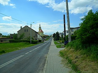
Pietrowice Wielkie is a village in Racibórz County, Silesian Voivodeship, in southern Poland, close to the Czech border. It is the seat of the gmina called Gmina Pietrowice Wielkie. It lies approximately 11 kilometres (7 mi) west of Racibórz and 68 km (42 mi) west of the regional capital Katowice.

Samborowice is a village in the administrative district of Gmina Pietrowice Wielkie, within Racibórz County, Silesian Voivodeship, in southern Poland, close to the Czech border. It lies approximately 5 kilometres (3 mi) south-east of Pietrowice Wielkie, 10 km (6 mi) south-west of Racibórz, and 67 km (42 mi) west of the regional capital Katowice.

Żerdziny is a village in the administrative district of Gmina Pietrowice Wielkie, within Racibórz County, Silesian Voivodeship, in southern Poland, close to the Czech border. It lies approximately 5 kilometres (3 mi) east of Pietrowice Wielkie, 7 km (4 mi) west of Racibórz, and 64 km (40 mi) west of the regional capital Katowice.
Gamów is a village in the administrative district of Gmina Rudnik, within Racibórz County, Silesian Voivodeship, in southern Poland. It lies approximately 4 kilometres (2 mi) west of Rudnik, 10 km (6 mi) north-west of Racibórz, and 64 km (40 mi) west of the regional capital Katowice.
Ponięcice is a village in the administrative district of Gmina Rudnik, within Racibórz County, Silesian Voivodeship, in southern Poland. It lies approximately 6 kilometres (4 mi) north of Rudnik, 12 km (7 mi) north-west of Racibórz, and 61 km (38 mi) west of the regional capital Katowice.

Sławienko is a village in the administrative district of Gmina Rudnik, within Racibórz County, Silesian Voivodeship, in southern Poland. It lies approximately 6 kilometres (4 mi) north-west of Rudnik, 12 km (7 mi) north-west of Racibórz, and 65 km (40 mi) west of the regional capital Katowice.
Kornice is a village in the administrative district of Gmina Pietrowice Wielkie, within Racibórz County, Silesian Voivodeship, in southern Poland, close to the Czech border. It lies approximately 3 kilometres (2 mi) east of Pietrowice Wielkie, 9 km (6 mi) west of Racibórz, and 66 km (41 mi) west of the regional capital Katowice.