Petroleum geology is the study of the origins, occurrence, movement, accumulation, and exploration of hydrocarbon fuels. It refers to the specific set of geological disciplines that are applied to the search for hydrocarbons.

An oil well is a drillhole boring in Earth that is designed to bring petroleum oil hydrocarbons to the surface. Usually some natural gas is released as associated petroleum gas along with the oil. A well that is designed to produce only gas may be termed a gas well. Wells are created by drilling down into an oil or gas reserve and if necessary equipped with extraction devices such as pumpjacks. Creating the wells can be an expensive process, costing at least hundreds of thousands of dollars, and costing much more when in difficult-to-access locations, e.g., offshore. The process of modern drilling for wells first started in the 19th century but was made more efficient with advances to oil drilling rigs and technology during the 20th century.
In petroleum exploration and development, formation evaluation is used to determine the ability of a borehole to produce petroleum. Essentially, it is the process of "recognizing a commercial well when you drill one".

Hydrocarbon exploration is the search by petroleum geologists and geophysicists for deposits of hydrocarbons, particularly petroleum and natural gas, in the Earth's crust using petroleum geology.
Permeability in fluid mechanics, materials science and Earth sciences is a measure of the ability of a porous material to allow fluids to pass through it.

Coalbed methane, coalbed gas, or coal seam gas (CSG) is a form of natural gas extracted from coal beds. In recent decades it has become an important source of energy in United States, Canada, Australia, and other countries.
Well logging, also known as borehole logging is the practice of making a detailed record of the geologic formations penetrated by a borehole. The log may be based either on visual inspection of samples brought to the surface or on physical measurements made by instruments lowered into the hole. Some types of geophysical well logs can be done during any phase of a well's history: drilling, completing, producing, or abandoning. Well logging is performed in boreholes drilled for the oil and gas, groundwater, mineral and geothermal exploration, as well as part of environmental and geotechnical studies.
A petroleum reservoir or oil and gas reservoir is a subsurface accumulation of hydrocarbons contained in porous or fractured rock formations. Such reservoirs form when kerogen is created in surrounding rock by the presence of high heat and pressure in the Earth's crust.
In petrophysics, Archie's law is a purely empirical law relating the measured electrical conductivity of a porous rock to its porosity and fluid saturation. It is named after Gus Archie (1907–1978) and laid the foundation for modern well log interpretation, as it relates borehole electrical conductivity measurements to hydrocarbon saturations.
Petrophysics is the study of physical and chemical rock properties and their interactions with fluids.
Reservoir simulation is an area of reservoir engineering in which computer models are used to predict the flow of fluids through porous media.

A fracture is any separation in a geologic formation, such as a joint or a fault that divides the rock into two or more pieces. A fracture will sometimes form a deep fissure or crevice in the rock. Fractures are commonly caused by stress exceeding the rock strength, causing the rock to lose cohesion along its weakest plane. Fractures can provide permeability for fluid movement, such as water or hydrocarbons. Highly fractured rocks can make good aquifers or hydrocarbon reservoirs, since they may possess both significant permeability and fracture porosity.
Effective porosity is most commonly considered to represent the porosity of a rock or sediment available to contribute to fluid flow through the rock or sediment, or often in terms of "flow to a borehole". Porosity that is not considered "effective porosity" includes water bound to clay particles and isolated "vuggy" porosity. The effective porosity is of great importance in considering the suitability of rocks or sediments as oil or gas reservoirs, or as aquifers.
Heavy oil production is a developing technology for extracting heavy oil in industrial quantities. Estimated reserves of heavy oil are over 6 trillion barrels, three times that of conventional oil and gas.
In the oil and gas industry, reservoir modeling involves the construction of a computer model of a petroleum reservoir, for the purposes of improving estimation of reserves and making decisions regarding the development of the field, predicting future production, placing additional wells and evaluating alternative reservoir management scenarios.
The black-oil equations are a set of partial differential equations that describe fluid flow in a petroleum reservoir, constituting the mathematical framework for a black-oil reservoir simulator. The term black-oil refers to the fluid model, in which water is modeled explicitly together with two hydrocarbon components, one (pseudo) oil phase and one (pseudo-)gas phase. This is in contrast with a compositional formulation, in which each hydrocarbon component is handled separately.
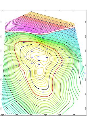
The Halibut Field is an oil field, within the Gippsland Basin offshore of the Australian state of Victoria. The oil field is located approximately 64 km offshore of southeastern Australia. The total area of this field is 26.9 km2 and is composed of 10 mappable units.

Oil and gas reserves denote discovered quantities of crude oil and natural gas that can be profitably produced/recovered from an approved development. Oil and gas reserves tied to approved operational plans filed on the day of reserves reporting are also sensitive to fluctuating global market pricing. The remaining resource estimates are likely sub-commercial and may still be under appraisal with the potential to be technically recoverable once commercially established. Natural gas is frequently associated with oil directly and gas reserves are commonly quoted in barrels of oil equivalent (BOE). Consequently, both oil and gas reserves, as well as resource estimates, follow the same reporting guidelines, and are referred to collectively hereinafter as oil & gas.

Fault zone hydrogeology is the study of how brittlely deformed rocks alter fluid flows in different lithological settings, such as clastic, igneous and carbonate rocks. Fluid movements, that can be quantified as permeability, can be facilitated or impeded due to the existence of a fault zone. This is because different mechanisms that deform rocks can alter porosity and permeability within a fault zone. Fluids involved in a fault system generally are groundwater and hydrocarbons.
The Officer Basin is an intracratonic sedimentary basin that covers roughly 320,000 km2 along the border between southern and western Australia. Exploration for hydrocarbons in this basin has been sparse, but the geology has been examined for its potential as a hydrocarbon reservoir. This basin's extensive depositional history, with sedimentary thicknesses exceeding 6 km and spanning roughly 350 Ma during the Neoproterozoic, make it an ideal candidate for hydrocarbon production.