Dadeldhura, a part of Sudurpashchim Province, is one of the seventy-seven districts of Nepal. The district, with Dadeldhura as its district headquarters, covers an area of 1,538 km2 (594 sq mi) and had a population of 126,162 in 2001 and 142,094 in 2011.

Gulmi District, a part of Lumbini Province, is one of the seventy-seven districts of Nepal. The district, with Tamghas as its headquarters, covers an area of 1,149 km2 (444 sq mi), had a population of 296,654 in 2001, 280,160 in 2011 and 268,597 in 2016.

Jhapa District is a district of Koshi Province in eastern Nepal named after a Rajbanshi |Surjapuri language word "Jhapa" meaning "to cover" (verb). The latest official data, the 2021 Nepal Census, puts the total population of the district at 994,090. The total area of the district is 1,606 square kilometres.

Kailali District, a part of Sudurpashchim Province in Terai plain, is one of the 77 districts of Nepal. The district, with Dhangadhi as its district headquarters, covers an area of 3,235 square kilometres (1,249 sq mi) and has a population 911,155 and, .
Mahottari District, a part of Madhesh Province, is one of the seventy-seven districts of Nepal. The district, with Jaleshwar as its district headquarters, covers an area of 1,002 km2 (387 sq mi) and had a population of 553,481 in 2001, 627,580 in 2011 and 705,838 in 2021 census. Its headquarters is located in Jaleshwar, a neighbouring town of the historical city of Janakpur. The name Jaleshwar means the 'God in Water'. One can find a famous temple of Lord Shiva in Water there. Jaleshwar lies at a few kilometres distance from the Nepal-India border and has a majority Maithili population.
Rangeli is a Municipality and rural market town in Morang District in the Koshi Zone of south-eastern Nepal. This municipality was formed merging existing four villages i.e.Amgachhi, Babiabirta, Darbesa and Rangeli itself since May 2014.
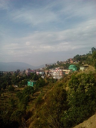
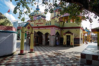
Marku is a village in the Chaurpati Rural Municipality of Achham District in the Sudurpashchim Province of western Nepal. At the time of the 1991 Nepal census the village had a population of 1855 living in 413 houses. At the time of the 2001 Nepal census, the population was 2058 of which 41% was literate. In Marku there is a most popular temple which called "Shri Shannikot Bajrayogini Maai"Now Marku is a ward of Chaurpati Rural Municipality. Pauwabazar, Birkhamma and Malikasthaan are the small market areas of Marku.
Siudi is a small town in the Chaurpati Rural Municipality of Achham District in the Sudurpashchim Province of western Nepal. At the time of the 1991 Nepal census, the town had a population of 3744 living in 816 houses. At the time of the 2001 Nepal census, the population was 4533, of which 21% was literate.
Sangachok is a village and market center of Chautara Sangachokgadi Municipality in Sindhupalchok District in the Bagmati Zone of central Nepal. The formerly Village Development Committee was merged to form the new municipality on 2017. At the time of the 2013 Nepal census it had a population of 10,791 and had 1,828 houses in the village.
Patarasi is a rural municipality located in Jumla District of Karnali Province of Nepal.
Chulachuli is a rural municipality (gaunpalika) out of six rural municipality located in Ilam District of Koshi Province of Nepal. There are a total of 10 municipalities in Ilam in which 4 are urban and 6 are rural.

Nijgadh, is a town and municipality in Nepal, located in Bara District of the Madhesh Province. The total area of the municipality is 289.4 sq. km. The municipality was formed on 8 May 2014 by merging Nijgadh VDC with Ratnapuri VDC and Bharatganj Singaul VDC.
Shantinagar is a town and a Rural municipality in Dang District in Lumbini Province of south-western Nepal. At the time of the 1991 Nepal census it had a population of 8,854.
Dhikurpokhari is a suburb and former Village Development Committee in Kaski District in the Gandaki Province of northern-central Nepal. At the time of the 1991 Nepal census it had a population of 7,392 persons living in 1,427 individual households.

Timure is a small town and headquarter of ward no. 2 of Gosaikund rural municipality. It is about 19 km north from Syaphru.
Triveni is a rural municipality in Salyan District in the Karnali Province of western-central Nepal. At the time of the 1991 Nepal census it had a population of 3789 people living in 710 individual households.
Bhagwanpur is a rural municipality in Siraha District in Province No. 2 of south-eastern Nepal. At the time of the 2011 Nepal census it had a population of 20957 people living. It is located nearly 370 kilometers or 107 miles east of the capital, Kathmandu.
Helambu is a rural municipality and former village development committee located in Sindhupalchok District of Bagmati Province of central Nepal.
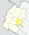
Chaurpati is a Gaupalika(Nepali: गाउपालिका ; gaupalika) in Achham District in the Sudurpashchim Province of far-western Nepal.