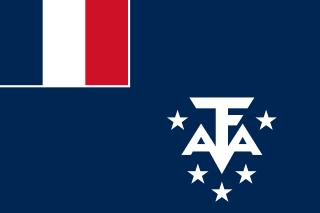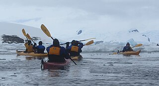
Adélie Land or Adélie Coast is a claimed territory of France located on the continent of Antarctica. It stretches from a portion of the Southern Ocean coastline all the way inland to the South Pole. France has administered it as one of five districts of the French Southern and Antarctic Lands since 1955 and applied the Antarctic Treaty System rules since 1961. Article 4 of the Antarctic Treaty deals with territorial claims, and although it does not renounce or diminish any preexisting claims to sovereignty, it also does not prejudice the position of contracting parties in their recognition or non-recognition of territorial sovereignty. France has had a permanent station in Adélie Land since 9 April 1950.

Booth Island is a Y-shaped island, 5 nautical miles long and rising to 980 metres (3,220 ft) in the northeast part of the Wilhelm Archipelago, Antarctica.
The Merrick Mountains are a cluster of mountains, 8 nautical miles long, standing 7 nautical miles northeast of the Behrendt Mountains in Ellsworth Land, Antarctica.

Alto Rio Doce is a Brazilian municipality in the state of Minas Gerais. As of 2020 its population is estimated to be 10,859.
The Flood Range is a range of large snow-covered mountains extending in an east–west direction for about 60 nautical miles and forming a right angle with the southern end of the Ames Range in Marie Byrd Land, Antarctica.

The Prince Charles Mountains are a major group of mountains in Mac. Robertson Land in Antarctica, including the Athos Range, the Porthos Range, and the Aramis Range. The highest peak is Mount Menzies, with a height of 3,228 m (10,591 ft). Other prominent peaks are Mount Izabelle and Mount Stinear. These mountains, together with other scattered peaks, form an arc about 420 km (260 mi) long, extending from the vicinity of Mount Starlight in the north to Goodspeed Nunataks in the south.

Dores de Campos is a Brazilian municipality. It is about 40 kilometers from São João del Rey at BR-265. About 30% of active people work in its principal factory: Marluvas.

Desaguadero or Chaka Marka is a town on the Bolivian-Peruvian border. On the Bolivian side it is situated in the La Paz Department, Ingavi Province, Desaguadero Municipality, Desaguadero Canton. On the Peruvian side it lies in the Puno Region, Chucuito Province, Desaguadero District. Both parts of the town are united by a binational bridge.
Coranzuli is a rural municipality and village in Jujuy Province in Argentina.
Adolfo E. Carranza is a village and municipality in Catamarca Province in northwestern Argentina.
Andalhualá is a village and municipality in Catamarca Province in northwestern Argentina.
San Pablo is a village and municipality in Catamarca Province in northwestern Argentina.
Campbell Glacier is a glacier, about 60 nautical miles long, originating near the south end of Mesa Range and draining southeast between the Deep Freeze Range and Mount Melbourne to discharge into north Terra Nova Bay in Victoria Land, Antarctica.
Cranton Bay is a bay about 20 nautical miles long and wide, lying south of the Canisteo Peninsula, Antarctica, at the eastern end of the Amundsen Sea. The southern limit of the bay is formed by the Backer Islands and an ice shelf which separates this bay from Pine Island Bay.
Cumpston Glacier is a small glacier on the east coast of Graham Land, draining between Breitfuss Glacier and Quartermain Glacier into the head of Mill Inlet. It was named by the UK Antarctic Place-Names Committee for J.S. Cumpston, an Australian historian of the Antarctic.
Jeffries Glacier is a glacier between Lenton Bluff and the Maro Cliffs, flowing northwest for at least 8 nautical miles (15 km) through the Theron Mountains of Antarctica. It was first mapped in 1956–57 by the Commonwealth Trans-Antarctic Expedition and named for Peter H. Jeffries, a meteorologist with the advance party of the expedition in 1955–56.

The Fish Islands are a group of small islands lying in the northern part of the entrance to Holtedahl Bay, off the west coast of Graham Land, Antarctica. They were discovered and named by the British Graham Land Expedition, 1934–37, under John Rymill.
Gambacorta Peak is a peak 1,840 metres (6,040 ft) high, standing 4 nautical miles east of Mount Kaschak in the southern Neptune Range, Pensacola Mountains, Antarctica.


