Hudson's Hope is a district municipality in northeastern British Columbia, Canada, in the Peace River Regional District. Having been first settled along the Peace River in 1805, it is the third-oldest European-Canadian community in the province, although it was not incorporated until 1965. Most jobs in the economy are associated with the nearby W. A. C. Bennett Dam and Peace Canyon Dam, and timber logging.
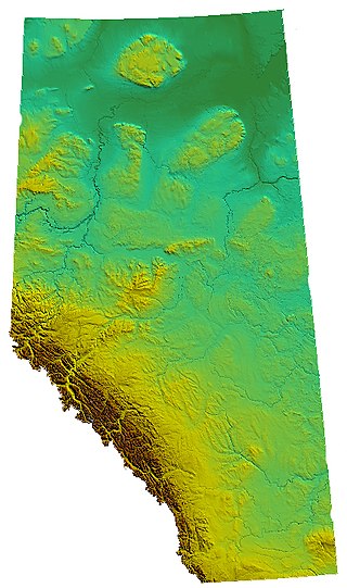
Alberta is one of the thirteen provinces and territories of Canada. Located in Western Canada, the province has an area of 661,190 km2 (255,290 sq mi) and is bounded to the south by the United States state of Montana along 49° north for 298 km (185 mi); to the east at 110° west by the province of Saskatchewan for 1,223 km (760 mi); and at 60° north the Northwest Territories for 644 km (400 mi). The southern half of the province borders British Columbia along the Continental Divide of the Americas on the peaks of the Rocky Mountains, while the northern half borders British Columbia along the 120th meridian west. Along with Saskatchewan it is one of only two landlocked provinces or territories.
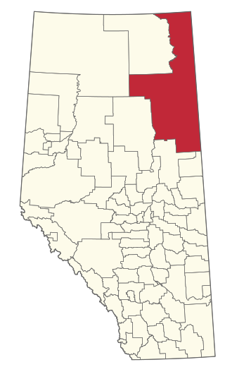
The Regional Municipality of Wood Buffalo is a specialized municipality in northeast Alberta, Canada. It is the largest municipality in North America by area and is home to oil sand deposits known as the Athabasca oil sands.

The Squamish-Lillooet Regional District is a quasi-municipal administrative area in British Columbia, Canada. It stretches from Britannia Beach in the south to Pavilion in the north. Lillooet, Pemberton, Whistler and Squamish are the four municipalities in the regional district. Its administrative offices are in the Village of Pemberton, although the district municipalities of Squamish and Whistler are larger population centres. The district covers 16,353.68 km2 of land area.
Sturgis is a town of 620 people in east-central Saskatchewan, Canada. The Town of Sturgis is 95 km north of Yorkton on Highway 9. It is located in the Assiniboine River valley near the Lakes and Woods region of the province.

The Thompson–Nicola Regional District is a regional district in the Canadian province of British Columbia. The Canada 2021 Census population was 143,680 and the area covers 44,449.49 square kilometres. The administrative offices are in the main population centre of Kamloops, which accounts for 78 percent of the regional district's population. The only other city is Merritt; other municipally-incorporated communities include the District Municipalities of Logan Lake, Barriere and Clearwater and the Villages of Chase, Ashcroft, Cache Creek, Clinton and Lytton, and also the Mountain Resort Municipality of Sun Peaks.

The Fraser Valley Regional District (FVRD) is a regional district in British Columbia, Canada. Its headquarters are in the city of Chilliwack. The FVRD covers an area of 13,361.74 km2 (5,159 sq mi). It was created in 1995 by an amalgamation of the Fraser-Cheam Regional District and Central Fraser Valley Regional District and the portion of the Dewdney-Alouette Regional District from and including the District of Mission eastwards.

Peace River South is a provincial electoral district for the Legislative Assembly of British Columbia, Canada. It was created under the name South Peace River by the Constitution Amendment Act, 1955, which split the old riding of Peace River into northern and southern portions for the 1956 BC election. Its current name has been in use since 1991.

The District of Taylor is a district municipality in northeastern British Columbia, Canada, located at mile 36 of the Alaska Highway. Taylor, a member municipality of the Peace River Regional District, covers an area of about 17 km2 with 1,317 residents as of 2021.

The Peace River Regional District is a regional district in northeastern British Columbia, Canada. The regional district comprises seven municipalities and four electoral areas. Its member municipalities are the cities of Fort St. John and Dawson Creek, the district municipalities of Tumbler Ridge, Chetwynd, Taylor, and Hudson's Hope, and the village of Pouce Coupe. The district's administrative offices are in Dawson Creek.

The Northern Rockies Regional Municipality (NRRM), formerly the Northern Rockies Regional District (NRRD), and before that the Fort Nelson–Liard Regional District, is a municipality in northeastern British Columbia, Canada. Although portrayed as a regional municipality in its official name, and existing on the same administrative level as a regional district, it is actually classified as a district municipality. The NRRM's offices are located in Fort Nelson, formerly an incorporated town that amalgamated with the NRRD on February 6, 2009, to form the NRRM. With the Peace River Regional District as the southern part, it was the northern part of the Peace River-Liard Regional District, which was split into two on October 31, 1987.
Peace River C is a regional district electoral area in the Peace River Regional District in northeastern British Columbia, Canada. The electoral covers the area around Fort St. John. It has no administrative or governmental function and is only used to select a rural representative to the regional district board.

Division No. 19 is a census division in Alberta, Canada. It is located in the west-central portion of northern Alberta and surrounds the City of Grande Prairie.

Valleyview is a town in northwest Alberta, Canada. It is surrounded by the Municipal District of Greenview No. 16 and in Census Division No. 18.
One Island Lake Provincial Park is a provincial park in British Columbia, Canada.
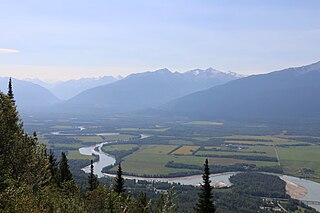
The Regional District of Fraser–Fort George (RDFFG) is a regional district located in the Central Interior of British Columbia, Canada. It is bounded by the Alberta border to the east, the Columbia–Shuswap and Thompson–Nicola regional districts to the south and southeast, Cariboo Regional District to the southwest, the Regional District of Bulkley–Nechako to the west, and the Peace River Regional District to the north and northeast. As of the Canada 2011 Census, Fraser–Fort George had a population of 91,879 and a land area of 51,083.73 km2. The offices of the regional district are located at Prince George.
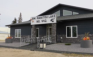
The Rural Municipality of Manitou Lake No. 442 is a rural municipality (RM) in the Canadian province of Saskatchewan within Census Division No. 13 and SARM Division No. 6.
Big River is a town located on the southern end of Cowan Lake in north central Saskatchewan, Canada. It is just north of Saskatchewan's extensive grain belt on Highway 55 and about 16 kilometres (10 mi) west of Prince Albert National Park. Delaronde Lake is accessed east of the town. Big River is approximately 132 kilometres (82 mi) from Prince Albert.
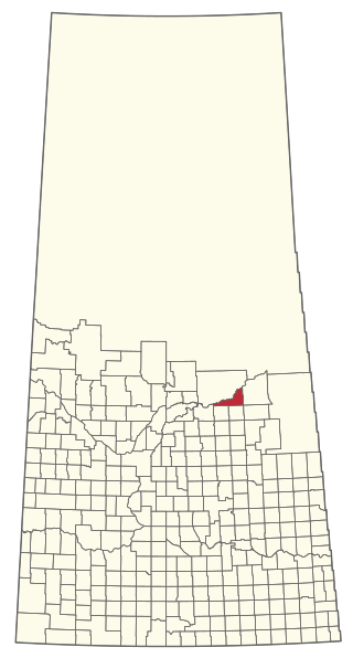
The Rural Municipality of Nipawin No. 487 is a rural municipality (RM) in the Canadian province of Saskatchewan within Census Division No. 14 and SARM Division No. 4.
Kelly Lake is a community in the Peace River Country of northeastern British Columbia, Canada. It is west of the border with the province of Alberta.


