
Muir Woods National Monument is a United States National Monument managed by the National Park Service, named after naturalist John Muir. It is located on Mount Tamalpais near the Pacific coast, in southwestern Marin County, California. It is part of the Golden Gate National Recreation Area, and is 12 miles (19 km) north of San Francisco. It protects 554 acres (224 ha), of which 240 acres (97 ha) are old growth coast redwood forests, one of a few such stands remaining in the San Francisco Bay Area.

Voyageurs National Park is an American national park in northern Minnesota near the city of International Falls established in 1975. The park's name commemorates the voyageurs—French-Canadian fur traders who were the first European settlers to frequently travel through the area. Notable for its outstanding water resources, the park is popular with canoeists, kayakers, other boaters, as well as fishermen. The Kabetogama Peninsula, which lies entirely within the park and makes up most of its land area, is accessible only by boat. To the east of the park lies the Boundary Waters Canoe Area Wilderness.

Nā Pali Coast State Park is a 6,175-acre (2,499 ha) state park in the U.S. state of Hawaii, located in the center of the rugged 16-mile (26 km) northwest side of Kauaʻi, the second-oldest inhabited Hawaiian island. The Nā Pali coast itself extends southwest from Keʻe Beach all the way to Polihale State Park. The nā pali along the shoreline rise as much as 4,000 feet (1,200 m) above the Pacific Ocean. The state park was formed to protect the Kalalau Valley.

Awenda Provincial Park is a provincial park in Tiny Township, Simcoe County in Central Ontario, Canada, located on a peninsula jutting into Georgian Bay north of Penetanguishene. The park occupies an area of 2,915 hectares and was established in 1975. It is classified as a Natural Environment Park and therefore all land is protected.
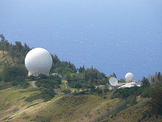
Kaena Point Space Force Station is a United States Space Force installation in Kaena Point on the island of Oahu in Hawaii. It is a remote tracking station of the Satellite Control Network responsible for tracking satellites in orbit, many of which support the United States Department of Defense, receiving and processing data and in turn, enabling control of satellites by relaying commands from control centers.

Gulf Islands National Seashore offers recreation opportunities and preserves natural and historic resources along the Gulf of Mexico barrier islands of Florida and Mississippi. The protected regions include mainland areas and parts of seven islands. Some islands along the Alabama coast were originally considered for inclusion, but none are part of the National Seashore.

Assateague Island National Seashore is a unit of the National Park Service system of the U.S. Department of the Interior. Located on the East Coast along the Atlantic Ocean in Maryland and Virginia, Assateague Island is the largest natural barrier island ecosystem in the Middle Atlantic states region that remains predominantly unaffected by human development. Located within a three-hour drive to the east and south of Richmond, Washington, Baltimore, Wilmington, Philadelphia major metropolitan areas plus north of the several clustered smaller cities around Hampton Roads harbor of Virginia with Newport News, Hampton, Norfolk, Portsmouth, Chesapeake and Virginia Beach. The National Seashore offers a setting in which to experience a dynamic barrier island and to pursue a multitude of recreational opportunities. The stated mission of the park is to preserve and protect “unique coastal resources and the natural ecosystem conditions and processes upon which they depend, provide high-quality resource-based recreational opportunities compatible with resource protection and educate the public as to the values and significance of the area”.

Bronte Creek Provincial Park is located in Oakville, Ontario, Canada, and is part of the Ontario Parks system.
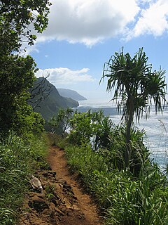
The Kalalau Trail is a trail along Nā Pali Coast of the island of Kauai in the state of Hawaii. The trail runs approximately 11 miles (18 km) along the island's north shore from Keʻe Beach to the Kalalau Valley. The trail has been named one of the most beautiful, and dangerous, hikes of the United States.

The Kalalau Valley is located on the northwest side of the island of Kauaʻi in the state of Hawaiʻi. The valley is located in the Nā Pali Coast State Park and houses the Kalalau Beach. The Nā Pali Coast is rugged and is inaccessible to automobiles. The only legal ways to access the valley are by kayak or by hiking the Kalalau Trail.

Golden Ears Provincial Park is a Provincial park in British Columbia, Canada and is 555.9 square kilometres (214.6 sq mi). It is named after the prominent twin peaks which are commonly referred to as Golden Ears. The park's southern end is located on the northern edge of the district municipality of Maple Ridge on the north side of the Fraser River.

Point Isabel Regional Shoreline in Richmond, California, is operated by East Bay Regional Park District, and is a multi-use park for joggers, windsurfers, kayakers, photographers, picnickers, and people walking dogs. It has access for pedestrians and via public transit, private vehicles, and bikes. It also features a concession offering food for people and grooming for pets. A longtime community organization and nonprofit, Point Isabel Dog Owners and Friends (PIDO), is active in the maintenance and improvement of the park.
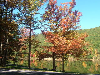
Poe Valley State Park is a 620-acre (251 ha) Pennsylvania state park in Penn Township, Centre County, Pennsylvania in the United States. The park is surrounded by Bald Eagle State Forest. Poe Paddy State Park is 4 miles (6.4 km) to the east. The forests of the park surround the 25-acre (10 ha) Poe Lake. Poe Valley State Park is in isolated Poe Valley which lies between Potters Mills on U.S. Route 322 and Millheim on Pennsylvania Route 45. The park was closed during the 2008 and 2009 season while the lake was drained for dam repairs and the park facilities were upgraded.

The Hawaiʻi Department of Land and Natural Resources (DLNR) is a part of the Hawaiʻi state government dedicated to managing, administering, and exercising control over public lands, water resources and streams, ocean waters, coastal areas, minerals, and other natural resources of the State of Hawaiʻi. The mission of the Hawaiʻi Department of Land and Natural Resources is to "enhance, protect, conserve and manage Hawaiʻi's unique and limited natural, cultural and historic resources held in public trust for current and future generations of the people of Hawaiʻi nei, and its visitors, in partnership with others from the public and private sectors." The organization oversees over 1.3 million acres of land, beaches, and coastal waters and 750 miles of coastal land.

Kickapoo State Recreation Area is an Illinois state park on 2,842 acres (1,150 ha) in Vermilion County, Illinois, United States. Located between Oakwood, Illinois and Danville, Illinois, this park is easily accessible through route I-74. It is 28 miles (45 km) away from the University of Illinois at Urbana-Champaign and 95 miles (153 km) from Indianapolis. According to the Illinois Department of Natural Resources, the name Kickapoo originated from the Kickapoo village that once existed near the junction of the Salt Fork and Middle Fork branches of the Vermilion River. After Europeans settled in the area and displaced the Native Americans, the Europeans began to dig wells to harvest salt from salt springs, called salines. In the early 20th century the land was then strip-mined for coal. Kickapoo State Park was the first park in the United States to be located on strip-mined land. The state of Illinois purchased the Kickapoo State Park Area in 1939 with donation money from Danville residents and the land has since recovered from the extraction of these resources.
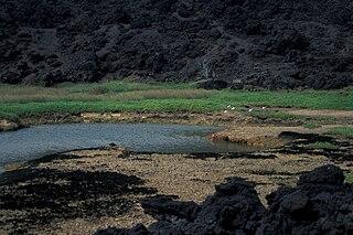
Established in 1973, ʻĀhihi-Kīnaʻu Natural Area Reserve includes a coastal lava field and surrounding waters on the southwest coast of the island of Maui, Hawaii. It consists of 1,238 acres (501 ha) on land and 807 acres (327 ha) of ocean along 3 miles (4.8 km) of Maui's southwestern coastline. The reserve includes several popular snorkeling/diving sites and many cultural and geologic sites as well as habitat for numerous rare and endangered species. The purpose and intent of the Reserve is to preserve and protect three unique components: the geologic setting of the most recent lava flow on Maui; unique assemblages of nearshore coral reef ecosystems; and the anchialine ponds found there.
The Hawaiian wild cattle are a feral breed of domestic cattle introduced at the end of 18th century. Thousands of them are still freely roaming forested areas on the Island of Hawaiʻi. It was listed as "extinct" in The State of the World's Animal Genetic Resources for Food and Agriculture, published by the FAO in 2007; it is not among the cattle breeds reported to DAD-IS by the National Animal Germplasm Program of the USDA Agricultural Research Service.
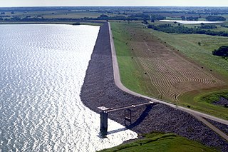
Lake Bardwell is a lake in Ellis County, Texas. The lake was constructed by the United States Army Corps of Engineers in 1965. Lake Bardwell is not used for military operations, and is accessible to the public for recreational purposes; it has seven facilities, but the state public ramp is closed.

The White Rim Road is a 71.2-mile-long (114.6 km) unpaved four-wheel drive road that traverses the top of the White Rim Sandstone formation below the Island in the Sky mesa of Canyonlands National Park in southern Utah in the United States. The road was constructed in the 1950s by the Atomic Energy Commission to provide access for individual prospectors intent on mining uranium deposits for use in nuclear weapons production during the Cold War. Large deposits had been found in similar areas within the region; however, the mines along the White Rim Road produced very little uranium and all the mines were abandoned.

Kīholo Bay is located in the ahupua`a of Pu`u Wa`awa`a in the North Kona District on the Big Island of Hawaii. the land surrounding the bay is flanked to the South by a lava flow from Mount Hualalai ca. 1801 and another flow from Mauna Loa in 1859. The land surrounding Kīholo Bay is under the authority of Hawai‘i State Parks. Approximately 2 miles long (3.2 km), it is one of the island's largest bays. Kīholo Bay is now a popular site for tourists and nature enthusiasts.


