Related Research Articles

Flagler County is a county located in the northeastern portion of the U.S. state of Florida. As of the 2020 census, the population was 115,378. Its county seat is Bunnell, and the largest city is Palm Coast. Created in 1917 from portions of Saint Johns and Volusia Counties, it was named for Henry Flagler, who built the Florida East Coast Railway.

St. Johns County is a county in the northeastern part of the U.S. state of Florida. As of the 2020 United States census, its population was 273,425. The county seat and most populous incorporated city is St. Augustine, although the nearby community, St. Johns, has a higher population. St. Johns County is part of the Jacksonville, Florida Metropolitan Statistical Area.
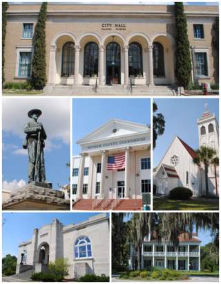
Palatka is a city in and the county seat of Putnam County, Florida, United States. Palatka is the principal city of the Palatka Micropolitan Statistical Area, which is home to 72,893 residents. As the Palatka micropolitan area is fewer than 40 miles south of Jacksonville, it is classified as part of the Jacksonville—Kingsland–Palatka, FL-GA Combined Statistical Area.

The Matanzas River is a body of water in St. Johns and Flagler counties in the U.S. state of Florida. It is a narrow saltwater bar-bounded estuary sheltered from the Atlantic Ocean by Anastasia Island. The river is part of the Atlantic Intracoastal Waterway.

The 74-mile-long (119 km) Ocklawaha River flows north from central Florida until it joins the St. Johns River near Palatka. Its name is derived from ak-lowahe, Creek for "muddy".

Larrys Creek is a 22.9-mile-long (36.9 km) tributary of the West Branch Susquehanna River in Lycoming County in the U.S. state of Pennsylvania. A part of the Chesapeake Bay drainage basin, its watershed drains 89.1 square miles (231 km2) in six townships and a borough. The creek flows south from the dissected Allegheny Plateau to the Ridge-and-valley Appalachians through sandstone, limestone, and shale from the Devonian, Mississippian, and Pennsylvanian periods.
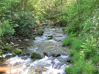
White Deer Hole Creek is a 20.5-mile (33.0 km) tributary of the West Branch Susquehanna River in Clinton, Lycoming and Union counties in the U.S. state of Pennsylvania. A part of the Chesapeake Bay drainage basin, the White Deer Hole Creek watershed drains parts of ten townships. The creek flows east in a valley of the Ridge-and-valley Appalachians, through sandstone, limestone, and shale from the Ordovician, Silurian, and Devonian periods.
Sawpit Bluff was a small settlement in East Florida during the American Revolutionary War on the site of a plantation at the mouth of Sawpit Creek where it discharges into Nassau Sound opposite the south end of Amelia Island. It was the location of a proposed rendezvous between mounted militia from Sunbury, Georgia and Continental troops under the command of Lt. Col. Samuel Elbert during the second invasion of Florida in May 1777.

In 1999, the Guana Tolomato Matanzas National Estuarine Research Reserve was designated in St. Johns and Flagler counties, Florida as a part of the National Oceanic and Atmospheric Administration (NOAA) National Estuarine Research Reserve (NERR) system. The GTM Research Reserve represents the east Florida sub-region of the Carolinian bioregion. It is one of 30 NERRs in 23 states and one territory. GTM is one of three NERRs in Florida and is administered on behalf of the state by the Florida Department of Environmental Protection's Florida Coastal Office as part of a network that includes forty-one aquatic preserves, three NERRs, a National Marine Sanctuary, the Coral Reef Conservation Program and the Florida Oceans and Coastal Council. Additional interests are held in the research and management of the GTM and connected preserved or conserved lands including:
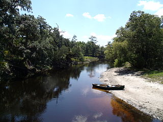
The Econlockhatchee River is an 54.5-mile-long (87.7 km) north-flowing blackwater tributary of the St. Johns River. The Econ River flows through Osceola, Orange, and Seminole counties in Central Florida, just east of the Orlando Metropolitan Area. It is a designated Outstanding Florida Waters.

Plunketts Creek is an approximately 6.2-mile-long (10 km) tributary of Loyalsock Creek in Lycoming and Sullivan counties in the U.S. state of Pennsylvania. Two unincorporated villages and a hamlet are on the creek, and its watershed drains 23.6 square miles (61 km2) in parts of five townships. The creek is a part of the Chesapeake Bay drainage basin via Loyalsock Creek and the West Branch Susquehanna and Susquehanna Rivers.
Shingle Creek is a small waterway in central Florida that is generally considered to be the northernmost headwaters of the Everglades watershed. It is named after the cypress trees that lined the bank in the late 19th century, which were used to make wood shingles. The stream and surrounding areas are protected wetlands.

Black Creek is a tributary of the St. Johns River in Clay County, Florida. It is formed by the confluence of North Fork Black Creek and South Fork Black Creek. North Fork Black Creek originates as an outflow from Kingsley Lake and flows north and then southeast, meeting South Fork Black Creek on the east side of MIddleburg. North Fork Black Creek has Yellow Water Creek as its main tributary. South Fork Black Creek originates in a chain of lakes about four miles south of Kingsley Lake, with Ates Creek, Bull Creek, and Greens Creek as its main tributaries. Both forks are fed by areas of wetlands and numerous small streams.
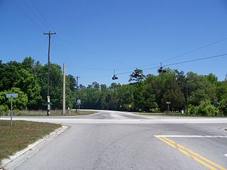
Gulf Hammock is an unincorporated community in Levy County, Florida, United States. It is near the edge of, and named for, the large wetlands area known as Gulf Hammock. It is located where US 19-98 and County Road 326 cross, near the Wekiva River, approximately 6 miles (9.7 km) southeast of Otter Creek.
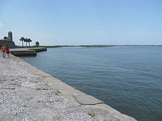
Matanzas Bay is a saltwater bay in St. Johns County, Florida; the entrance to the bay from the South Atlantic is via St. Augustine inlet. Technically this stretch of water running along the city's waterfront is part of the Matanzas River, though it is regularly referred to as a bay or harbor. Bodies of water that connect to the bay in addition to the South Atlantic are clockwise from the inlet:
Francisco Pellicer ( c1747-1826) was an early resident and carpenter of colonial St. Augustine, Florida. He was named a Great Floridian in 2000, and Pellicer Creek is named in his honor.
The King's Road was a road built by the British in their colony of East Florida. It stretched from the St. Marys River, the border between East Florida and Georgia, to south of New Smyrna, and was mostly completed by 1773.
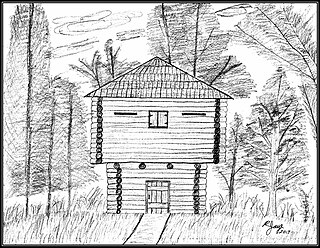
Fort Fulton was established on February 21, 1840, between Old Kings Road and Pellicer Creek in present-day Flagler County, Florida. A January 17, 1840 article in the Florida Herald of St. Augustine stated, "Can anyone inform us why the Mounted Volunteer Company, raised in this city, and now stationed at Hewlett’s [Hewitt’s] Mill, is weakened by a detail of ten men subject to the order of the city council, and kept in town idle." This article suggests that Fort Fulton was most likely manned with militia volunteers since it was the only military post in the general area of Hewitt's Mill. Hewitt's Mill was a sawmill built in 1768 by John Hewitt on his 1,000-acre plot of land in St. Johns County. This sawmill is known to have supplied many wooden building materials to the St. Augustine area and surrounding plantations.
Tocoi Creek is a tributary of the St. Johns River in St. Johns County, Florida. Kayakers report seeing abundant wildlife including turtles, alligators, and osprey and what is left of an old steamship dock as they paddle the creek. The creek is named after a Timucuan word that means water lily. The indigenous Timucua lived in the area prior to European contact in the 1500s through about 1800.
References
- ↑ U.S. Geological Survey Geographic Names Information System: Pellicer Creek
- ↑ "Pellicer Creek Aquatic Preserve". Florida Department of Environmental Protection. Retrieved 21 August 2020.
- ↑ The Revised General Statutes of Florida: Prepared Under Authority of Chapter 6930, Acts 1915, Chapter 7347, Acts 1917, and Chapter 7838, Acts 1919, Laws of Florida. E. O. Painter Printing Company. 1920. p. 298–299.
- ↑ Kumiski, John (2019). Fishing Florida by Paddle: An Angler's Guide. Arcadia Publishing. p. 108. ISBN 978-1-4671-4063-8.
- ↑ "History". Florida State Parks. Retrieved 21 August 2020.
- ↑ Alderson, Doug (2021). Florida's Rivers: A Celebration of Over 40 of the Sunshine State's Dynamic Waterways. Rowman & Littlefield. p. 123. ISBN 978-1-68334-262-5.
- ↑ Anderson, Danielle (3 July 2019). "Lumber for loyalists | Officials rededicate pre-Revolutionary War sawmill site". Daytona Beach News-Journal Online. Archived from the original on 25 February 2022.
- ↑ Staff (15 August 2017). "Florida Agricultural Museum, Palm Coast, Florida at MuseumsUSA.org". www.museumsusa.org. Archived from the original on 28 October 2020. Retrieved 11 March 2023.