Related Research Articles
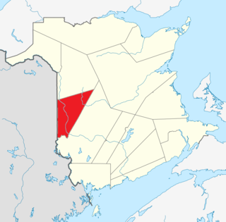
Carleton County is located in west-central New Brunswick, Canada.

York County is located in west-central New Brunswick, Canada. The county contains the provincial capital, Fredericton. Outside the city, farming and forestry are two major industries in the county, which is bisected by the Saint John River. The Southwest Miramichi River flows through the northern section of the county.
The Tobique River is a river in northwestern New Brunswick, Canada. The river rises from Nictau Lake in Mount Carleton Provincial Park and flows for 148 kilometres to its confluence with the Saint John River near Perth-Andover.
Waterville is a Canadian rural community in Carleton County, New Brunswick on Route 590.
Glassville is a community in the Canadian province of New Brunswick located mainly at the intersection of Route 107 and Route 580. It is situated in Aberdeen, a parish of Carleton County.
Hainesville is a community in the Canadian province of New Brunswick.
Hartfield is a community in the Canadian province of New Brunswick.
Lakeville is a community in the Canadian province of New Brunswick. This small village is located between Centreville and Woodstock. It is located on Route 560 in Carleton County. It has two churches, a convenience store, a post office, a fire hall, a park, and a community center. In the center of this village is the Williamstown Lake.
Pinder is a Canadian community in York County, New Brunswick at the intersection of Route 595 and Route 605 on the Nackawic River.
Temperance Vale is a community in York County, New Brunswick, Canada on Route 595.
The North Branch Meduxnekeag River is a river in Aroostook County, Maine and Carleton County, New Brunswick. From the outlet of a small pond in Maine Township 8, Range 3, WELS, the river runs about 20 miles (30 km) northeast, south, and east to the Canada–United States border, crossing into Canada at 46°16′40″N67°46′56″W. It runs about 4 miles (6 km) southeast to its confluence with the Meduxnekeag River in Wakefield, NB.
The River de Chute is a river in Maine and New Brunswick. From the outflow of Lindsay Lake in Easton, Maine, the river runs about 5 miles (8 km) south, about half a mile west of the Canada–United States border. The river turns east and crosses into Canada at 46°36′04″N67°47′18″W. It runs about 3 miles (5 km) to its confluence with the Saint John River. This section of the river forms the border between Carleton County, New Brunswick and Victoria County, New Brunswick.

Hartland Community School is a K-12 school located in Hartland, New Brunswick, Canada. Hartland Community School has around 575 students. The students in Hartland Community School are from all of Carleton County. The school logo is a garnet-colored husky.
Route 380 is a 12-kilometre (7.5 mi) long mostly east–west secondary highway in the northwest portion of New Brunswick, Canada.
Route 390 is a 12-kilometre (7.5 mi) long mostly east–west secondary highway in the northwest portion of New Brunswick, Canada.
Route 395 is a 12-kilometre (7.5 mi) long mostly North–South secondary highway in the northwest portion of New Brunswick, Canada.
Route 605 is a 14.7-kilometre (9.1 mi) long north–south secondary highway in the eastern portion of New Brunswick, Canada.
Route 610 is a 12.3-kilometre (7.6 mi) long north–south secondary highway in the eastern portion of New Brunswick, Canada.
Route 615 is a 23.2-kilometre (14.4 mi) long east–west secondary highway in the eastern portion of New Brunswick, Canada.
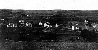
Victoria Corner, New Brunswick is a community in Carleton County, New Brunswick, Canada located on the west side of the Saint John River, 3.71 km north of Wakefield, 10 miles from Woodstock, on the road to Somerville.
References
- ↑ "Place Names of New Brunswick". Provincial Archives of New Brunswick. Retrieved 17 February 2024.
46°11′00″N67°32′02″W / 46.1832°N 67.5338°W
| | This New Brunswick location article is a stub. You can help Wikipedia by expanding it. |