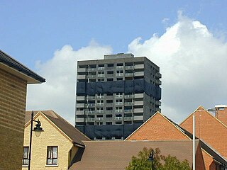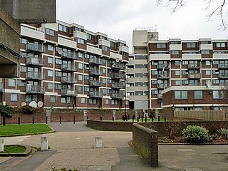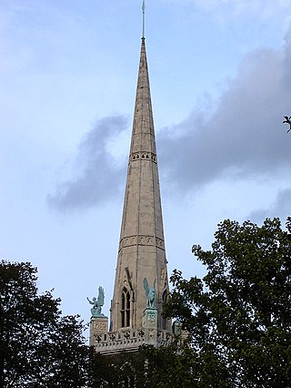
The London Borough of Hackney is a London borough in Inner London, England. The historical and administrative heart of Hackney is Mare Street, which lies 5 miles (8 km) north-east of Charing Cross. The borough is named after Hackney, its principal district. Southern and eastern parts of the borough are popularly regarded as being part of east London that spans some of the traditional East End of London with the northwest belonging to north London. Its population is estimated to be 281,120.

Old Street is a 1-mile (1.6 km) street in inner north-east Central London, England that runs west to east from Goswell Road in Clerkenwell, in the London Borough of Islington, via St Luke's and Old Street Roundabout, to the crossroads where it meets Shoreditch High Street (south), Kingsland Road (north) and Hackney Road (east) in Shoreditch in the London Borough of Hackney.

The Metropolitan Borough of Shoreditch was a metropolitan borough of the County of London between 1899 and 1965, when it was merged with the Metropolitan Borough of Stoke Newington and the Metropolitan Borough of Hackney to form the London Borough of Hackney.

Pembury is a large village in Kent, in the south east of England, with a population of 6,128 at the 2011 Census. It lies just to the north-east of Royal Tunbridge Wells.

The Wenlock Arms is a public house in Hoxton, in East London which began trading in 1787. The pub is located halfway between Old Street and Angel, just off the City Road and the City Road Basin and Wenlock Basin on the Regent's Canal. The pub has won awards for the quality and range of its cask ales.

Kingsland Road is the name given to an East London stretch of the A10 road within the London Borough of Hackney in England. The A10 was originally a Roman Road better known as Ermine Street or sometimes the Old North Road.

Hackney South and Shoreditch is a constituency represented in the House of Commons of the UK Parliament since 2005 by Meg Hillier of Labour Co-op.

The Peabody Trust was founded in 1862 as the Peabody Donation Fund and now brands itself simply as Peabody. It is one of London's oldest and largest housing associations with over 100,000 homes across London and the home counties. It is also a community benefit society and urban regeneration agency, with a focus on placemaking, stewardship and a provider of an extensive range of community programmes.

Hackney Wick is a neighbourhood in North East London, England. The area forms the south-eastern part of the district of Hackney, and also of the wider London Borough of Hackney. Adjacent areas of the London Borough of Tower Hamlets, namely Fish Island, are sometimes also described as being part of Hackney Wick. The area lies 4.2 miles (6.8 km) northeast of Charing Cross.

Cathall is a housing estate in the Cathall ward, Leytonstone, East London. It is currently managed by Community-based Housing Association.

Sutton Place, is a small street in the London Borough of Hackney. It links Homerton High Street with St John's Church Gardens, in Hackney. The Georgian terrace of 1790–1806, is Grade II listed as a whole, together with the villas on the north side of the street which date from 1820, and is sited in the conservation area around the gardens of St John-at-Hackney. The street replaced Church Path, an historic path connecting the villages of Homerton and Hackney.

The A264 is an east–west road in southern England that runs from Pembury in west Kent to Five Oaks in West Sussex.

Tottenham is a town in north London, England, within the London Borough of Haringey. It is located in the ceremonial county of Greater London. Tottenham is centred 6 mi (10 km) north-northeast of Charing Cross, bordering Edmonton to the north, Walthamstow, across the River Lea, to the east, and Stamford Hill to the south, with Wood Green and Harringay to the west.

A series of riots took place between 6 and 11 August 2011 in cities and towns across England, which saw looting and arson, as well as mass deployment of police and the deaths of five people.
The Gravel Pit Chapel was established in 1715–1716 in Hackney, then just outside London, for a Nonconformist congregation, which by the early 19th century began to identify itself as Unitarian. In 1809 the congregation moved to the New Gravel Pit Chapel nearby, while its old premises were taken over by Congregationalists. The New Gravel Pit Chapel was closed and demolished in1969.
House of Hackney is a luxury interiors label with a flagship store at St Michaels Clergy House, based in the East London shopping district of Central London. The brand specialises in British-made goods and reinvents traditional designs.

London Fields Brewery was a brewery in the London Fields area of the London Borough of Hackney, London. It was founded in 2011 with significant success riding the wave of new craft beers, though by December 2014 the company had fallen into trouble following the arrest of co-founder Julian de Vere Whiteway-Wilkinson, on suspicion of tax evasion. In 2017, London Fields Brewery was purchased in a joint-venture by Brooklyn Brewery and Carlsberg UK with plans to bring brewing back onsite. In 2023 Grace Land Group acquired London Fields Brewery from Carlsberg.

The Strawberry Vale Estate is a housing estate in East Finchley in the London Borough of Barnet, built in the 1980s.

The Nightingale Estate is located in the Lower Clapton area of the London Borough of Hackney, next to Hackney Downs. The estate originally consisted of six 22 story tower blocks, but was redeveloped between 2003-2006 and replaced with mostly low-rise buildings. Only one of the towers, Seaton Point, still remains.

Clapton is a district of East London, England, in the London Borough of Hackney.


