Cape Breton Island is an island on the Atlantic coast of North America and part of the province of Nova Scotia, Canada.

Canadian Gaelic or Cape Breton Gaelic, often known in Canadian English simply as Gaelic, is a collective term for the dialects of Scottish Gaelic spoken in Atlantic Canada.

St. Catherine's Down is a chalk down on the Isle of Wight, located near St Catherine's Point, the southernmost point on the island. The Down rises to 240 metres at its highest point, between the towns of Niton and Chale.

McNabs Island is the largest island in Halifax Harbour located in Halifax Regional Municipality, Nova Scotia, Canada. It played a major role in defending Halifax Harbour and is now a provincial park. The island was settled by Britons in the 1750s and later by Peter McNab, and McNab family members lived on the island until 1934.

St. Catherine's Oratory is a medieval lighthouse on St. Catherine's Down, above the southern coast of the Isle of Wight. It was built by Lord of Chale Walter de Godeton as an act of penance for plundering wine from the wreck of St. Marie of Bayonne in Chale Bay on 20 April 1313. The tower is known locally as the "Pepperpot" because of its likeness.
Lighthouse Digest, a specialty magazine from FogHorn Publishing in East Machias, Maine, is about maritime history with particular attention to the preservation of lighthouses and their past. Though it is geared toward enthusiasts and antiquarians in the United States, it is also quoted commonly in more academic publications, and its editors have become a staple presence in scholarly circles. Editor Tim Harrison issued the first number in May, 1992.

Seal Island is an island on the outermost extreme of Southwestern Nova Scotia, Canada, in the Municipality of the District of Argyle in Yarmouth County. It is approximately 4.3 kilometres (2.7 mi) long and 0.8 kilometres (0.50 mi) wide and is surrounded on its east, south and west sides by dangerous shoals. It is surrounded by the Atlantic Ocean and is the biggest of a group of five islands which extend north for 12 kilometres (7.5 mi). It is the second southernmost point of land of Nova Scotia. The southern tip of nearby Cape Sable Island is 250 metres (820 ft) farther south than the southern tip of land on Seal Island.

Sambro Island Lighthouse is a landfall lighthouse located at the entrance to Halifax Harbour, Nova Scotia, on an island near the community of Sambro in the Halifax Regional Municipality. It is the oldest surviving lighthouse in North America and its construction is a National Historic Event.

The Heritage Lighthouse Protection Act is an Act of the Parliament of Canada for the designation and preservation of historically significant Canadian lighthouses. It was passed by the Canadian Parliament in May 2008. The act set up a public nomination process and sets heritage building conservation standards for lighthouses which are officially designated. First introduced in 2000 as Bill S-21 in the Senate of Canada the bill enjoyed consistent multi-party support despite the unpredictable legislative agendas of minority Parliaments and was repeatedly re-introduced. The final vote of approval was made by the Canadian Senate in 2008 and the bill received Royal Assent on May 29, 2008.

Louisbourg Lighthouse is an active Canadian lighthouse in Louisbourg, Nova Scotia. The current tower is the fourth in a series of lighthouses that have been built on the site, the earliest was the first lighthouse in Canada.

Isle Haute is an island in the upper regions of Bay of Fundy in Nova Scotia, near the entrance to the Minas Basin. It is 16 kilometers from Harbourville and eight kilometers south-southwest of Cape Chignecto. The island is part of Cumberland County, Nova Scotia and is three kilometres long and 400 metres wide. The Mi'kmaq used the island to make stone tools before Europeans arrived and called the island "Maskusetik", meaning place of wild potatoes. In 1604, Samuel de Champlain gave the present name to the island, which means "High Island" in French, when he observed the towering bluffs, timber and fresh-water springs. The steep 100 m (328 ft) basalt cliffs of the island are the result from volcanic eruptions in the Jurassic period and may have been connected to the North Mountain volcanic ridge on the mainland 200 million years ago, before the Bay of Fundy was formed.

Port George is a seaside community in the Canadian province of Nova Scotia, located in Annapolis County. It is a former port situated on the Bay of Fundy, 11 km north of Middleton, Nova Scotia just across North Mountain. It sits on the 45th parallel north.
The history of lighthouses in Canada dates back to 1734.

Low Point Lighthouse is an historic Canadian lighthouse marking the eastern entrance to Sydney Harbour at New Victoria, Nova Scotia, near New Waterford, Nova Scotia. This is one of the earliest and most important light stations of Nova Scotia, one of the first dozen beacons in Nova Scotia to be lit to guide mariners, a classic red-and-white lighthouse still operated by the Canadian Coast Guard.

Georges Island Lighthouse is a prominent concrete lighthouse, built in 1917 on Georges Island, which replaced an earlier tower built in 1876. The light-keeper's house remains standing a few hundred feet to the north. The lighthouse is operated by the Canadian Coast Guard.

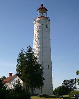
St Catherine's Lighthouse is a lighthouse located at St Catherine's Point at the southern tip of the Isle of Wight. It is one of the oldest lighthouse locations in Great Britain.

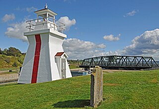
Balache Point Lighthouse also known as Balache Point Range Rear Lighthouse is an active Canadian lighthouse located next to the Canso Canal, near Port Hastings, Inverness County, Nova Scotia. The salt shaker style light, which sits on a small hillock on the Cape Breton side of the canal, is the second lighthouse to be built on the site.

Lennox Passage Provincial Park is a small picnic and beach park on the shores of Lennox Passage (waterway) on the North Shore of Isle Madame on Cape Breton Island with 2 kilometres (1.2 mi) of shoreline, an operating lighthouse and site of a former post office (c.1910), ferry terminal and two limestone quarries. Visitors can picnic at tables scattered through a forest and open areas, enjoy the 2 kilometres (1.2 mi) of trails, or explore the working lighthouse. In summer the park offers swimming, kayaking, and biking opportunities. There are snowshoeing and cross-country skiing opportunities in the winter, however parking is available at the gate only in the off season. Located on Hwy 320, 5 kilometres (3.1 mi) east of the junction of Routes 320 and 206.

Grandique Point Lighthouse is an aid to navigation for Lennox Passage, which is the channel of water between the southern shore of Cape Breton Island and Isle Madame, Nova Scotia, Canada. The lighthouse is located on the beach at Grandique Point in Lennox Passage Provincial Park and is accessible by a gravel road within the provincial park. The site is open to the public, the tower is closed.


