
Guildford is a town in west Surrey, England, around 27 mi (43 km) south-west of central London. As of the 2011 census, the town has a population of about 77,000 and is the seat of the wider Borough of Guildford, which had around 145,673 inhabitants in 2022. The name "Guildford" is thought to derive from a crossing of the River Wey, a tributary of the River Thames that flows through the town centre.

An optical telegraph is a line of stations, typically towers, for the purpose of conveying textual information by means of visual signals. There are two main types of such systems; the semaphore telegraph which uses pivoted indicator arms and conveys information according to the direction the indicators point, and the shutter telegraph which uses panels that can be rotated to block or pass the light from the sky behind to convey information.

The Hog's Back is a hilly ridge, part of the North Downs in Surrey, England. It runs between Farnham in the west and Guildford in the east.

Witley is a village in the civil parish of Witley and Milford in the Waverley district in Surrey, England centred 2.6 miles (4 km) south west of the town of Godalming and 6.6 miles (11 km) southwest of Guildford. The land is a mixture of rural contrasting with elements more closely resembling a suburban satellite village. In 2011 the parish had a population of 8130.

Merrow is a suburb in the north-east of Guildford, in Surrey, England. It is 2 miles (3.2 km) from the town's centre, on the edge of the ridge of hills that forms the North Downs. Although now a relatively obscure suburb, the village can trace its origins back many hundreds of years. Merrow is separated from Burpham by the New Guildford Line, the second railway line between Guildford and London.

The London Defence Positions were a late 19th-century scheme of earthwork fortifications in the southeast of England, designed to protect London from foreign invasion landing on the south coast. The positions were a carefully surveyed contingency plan for a line of entrenchments, which could be quickly excavated in a time of emergency.

The Pilgrims' Way is the historical route supposedly taken by pilgrims from Winchester in Hampshire, England, to the shrine of Thomas Becket at Canterbury in Kent. This name, of comparatively recent coinage, is applied to a pre-existing ancient trackway dated by archaeological finds to 600–450 BC, but probably in existence since the Stone Age. The prehistoric route followed the "natural causeway" east to west on the southern slopes of the North Downs.

Claygate is an affluent suburban village in Surrey, England, 14 miles southwest of central London. It is the only civil parish in the borough of Elmbridge. Adjoining Esher and Hinchley Wood to the west and north respectively, and bordered by green belt land to the south and east, Claygate lies within the Greater London Built-up Area.

St Martha's Hill is a landmark in St Martha in Surrey, England between the town of Guildford and village of Chilworth. It is the 18th highest hill in the county and on the Greensand Ridge, in this case at the closest point to the North Downs, commencing to the immediate north at the Guildown-Merrow Down in the parishes of Guildford and Merrow. The top of the hill provides a semi-panorama of Newland's Corner also in the Surrey Hills AONB. Its church is the main amenity of the small parish extending to the south into the streets of Chilworth, with some medieval stone incorporations from a 12th-century predecessor and is a wedding venue mainly to outside the sparsely populated parish.

Tongham is a village northeast of the town of Farnham in Surrey, England. The village's buildings occupy most of the west of the civil parish, adjoining the A31 and the A331. The boundaries take in Poyle Park in the east and the replacement to Runfold's manor house in the west.
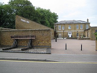
The Staines & West Drayton Railway (S&WDR), also called the Staines–West Drayton line and the Colnbrook branch, is a partially open, freight-only railway line in southern England. Formerly it ran for around 6 miles (9.7 km) from the Great Western Main Line at West Drayton to Staines-upon-Thames in Surrey, passing through the village of Colnbrook in Berkshire. The operational part of the line, north of Colnbrook, runs for 2 mi 74 ch (4.7 km) and is used exclusively by freight trains.
Poyle for Stanwell Moor Halt railway station was on the outskirts of London, on the now closed line of the Staines and West Drayton Railway.

Chatley Heath is part of a 336 hectares (1.3 sq mi) reserve including Wisley Common, Ockham and parts of Hatchford. It is an area consisting of mixed habitats including heathland, ancient woodland and conifer woodland. On the top of Chatley Heath is a tower built as part of the Royal Navy Semaphore line.

Hascombe Hill or Hascombe Camp is the site of an Iron Age multivallate hill fort close to the village of Hascombe in Surrey, England.
Haste Hill is a hill near Haslemere, Surrey in England which was probably the original settlement of the town of Haslemere. It was used as the site of a semaphore station in the nineteenth century.

Camp Down is a location at Portsdown Hill, Hampshire, near Farlington, which was used as an Admiralty semaphore station and later as a redoubt on the line of Palmerston Forts, Portsmouth.

One Tree Hill is a defining feature of Honor Oak, mostly in London Borough of Southwark but with parts also in the London Borough of Lewisham. It includes a 7 hectare public park, local nature reserve and Site of Borough Importance for Nature Conservation, Grade 1, which is owned and managed by Southwark Council. Its name, and that of the Honor Oak area, derive from the Oak of Honor, a tree on the hill which marked the southern boundary of the Norman Honour of Gloucester.

Caesar's Camp is an Iron Age hill fort straddling the border of the counties of Surrey and Hampshire in southern England. The fort straddles the borough of Waverley in Surrey and the borough of Rushmoor and the district of Hart, both in Hampshire. Caesar's Camp is a scheduled monument with a list entry identification number of 1007895. It lies approximately 3 kilometres (1.9 mi) north of the town of Farnham, and a similar distance west of Aldershot. The hillfort lies entirely within the Bourley and Long Valley Site of Special Scientific Interest. Caesar's Camp is a multivallate hillfort, a fort with multiple defensive rings, occupying an irregular promontory, with an entrance on the south side. The site has been much disturbed by military activity, especially at the southeast corner. The remains of the hillfort are considered to be of national importance.

Beacon Hill, also known as Harting Beacon, is a hillfort on the South Downs, in the county of West Sussex in southern England. The hillfort is located in the parish of Elsted and Treyford, in Chichester District. It is a Scheduled Ancient Monument with a list entry identification number of 1015915. The hilltop enclosure is dated to the Late Bronze Age, from the 8th to 6th centuries BC. The hillfort defences were renewed during the Late Iron Age.

Pewley Down is a 9.5-hectare (23-acre) Local Nature Reserve on the southern outskirts of Guildford in Surrey, adjacent to Pewley Hill. It is owned and managed by Guildford Borough Council. The site is on a hill offering views south to St Martha's Hill, Chantry Wood, and beyond.
