
In the 1860s the first facsimile of Domesday Book was created by the process of photozincography (later termed zinco), and was executed under the directorship of Henry James at the Southampton offices of the Ordnance Survey.
In the 1860s the first facsimile of Domesday Book was created by the process of photozincography (later termed zinco), and was executed under the directorship of Henry James at the Southampton offices of the Ordnance Survey.
Having developed the photozincographic process, in a meeting arranged between James and William Ewart Gladstone, then Chancellor of the Exchequer, Sir Henry expressed his ability to produce photozincographic copies of ancient documents at "a very trifling cost". [1] James outlined for his superiors the cost of a complete reproduction of Domesday Book (an estimate of £1575 for 500 copies or £3.3s per copy) using his process. In addition to this James further outlined the cost of a single county to demonstrate the affordability of the process, using Cornwall as an example of one of the shorter entries in the volumes (eleven folio pages) and estimated the cost of 500 copies to be £11. 2s. 4d. In doing so he selected the first extract of Domesday Book that he would photozincograph.[ full citation needed ]
On 24 January 1861, Sir Henry was granted permission to photozincograph the Cornwall fragment of Domesday as a Treasury funded experiment to determine the success of the process. Joseph Burtt, one of the Assistant Keepers of the Records was directed to assist the Record Office binder, Hood, to unbind the relevant pages from Domesday and on Monday 4 February 1861 Burtt transported Domesday to Southampton by train. [2]

On arrival at the Ordnance Survey offices in Southampton, Burtt expressed his satisfaction with the buildings' "fireproof principles, and…military guard", and was given use of the best room in the building in which Domesday was placed in a fireproof safe, and the key entrusted to Burtt. Burtt’s description of the preparations extends to the actual photozincographic process, including James’s insistence that all plates should be developed and printed before the folios were returned. Nevertheless, the photozincography of Cornwall was completed in 11 days and Burtt returned to London. [3] The process was carried out in the Ordnance Survey photography building nicknamed the glasshouse.
Having completed Cornwall, James requested permission to photozincograph the rest of Domesday. Despite his claim that the public sale of the bound and engraved copies could cover the entire cost of the photozincography of the counties, the Lords of the Treasury wished to consult the Master of the Rolls regarding the comparison of James’s photozincographic reproductions with a rival process employed by Rev. Lambert Larking of Kent. [4] Larking (a local antiquarian) had employed an artist to assist the reproduction of the county of Kent using the lithographic process – a much more expensive means of reproduction than photozincography. However, in order to secure this permission over Larking's process James had to provide the Treasury with evidence of public interest and a guarantee of low-cost production. Thomas Letts of Letts Son & Co. Limited, London distributed a circular nationally bearing a foreword from James encouraging subscription, and by late October more than fifty subscribers to each county had been amassed. On 28 November 1861 Burtt returned to Southampton once more with Domesday for the aforementioned counties’ photozincographing, and by December James had secured permission from the Treasury to copy the remainder of Great Domesday – but he was explicitly forbidden from reproducing Kent, in defence of Larking’s lithograph. By 1864 the facsimile of the entirety of Great Domesday had been completed, and had been published in 32 county volumes including Kent following Larking's death, who granted James permission to complete the reproduction of the county due to his infirmity in the final stages of his life. [5]
The volumes were published in two colours (red and black), replicating the colours used in the original manuscript.
The books which were printed by James's method are still sought after even if they are not up to the standard of later facsimiles. His edition of Domesday Book is still the only facsimile of it available and can be found reasonably cheaply, whereas the letterpress is extremely rare and very expensive.
— G. Wakeman, 1970. [6]

Domesday Book is a manuscript record of the "Great Survey" of much of England and parts of Wales completed in 1086 at the behest of King William I, known as William the Conqueror. The manuscript was originally known by the Latin name Liber de Wintonia, meaning "Book of Winchester", where it was originally kept in the royal treasury. The Anglo-Saxon Chronicle states that in 1085 the king sent his agents to survey every shire in England, to list his holdings and dues owed to him.

The historic counties of England are areas that were established for administration by the Normans, in many cases based on earlier kingdoms and shires created by the Angles, Saxons, Jutes, Celts and others. They are alternatively known as ancient counties, traditional counties, former counties or simply as counties. In the centuries that followed their establishment, as well as their administrative function, the counties also helped define local culture and identity. This role continued even after the counties ceased to be used for administration after the creation of administrative counties in 1889, which were themselves amended by further local government reforms in the years following.

Antony is a coastal civil parish and a village in Cornwall, England, United Kingdom.
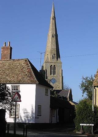
Spaldwick is a village and civil parish in Cambridgeshire, England. Spaldwick lies approximately 6 miles (10 km) west of Huntingdon, near Catworth. Spaldwick is situated within Huntingdonshire which is a non-metropolitan district of Cambridgeshire as well as being a historic county of England.

Ludgvan is a civil parish and village in Cornwall, England, UK, 2+1⁄2 miles (4.0 km) northeast of Penzance. Ludgvan village is split between Churchtown, on the hill, and Lower Quarter to the east, adjoining Crowlas. For the purposes of local government, Ludgvan elects a parish council every four years; the town elects a member to Cornwall Council under the Ludgvan division.

Antingham is a village and civil parish in the north of the English county of Norfolk. The village is located about 6 miles (9.7 km) south of Cromer and 3 miles (4.8 km) north of North Walsham. The civil parish has an area of 6.12 square kilometres and in the 2001 census had a population of 287 in 120 households, the population increasing to 355 at the 2011 Census. For the purposes of local government, the parish falls within the district of North Norfolk.
Photozincography, sometimes referred to as heliozincography but essentially the same process, known commercially as zinco, is the photographic process developed by Sir Henry James FRS (1803–1877) in the mid-nineteenth century.

Col Alexander Ross Clarke FRS FRSE (1828–1914) was a British geodesist, primarily remembered for his calculation of the Principal Triangulation of Britain (1858), the calculation of the Figure of the Earth and one of the most important text books of Geodesy (1880). He was an officer of the Royal Engineers employed on the Ordnance Survey.
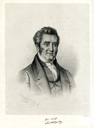
Lieutenant-General Sir Henry James FRS MRIA (1803–1877) was a Royal Engineers officer who served as the director-general of the Ordnance Survey, the British Government mapping agency, from 1854 to 1875. Sir Henry was described by the agency itself as "perhaps Ordnance Survey's most eccentric and egotistical Director General". Sir Henry spent most of his life working for the Ordnance Survey and after becoming its head he introduced the new science of photography. He also would later claim to be the inventor of the process known as Photozincography or Zinco. Sir Henry also played a part in the resolving of the battle of the scales.
Joshua Toulmin Smith was a British political theorist, lawyer and local historian of Birmingham.
Werrington is a civil parish and former manor now in Cornwall, England, United Kingdom. Prior to boundary changes it straddled the Tamar and lay within the county of Devon. The portion on the west side was transferred to Cornwall by the abolition of Broadwoodwidger Rural District by the Local Government Commission for England in 1966. It is situated 1 mile (1.6 km) to the west of the Tamar, the traditional boundary between Devon and Cornwall, and 1 mile (1.6 km) north of Launceston.

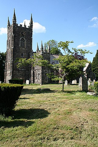
Bratton Clovelly is a village, parish and former manor in the west part of Devon, England. It is situated about 8 miles (13 km) south-west of Okehampton immediately north of the A30 road. The manor of Bratton Clovelly was listed in the Domesday Book of 1086. The parish church dedicated to St Mary is 15th-century, with many Norman features. The former village stocks are kept in the belfry. The parish is thought to have been the birthplace of influential 13th-century jurist Henry de Bracton; however, this claim is also made for at least two other places.
The text of Domesday Book, the record of the great survey of England completed in 1086 executed for William I of England, was first edited by Abraham Farley in the 1770s. The first facsimile edition of the manuscripts was made in a project led by the cartographer Henry James in the 1860s. An English translation of the Latin text for most counties was published by the Victoria County History (VCH) during much of the 20th century.
Lambert Blackwell Larking was an English clergyman, writer and antiquarian.
Joseph Burtt was an archivist and an Assistant Keeper of the Public Records.

The Ordnance Survey (OS) is the national mapping agency for Great Britain. The agency's name indicates its original military purpose, which was to map Scotland in the wake of the Jacobite rising of 1745. There was also a more general and nationwide need in light of the potential threat of invasion during the Napoleonic Wars. Since 1 April 2015, the Ordnance Survey has operated as Ordnance Survey Ltd, a government-owned company, 100% in public ownership. The Ordnance Survey Board remains accountable to the Secretary of State for Science, Innovation and Technology. It was also a member of the Public Data Group.
(John) Brian Harley was a geographer, cartographer, and map historian at the universities of Birmingham, Liverpool, Exeter and Wisconsin–Milwaukee. He helped found the History of Cartography Project and was the founding co-editor of the resulting The History of Cartography. In recent years, Harley's work has gained broad prominence among geographers and social theorists, and it has contributed greatly to the emerging discipline of critical cartography.

Record type is a family of typefaces designed to allow medieval manuscripts to be published as near-facsimiles of the originals. The typefaces include many special characters intended to replicate the various scribal abbreviations and other unusual glyphs typically found in such manuscripts. They were used in the publication of archival texts between 1774 and 1900.

James Waterhouse (1842–1922) was a British photographer and Indian Army officer who headed the Photographic Department of the Survey of India and pioneered the development of photomechanical printing.
William Griggs was an English inventor of a process of chromolithography known as photo-chromo-lithography. He was associated with the India Office, and publications for which he produced coloured illustrations include many works about India.