Pila, officially the Municipality of Pila, is a 3rd class municipality in the province of Laguna, Philippines. According to the 2020 census, it has a population of 54,613 people.

San Juan, officially the Municipality of San Juan, is a 1st class municipality in the province of Batangas, Philippines. According to the 2020 census, it has a population of 114,068 people.

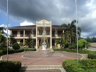
Catanauan, officially the Municipality of Catanauan, is a 1st class municipality in the province of Quezon, Philippines. According to the 2020 census, it has a population of 72,752 people.

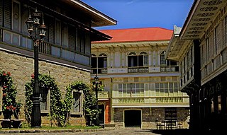
The architecture of the Philippines reflects the historical and cultural traditions in the country. Most prominent historic structures in the archipelago are influenced by Austronesian, Chinese, Spanish, and American architectures.

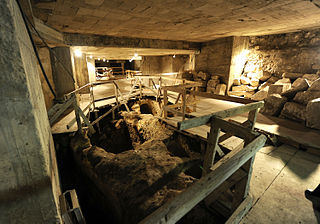
Siebenberg House is a museum below a house on 5 Beit HaShoeva Alley in the Old City of Jerusalem in the Jewish Quarter.
The Sixtoe Mound site (9MU100) is an archaeological site in Murray County, Georgia excavated by Arthur Randolph Kelly from 1962-1965 as a part of the Carters Dam project conducted for the National Park Service by the University of Georgia. The site consisted of a low platform mound and an associated village. The majority of the mound was excavated, while the village received little excavation.

Tarsus Museum is an archaeology and ethnography museum in Tarsus, Mersin Province, in southern Turkey.
The ruins of Old Tanauan located at the lake shore of Talisay in Batangas Province are remains of a church structure dating to the Spanish Colonial Period of the Philippines. It is the site of the first stone church of Tanauan, before the whole town relocated to its present location in 1754. Currently the ruins are within the property of Club Balai Isabel Resort.

The Our Lady of the Assumption Parish Church, commonly known as Maragondon Church, is the only heritage structure in the municipality of Maragondon, Cavite, Philippines declared by the National Museum as a National Cultural Treasure.

Handoga is located 14 km to the west of Dikhil, Djibouti. During the first excavations in 1970, archaeologists discovered foundations of stone houses and the walls of a stone edifice with a recess that faces Mecca.
Dewil Valley, located in the northernmost part of Palawan, an island province of the Philippines that is located in the Mimaropa region, is an archaeological site composed of thousands of artifacts and features. According to the University of the Philippines Archaeological Studies Program, or UP-ASP, the closest settlement can be found in New Ibajay, which is covered by the town capital of El Nido, which is located around 9 km (5.6 mi) south-east of Dewil Valley. Physically it measures around 7 km (4.3 mi) long, and 4 km (2.5 mi) wide. It is in this place which the Ille Cave, one of the main archaeological sites, can be found. It is actually a network of 3 cave mouths located at its base. It has been discovered that this site in particular has been used and occupied by humans over multiple time periods.
Porac, Pampanga contains areas in and near Babo Balukbuk in Porac, Philippines that have strong indication of human habitation, according to investigations published on the University of the Philippines Archaeological Studies Program website. Later test excavations confirmed this conclusion through the presence of materials dated around the 12th century to the 17th century C.E.
Laguna is a province of the Philippines found in Southern Luzon and features a freshwater lake and river valleys surrounded by arable land. This makes Laguna a good site for potential archeological sites. Its lake basin and fertile land makes for the area easily habitable, granting early settlers an accessible source of fish, eels, game and grain to support a thriving community of people. The coasts rivers of Laguna give the region a quick method of transportation and make trade with foreign merchants easier.
Pinagbayanan is a barrio in the municipality of Pila, Laguna, Philippines. The 2010 census estimates its population at 5,305 people. Archaeological excavations in the area have contributed to developments in the field of ceramics and led to the recognition of the importance of the area to archaeology.
The Kalanay Cave is a small cave located on the island of Masbate in central Philippines. The cave is located specifically at the northwest coast of the island within the municipality of Aroroy. The artifacts recovered from the site were similar to those found to the Sa Huynh culture of Southern Vietnam. The site is part of the "Sa Huynh-Kalanay Interaction Sphere" which was an Iron Age maritime trading network associated with the Austronesian peoples of the Philippines, Vietnam, Taiwan, as well as most of northeastern Borneo and Southern Thailand. The type of pottery found in the site were dated 400 BC to AD 1500. The "Sa Huynh-Kalanay Interaction Sphere" is characterized by a remarkable continuity in trade goods, including decorated pottery and double-headed pendants and earrings known as lingling-o.
Tønnesminde is the site of an archaeological excavation ground and present day organic farm on the island of Samsø, Denmark. Archaeological evidence attests the area around Tønnesminde has a long history of human occupation, dating from approximately 4000 BC to present day. Recent excavations suggest that Tønnesminde contains settlements dating from the Funnelbeaker culture in the Early Neolithic period, Early Bronze Age, Pre-Roman Iron Age, and Viking Age.

The archaeology of the Philippines is the study of past societies in the territory of the modern Republic of the Philippines, an island country in Southeast Asia, through material culture.
Endebjerg is the location of an excavation site set in the middle of farmland on the island of Samsø, Denmark. A series of excavations have shown that this site has been occupied by a variety of cultures since the Early Neolithic period. The site was first officially excavated in 1988 under Christian Adamsen. It was most recently excavated in the summer of 2018 by a joint task force of the Harvard University Viking Studies Program and Moesgaard Museum, led by Peter Jensen.
Boncuklu Tarla is an archaeological site in the Southeastern Anatolia of Turkey. It is the remains of a settlement occupied from the Late Epipalaeolithic to Pre-Pottery Neolithic B periods, starting over 12,000 years ago. It was discovered in 2008 during an archaeological survey in advance of the construction of the Ilısu Dam and has been excavated by a team from Mardin Museum since 2012.


