Related Research Articles

Lake Michigan is one of the five Great Lakes of North America. It is the second-largest of the Great Lakes by volume and the third-largest by surface area, after Lake Superior and Lake Huron. To the east, its basin is conjoined with that of Lake Huron through the 3+1⁄2-mile (5.6-kilometer) wide, 295-foot deep Straits of Mackinac, giving it the same surface elevation as its easterly counterpart; the two are geologically a single lake.

The Au Sable River in Michigan, United States runs approximately 138 miles (222 km) through the northern Lower Peninsula, through the towns of Grayling and Mio, and enters Lake Huron at the town of Oscoda. It is considered one of the best brown trout fisheries east of the Rockies and has been designated a blue ribbon trout stream by the Michigan Department of Natural Resources. A map from 1795 located in the United States Gazetteer calls it the Beauais River. In French, the river is called the Rivière au sable, literally "Sand River".

Mackinac County is a county in the Upper Peninsula of the U.S. state of Michigan. As of the 2020 census, the population was 10,834. The county seat is St. Ignace. Formerly known as Michilimackinac County, in 1818 it was one of the first counties of the Michigan Territory, as it had long been a center of French and British colonial fur trading, a Catholic church and Protestant mission, and associated settlement.

Chippewa County is a county in the eastern Upper Peninsula of the U.S. state of Michigan. As of the 2020 Census, the population was 36,785. The county seat is Sault Ste. Marie. The county is named for the Ojibwe (Chippewa) people, and was set off and organized in 1826. Chippewa County comprises the Sault Ste. Marie, MI micropolitan statistical area.
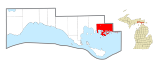
Clark Township is a civil township of Mackinac County in the U.S. state of Michigan. As of the 2020 census, the population was 1,917, down from 2,256 in 2010.

Hiawatha National Forest is a 894,836-acre (362,127 ha) National Forest in the Upper Peninsula of the state of Michigan in the United States. Commercial logging is conducted in some areas. The United States Forest Service administers this National Forest; it is physically divided into two subunits, commonly called the Eastside 46°14′N84°50′W and Westside 46°08′N86°40′W.

The Wolf River is a 225 mi (362 km) long tributary of the Fox River in northeastern Wisconsin in the Great Lakes region of the United States. The river is one of the two National Scenic Rivers in Wisconsin, along with the St. Croix River. The scenic portion is 24 miles (39 km) long. The river and its parent the Fox River and associated lakes are known for their sturgeon which spawn every spring upstream on the lower river until blocked by the Shawano Dam. The river flows through mostly undeveloped forestland southerly from central Forest County in the north to Lake Poygan in the south. The lake is part of the Winnebago Pool of lakes fed by both the Fox and Wolf Rivers. The Fox-Wolf basin is usually considered to be a single unified basin and the rivers themselves may be referred to as the Fox-Wolf River system.

Northern Michigan, also known as Northern Lower Michigan, is a region of the U.S. state of Michigan. A popular tourist destination, it is home to several small- to medium-sized cities, extensive state and national forests, lakes and rivers, and a large portion of Great Lakes shoreline. The region has a significant seasonal population much like other regions that depend on tourism as their main industry. Northern Lower Michigan is distinct from the more northerly Upper Peninsula and Isle Royale, which are also located in "northern" Michigan. In the northernmost 21 counties in the Lower Peninsula of Michigan, the total population of the region is 506,658 people.
Gull Island is the name of a dozen small islands in the U.S. state of Michigan.

Lake Michigan–Huron is the body of water combining both Lake Michigan and Lake Huron, which are joined through the 5-mile-wide (8.0 km), 295-foot-deep (90 m), open-water Straits of Mackinac. Huron and Michigan are hydrologically a single lake because the flow of water through the straits keeps their water levels in overall equilibrium. Although the flow is generally eastward, the water moves in either direction depending on local conditions. Combined, Lake Michigan–Huron is the largest freshwater lake by area in the world. Lake Superior is larger than either individually, so it is counted as the largest of the Great Lakes when Lake Michigan and Lake Huron are considered separately.

Pine River may refer to any of the following rivers in the U.S. state of Michigan:

The Chippewa River is a stream in Michigan, United States, that runs 91.8 miles (147.7 km) through the central Lower Peninsula. The Chippewa is a tributary of the Tittabawassee River and is thus part of the Saginaw River drainage basin. The river is named after the Chippewa people.
Carp River is a 40.2-mile-long (64.7 km) river in Chippewa and Mackinac counties in the U.S. state of Michigan. 21.7 miles (34.9 km) of the river were added to the National Wild and Scenic Rivers System in 1992.

The Cheboygan River is a short but significant river in the Lake Huron drainage basin of the U.S. state of Michigan.

The Charlotte River is a tributary of the St. Marys River in the state of Michigan in the United States. The stream is 17.1 miles (27.5 km) long and drains an area of 58.4 square miles (151 km2) on the eastern Upper Peninsula. Via the St. Marys River, it is part of the watershed of Lake Huron. Via Lake Huron and the Great Lakes system, it is part of the larger watershed of the St. Lawrence River.
Rabbit's Back, also called Rabbit Back, is an elevated promontory, or peninsula, that extends eastward into Lake Huron. It is located 4 miles (6.4 km) north of St. Ignace in the U.S. state of Michigan.
The Maple River, which flows into Burt Lake, is a major river in the northern tip of the Lower Peninsula of the U.S. state of Michigan. The river drains sections of Cheboygan County and Emmet County, and provides an outflow for the 3,395-acre (1,374 ha) Douglas Lake.
West Branch Manistique River is a river in the Upper Peninsula of the U.S. state of Michigan. It rises in Alger County, flows southeast into Schoolcraft County, and discharges into the Manistique River. Its principal tributary is the Creighton River. Much of the river's course flows through wetlands that are a part of the Lake Superior State Forest, a semi-protected land area. Despite the name of the state forest, the waters of the West Branch ultimately flow into Lake Michigan.
Munuscong Lake is a section of the St. Marys River in Chippewa County in the U.S. state of Michigan, with the northeastern edge of the lake forming part of the riparian bottomland of the Canadian province of Ontario. Hydrologically the lake and river section are an arm of Lake Huron, and Munuscong Lake shares a common water level with the Great Lake into which it flows.