This article needs additional citations for verification .(May 2024) |
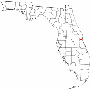
Pineda is a former village in Brevard County, Florida, United States.
This article needs additional citations for verification .(May 2024) |
Pineda is a former village in Brevard County, Florida, United States.
The original settlement was near the FEC track at the west end of Anderson Way, (known on some plats as Pineda Park). Two developers, E.C. and Anna Dearborn, arrived in November 1894 and began to survey the area. Their recorded plat, "Plat of the Town of Pineda", showed hundreds of subdivided house lots. The main street, Pineda Avenue, was renamed Suntree Boulevard. One early land speculator in Pineda was John Aspinwall, who gave his name to today's Aspinwall Street. Many large landowners surrounded early Pineda, including the Duda family, Parrot family, Haskins, C.J. Hart, and the Stewart family. [1] The Pineda Causeway, named after this place, carries four lanes of State Road 404 1.8 miles (2.9 km) south of the former village. It is located at the intersection of Suntree Boulevard and U.S. Route 1 east of Suntree and the Florida East Coast Railroad.
Pineda is located at 28°13′47″N80°40′16″W / 28.22972°N 80.67111°W . (28°13"47 N -80°40'16 W).
The village has 33 homes, including eight riverfront homes. The residential streets are: Third Street, Aspinwall Avenue, Gannet Plaza Avenue, Friendship Place, Ernest Sand Road, 2nd Street, Turner Road, and Byham Road.
A 10 acres (4.0 ha) community river park is situated at the junction of Suntree Boulevard and U.S. Route 1, on the shore of the Indian River Lagoon. The park is listed in the State of Florida Great Florida Birding Trail, and is home to Waders, Shorebirds; Migratory Ducks, Loon and Grebe (winter).

Cocoa is a city in Brevard County, Florida. The population was 19,041 at the 2020 United States Census. It is part of the Palm Bay–Melbourne–Titusville Metropolitan Statistical Area.

Indialantic is a town in Brevard County, Florida. It is part of the Palm Bay–Melbourne–Titusville Metropolitan Statistical Area. The town's population was 3,010 at the 2020 United States Census.

Melbourne is a city in Brevard County, Florida, United States. It is located 72 miles (116 km) southeast of Orlando and 175 miles (282 km) northwest of Miami. As of the 2020 Decennial Census, there was a population of 84,678. The municipality is the second-largest in the county by both size and population. Melbourne is a principal city of the Palm Bay – Melbourne – Titusville, Florida Metropolitan Statistical Area. In 1969, the city was expanded by merging with nearby Eau Gallie.

Michigan Avenue is a north-south street in Chicago that runs at 100 east on the Chicago grid. The northern end of the street is at Lake Shore Drive on the shore of Lake Michigan in the Gold Coast Historic District. The street's southern terminus is at Sibley Boulevard in the southern suburb of Dolton, but like many other Chicago streets, it exists in several disjointed segments.
Viera is a planned community located in the central coastal region of Brevard County, Florida. It is part of an unincorporated section adjacent to the Melbourne, Florida area. However, Viera is actually much closer to Cocoa than to Melbourne. For census purposes, it is divided between the Census Designated Places of Viera East and Viera West. At the 2020 census, Viera East had a population of 11,687, while Viera West had a population of 16,688.
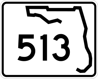
State Road 513, also known as South Patrick Drive, is a short north–south road located along the western side of the barrier island towns of Indian Harbour Beach, Satellite Beach and South Patrick Shores in Brevard County. The southern terminus is at an intersection with SR 518 near the eastern end of the Eau Gallie Causeway in Indian Harbour Beach. The northern terminus is at a partial interchange with the Pineda Causeway, just south of the southern entrance of Patrick Space Force Base.

The Melbourne Causeway is located entirely within Brevard County, Florida in the United States. It is composed of three bridges and connects the municipalities of Melbourne and Indialantic across the Indian River Lagoon in Brevard County. The causeway is part of U.S. 192, whose eastern terminus is located approximately 2 miles (3.2 km) east of the bridge, at SR A1A. East of the bridge, the road is known locally as Fifth Avenue. On the western side, the road continues through downtown Melbourne as Strawbridge Avenue. Each July 4, the bridge is closed for a fireworks show.

State Road 404 (SR 404), the Pineda Causeway, is an east–west divided highway currently running from Interstate 95 (I-95) to SR A1A at Patrick Space Force Base, Florida, US. It was opened as a toll road in 1971 and classified as a state road two years later. The tolls were removed in 1990. It was named after Pineda, a former village east of Suntree on U.S. Route 1 (US 1). With interchanges at US 1 (SR 5), South Tropical Trail, and South Patrick Drive (SR 513), the Pineda Causeway is the primary access for Patrick Space Force Base and the southern end of Merritt Island. From US 1 to the eastern terminus, it is part of the Indian River Lagoon Scenic Highway system.

The Merritt Island Causeway, mostly in Merritt Island, connects Cocoa, Merritt Island, Florida, and Cocoa Beach, Florida. The causeway transits the Willard Peebles bridge over the Banana River Lagoon. In the 1960s, SR A1A was routed over the eastern causeway from present day SR 520 and SR A1A, to the present day intersection of SR 520 and SR 3 on Merritt Island. The eastern section is known as the Cocoa Beach Causeway.
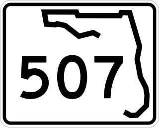
State Road 507 is a 4.9-mile-long (7.9 km), four-lane highway serving Melbourne and Palm Bay, Florida. It is also known locally as Babcock Street. The southern terminus is an intersection with Malabar Road in Palm Bay; the current northern terminus is an intersection with New Haven Avenue in Melbourne.

The Old Spanish Trail was an auto trail that once spanned the United States with almost 2,750 miles (4,430 km) of roadway from ocean to ocean. It crossed eight states and 67 counties along the southern border of the United States. Work on the auto highway began in 1915 at a meeting held at the Battle House Hotel in Mobile, Alabama; and, by the 1920s, the trail linked St. Augustine, Florida, to San Diego, California, with its center and headquarters in San Antonio, Texas. The work at San Antonio, and indeed nationally, was overseen by an executive committee consisting of prominent San Antonio businessmen which met at the Gunter Hotel weekly.
Suntree is an unincorporated community in Brevard County, Florida, United States. It is located near the center of the county, off I-95 near Viera between Interstate 95 and the Florida East Coast Railroad. It lies approximately halfway between Rockledge and Melbourne.

U.S. Highway 1 (US 1) in Florida runs 545 miles (877 km) along the state's east coast from Key West to its crossing of the St. Marys River into Georgia north of Boulogne and south of Folkston. US 1 was designated through Florida when the U.S. Numbered Highway System was established in 1926. With the exception of Monroe County, the highway runs through the easternmost tier of counties in the state, connecting numerous towns and cities along its route, including nine county seats. The road is maintained by the Florida Department of Transportation (FDOT).

Miami Avenue is a 16.8-mile (27.0 km) main north–south street running through Coconut Grove, Brickell, Downtown, and Midtown in Miami, Florida. It is the meridian road dividing the street grid of Miami and Miami-Dade County into east and west avenues.
Brickell Avenue is a north–south road that is part of U.S. Route 1, in Miami, Florida, just south of the Miami River. North of the Brickell Avenue Bridge, U.S. Route 1 is known as Biscayne Boulevard. Brickell Avenue is the main road through the Brickell financial district of Downtown Miami and is considered the Park Avenue of Florida. Brickell Avenue is lined with high-rise office buildings and residential condominiums, as well as many banks and restaurants. It is also famed for "Millionaire Row's" home to a cluster of Miami's most expensive residences.
Canaveral Groves is an unincorporated community in Brevard County, Florida, United States. It is a rural area between State Road 528 and Port St. John. The community is part of the Palm Bay–Melbourne–Titusville Metropolitan Statistical Area. There is a lower population density in the southwestern region, with a total of 140 households.

Lotus is a former village in Brevard County, Florida, United States. It is the location of Honeymoon Hill, the highest point on Merritt Island. Only one road runs through the area, CR 3, accessible to the south by Pineda Causeway and from the north via Florida State Road 520.
Tropic is an unincorporated area in Brevard County, Florida, United States. It is the southernmost area on Merritt Island, and its identity was absorbed into the census-designated place of Merritt Island during the Space Age of the 1950s and 1960s. This portion of Merritt Island is served by County Road 3 and the Mather's Bridge.