Pinopolis Dam

Last updated
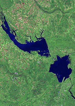
View of Lake Marion (upper left) and Lake Moultrie (bottom right) Lake marion moultrie map.jpg
View of Lake Marion (upper left) and Lake Moultrie (bottom right)

Pinopolis Dam is a dam in Berkeley County, South Carolina.

The earthen and concrete dam was completed in 1941 by Santee Cooper, the state-owned electric and water utility also known as South Carolina Public Service Authority. [1] The dam is 138 feet high and 11,500 feet long at its crest. [2]

Broadly speaking, the dam impounds the Cooper River and creates Lake Moultrie. Specifically Lake Moultrie is fed directly from Lake Marion by a diversion canal built concurrently with the dam. This artificial rerouting of the Cooper River basin has effectively unified the Santee and Cooper River systems into a single hydrological drainage entity.

The overall New Deal-era Santee Cooper Power and Navigation Project improved navigation, provided hydroelectric power, and improved the general health, recreation, and economy of the area. The project was the largest land-clearing project in U.S. history up to that point, with over 12,500 workers clearing over 177,000 acres (720 km2) of swamp and forestland. 42 miles (68 km) of dams and dikes were constructed, including a 26-mile (42 km), 78-foot (24 m) tall earthen dike. The Pinopolis Dam included the hydroelectric station and navigation lock, the highest single-lift lock in the world. A 3,400-foot (1,000 m) spillway was built to control floodwaters, with 62 gates allowing overflow of excess water. In completing the largest earth-moving project in the nation's history, 42,000,000 cubic yards (32,000,000 m3) of earth were moved and 3.1 million cubic yards of concrete were poured. [3] [4] [ citation needed ]

The $48.2 million project (55 percent federal loan, 45 percent federal grant) first generated electricity on Feb. 17, 1942. As transmission lines were built, power flowed to customers in Berkeley, Georgetown and Horry counties, and ultimately to electric cooperatives serving customers in 46 counties. [3] [ citation needed ]

The Pinopolis generating station was renamed Jefferies Hydroelectric Station in 1996 after Richard Manning Jefferies, former Governor of South Carolina and executive of Santee Cooper. It produced 243 MWh electricity in 2019. [5] [6] [7]

The project also flooded the Santee Canal, the cemeteries and plantations of St John's Parish Berkeley, [8] and other historic resources. [1]

Related Research Articles

<span class="mw-page-title-main">Santee River</span> River in South Carolina, United States

The Santee River is a river in South Carolina in the United States, and is 143 miles (230 km) long. The Santee and its tributaries provide the principal drainage for the coastal areas of southeastern South Carolina and navigation for the central coastal plain of South Carolina, emptying into the Atlantic Ocean about halfway between Myrtle Beach and Charleston near the community of McClellanville. The farthest headwaters lie 440 miles (708 km) away on the Catawba River in North Carolina. Besides the Catawba, other principal rivers of the Santee watershed include the Congaree, Broad, Linville, Saluda and the Wateree. The watershed drains a large portion of the Piedmont regions of South and North Carolina. The Santee River is the second largest river on the eastern coast of the United States, second only to the Susquehanna River in drainage area and flow. Much of the upper river is impounded by the expansive, horn-shaped Lake Marion reservoir, formed by the 8-mile (13 km)-long Santee Dam. The dam was built during the Great Depression of the 1930s as a Works Progress Administration (WPA) project to provide a major source of hydroelectric power for the state of South Carolina.

Santee Cooper Country is a tourism district in the south central area of the U.S. state of South Carolina. It surrounds the Santee Cooper Lakes, Lake Moultrie and Lake Marion, which were formed from damming the Santee River and the Cooper River.

<span class="mw-page-title-main">Cooper River (South Carolina)</span> Tidal river of South Carolina, United States

The Cooper River is a mainly tidal river in the U.S. state of South Carolina. The cities of Mt. Pleasant, Charleston, North Charleston, Goose Creek, Moncks Corner, and Hanahan are located along the river. Short and wide, the river is joined first by the blackwater East Branch and then farther downstream at the tidal Wando River. Almost immediately thereafter, the Cooper River widens into its estuary and unites with the Ashley River to form the Charleston Harbor.

<span class="mw-page-title-main">Watts Bar Dam</span> Dam in Tennessee, United States

Watts Bar Dam is a hydroelectric dam on the Tennessee River in Meigs and Rhea counties in Tennessee, United States. The dam is one of nine dams on the main Tennessee River channel operated by the Tennessee Valley Authority, which built the dam in the early 1940s to provide flood control and electricity and to help create a continuous navigable channel along the entire length of the river. The dam is the technical boundary between the 39,090-acre (15,820 ha) Watts Bar Lake— which it impounds— and Chickamauga Lake, which stretches from the dam's tailwaters southward to Chattanooga.

<span class="mw-page-title-main">Pinopolis, South Carolina</span> Census-designated place in South Carolina, United States

Pinopolis is an unincorporated community and census-designated place in Berkeley County, South Carolina, United States. As of the 2010 census it had a population of 948.

<span class="mw-page-title-main">Lake Murray (South Carolina)</span> Body of water

Lake Murray is a reservoir in the U.S. state of South Carolina. It is approximately 50,000 acres in size, and has roughly 650 mi of shoreline. It was impounded in the late 1920s to provide hydroelectric power to the state of South Carolina. Lake Murray is fed by the Saluda River, which flows from upstate South Carolina near the North Carolina state line. The Saluda Dam was an engineering feat at the time of its construction. The dam, using the native red clay soil and bedrock, was the largest earthen dam in the world when it was completed in 1930. Lake Murray itself is named after the project's chief engineer, William S. Murray. The Saluda Dam is approximately 1.5 miles (2.4 km) long and 220 feet (67 m) high. Lake Murray is 41 miles (66 km) long, and 14 miles (23 km) wide at its widest point. At the time when the lake was finished, it was the world's largest man-made reservoir.

<span class="mw-page-title-main">Saluda Dam</span> Dam in near Lexington, South Carolina

The Saluda Dam or Saluda River Dam, officially the Dreher Shoals Dam, commonly referred to as the Lake Murray Dam, is an earthen embankment dam located approximately 10 miles (15 km) west of Columbia, South Carolina on the Saluda River. Construction on the dam began in 1927 and was completed in 1930. The purpose of the dam is flood control, hydroelectricity, recreation and water supply. At the time of its completion, the Saluda Dam was the world's largest earthen dam, creating the world's largest man-made lake, Lake Murray. In 2005, construction on a 213 ft (65 m). tall roller-compacted concrete (RCC) dam was completed at the toe of the original dam in order to mitigate an earthquake-caused dam failure.

<span class="mw-page-title-main">Blowering Dam</span> Dam in Snowy Mountains, New South Wales

The Blowering Dam is a major ungated rock fill with clay core embankment dam with concrete chute spillway impounding a reservoir under the same name. It is located on the Tumut River upstream of Tumut in the Snowy Mountains region of New South Wales, Australia. Purposes for the dam include flood mitigation, hydro-power, irrigation, water supply and conservation. The dam is part of the Snowy Mountains Scheme, a vast hydroelectricity and irrigation complex constructed in south-east Australia between 1949 and 1974 and now run by Snowy Hydro.

The Shoalhaven Scheme is a dual-purpose water supply and Pumped-storage Hydroelectricity scheme located on the South Coast region of New South Wales, Australia.

Hartwell Dam Dam in Georgia, USA

Hartwell Dam is a concrete and embankment dam located on the Savannah River at the border of South Carolina and Georgia, creating Lake Hartwell. The dam was built by the U.S. Army Corps of Engineers between 1955 and 1962 for the purposes of flood control, hydropower and navigation. The concrete and earthen structure spans 15,840 feet (4,828 m). The concrete section is 1,900 feet (579 m) long and rises 204 feet (62 m) above the riverbed at its apex. The Hartwell Dam currently produces 468 million KWh of electricity annually, has prevented over $40 million in flood damage since completion and also provides recreation, water quality, water supply, along with fish and wildlife management.

<span class="mw-page-title-main">Robert-Bourassa generating station</span> Hydroelectric power station in Québec, Canada

The Robert-Bourassa generating station, formerly known as La Grande-2 (LG-2), is a hydroelectric power station on the La Grande River that is part of Hydro-Québec's James Bay Project in Canada. The station can generate 5,616 MW and its 16 units were gradually commissioned between 1979 and 1981. Annual generation is in the vicinity of 26500 GWh.

Santee Cooper, also known officially from the 1930s as the South Carolina Public Service Authority, is South Carolina's state-owned electric and water utility that came into being during the New Deal as both a rural electrification and public works project that created two lakes and cleared large tracts of land while building hydro-electric dams and power plants. Its headquarters are located in Moncks Corner, South Carolina.

<span class="mw-page-title-main">Kentucky Dam</span> Dam in Kentucky, United States

Kentucky Dam is a hydroelectric dam on the Tennessee River on the county line between Livingston and Marshall counties in the U.S. state of Kentucky. The dam is the lowermost of nine dams on the river owned and operated by the Tennessee Valley Authority, which built the dam in the late 1930s and early 1940s to improve navigation on the lower part of the river and reduce flooding on the lower Ohio and Mississippi rivers. It was a major project initiated during the New Deal of President Franklin D. Roosevelt's administration, to invest in infrastructure to benefit the country. The dam impounds the Kentucky Lake of 160,000 acres (65,000 ha), which is the largest of TVA's reservoirs and the largest artificial lake by area in the Eastern United States. It was designated as an National Historic Civil Engineering Landmark by the American Society of Civil Engineers in 1996 and listed on the National Register of Historic Places in 2017.

<span class="mw-page-title-main">Lake Marion (South Carolina)</span> Largest lake in South Carolina, United States

Lake Marion is the largest lake in South Carolina, centrally located and with territory within five counties. The lake is referred to as South Carolina's inland sea. It has a 315-mile (507 km) shoreline and covers nearly 110,000 acres of rolling farmlands, former marshes, and river valley landscape.

<span class="mw-page-title-main">Lake Moultrie</span> Man-made reservoir in South Carolina, United States

Lake Moultrie is the third largest lake in South Carolina. Created in the 1940s by a state utility project to dam the Cooper River, it covers more than 60,000 acres (240 km2). It provides a wide variety of recreational opportunities, including fishing.

<span class="mw-page-title-main">Hanover House (Clemson)</span> Historic house in South Carolina, United States

Hanover House is a colonial house built by a French Huguenot family in 1714–1716, on the upper Cooper River in present-day Berkeley County of the South Carolina Low Country. The house is also known as the St. Julien-Ravenel House after its early owners.

According to the International Hydropower Association, Canada is the fourth largest producer of hydroelectricity in the world in 2021 after the United States, Brazil, and China. In 2014, Canada consumed the equivalent of 85.7 megatonnes worth of oil of hydroelectricity, 9.8% of worldwide hydroelectric consumption. Furthermore, hydroelectricity accounted for 25.7% of Canada's total energy consumption. It is the third-most consumed energy in Canada behind oil and natural gas.

The Upper Siang Hydroelectric Project consists of the construction of several hydroelectric power dams in the Upper Siang district of Arunachal Pradesh, India. Construction work on the project was commenced by the National Hydroelectric Power Corporation (NHPC) in April 2009 and various hydro dams will be constructed in phases over a span of 15–20 years.

The Kpong Dam, also known as the Akuse Dam, is a hydroelectric power generating dam on the lower Volta River near Akuse in Ghana. It is owned and operated by Volta River Authority. It was constructed between 1977 and 1982. Its power station has a capacity of 148 megawatts (198,000 hp) with all four units running, though the total nameplate capacity is 160 megawatts (210,000 hp).

References

  1. 1 2 "Your Santee Cooper History". Santee Cooper. Archived from the original on 2001-06-16.
  2. "Cooper Dev - Pinopolis Dam, east South Carolina". Findlakes.com. Archived from the original on 2012-10-17.
  3. 1 2 "Pinopolis Lock". Santee Cooper . Archived from the original on 2017-09-30.
  4. "Santee Cooper Project". Poe Family Papers. Clemson University Library Special Collections. Retrieved 2022-09-27.
  5. "Download Data eGRID2019". U.S EPA Emissions & Generation Resource Integrated Database. 20 August 2020. Retrieved 2021-08-03.
  6. Jackson, Susan. "Renewable hydro generation and art deco architecture Great Depression's lasting legacy". Santee Cooper . Retrieved 2021-08-03.
  7. "Jefferies Hydro Powerhouse Tour Brochure" (PDF). Santee Cooper. Archived from the original (PDF) on 2010-11-03.
  8. "South Carolina - Lost Places".

Coordinates: 33°15′53″N80°06′02″W / 33.26464°N 80.10061°W / 33.26464; -80.10061