Related Research Articles

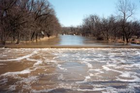
The Wabash River is a 503-mile-long (810 km) river that drains most of the state of Indiana, and a significant part of Illinois, in the United States. It flows from the headwaters in Ohio, near the Indiana border, then southwest across northern Indiana turning south near the Illinois border, where the southern portion forms the Indiana-Illinois border before flowing into the Ohio River.

The White River is an American two-forked river that flows through central and southern Indiana and is the main tributary to the Wabash River. Via the west fork, considered to be the main stem of the river by the U.S. Board on Geographic Names, the White River is 362 miles (583 km) long. Indiana's capital, Indianapolis, is located on the river. The two forks meet just north of Petersburg and empty into the Wabash River at Mount Carmel, Illinois.

The Wabash and Erie Canal was a shipping canal that linked the Great Lakes to the Ohio River via an artificial waterway. The canal provided traders with access from the Great Lakes all the way to the Gulf of Mexico. Over 460 miles long, it was the longest canal ever built in North America.

Cedar Creek is the largest tributary of the St. Joseph River, draining 174,780 acres (707.3 km2) in the Eastern Corn Belt Plains of northeastern Indiana. It is 31.9 miles (51.3 km) long, rising in northwestern DeKalb County and joining the St. Joseph just below the Cedarville Dam in Allen County.
The Eel River is a 94-mile-long (151 km) tributary of the Wabash River in northern Indiana in the United States. Via the Wabash and Ohio rivers, its waters flow to the Mississippi River and ultimately the Gulf of Mexico. The Eel River rises southeast of Huntertown in Allen County and flows southwest through Allen, Whitley, Kosciusko, Wabash, Miami, and Cass counties to join the Wabash at Logansport. The river was called Kineepikwameekwa Siipiiwi - "river of the snake fish" by the Miami people, who inhabited the area at the time of European contact, the English rendered it as Ke-na-po-co-mo-co. It is the northern of the two rivers named Eel River within Indiana.
The Little River is a 22.6-mile-long (36.4 km) stream in Allen and Huntington counties in northeastern Indiana. A tributary of the Wabash River, it is sometimes called the "Little Wabash", which may cause it to be confused with the Little Wabash River of Illinois. The river drains an area of 287.9 square miles (746 km2).

Wildcat Creek is a tributary of the Wabash River in north-central Indiana. The stream is 84 miles (135 km) long and drains an area of 804.2 square miles (2,083 km2). Wildcat Creek consists of three main forks-North, South, and Middle. All forks flow in a general east-west direction through varied topography and land uses, including cropland, pasture, forest and developed areas.

Sugar Creek is a waterway located in the U.S. state of Indiana. It originates in a farm field approximately two miles south of Kempton, Indiana, and travels west-southwest for about 93 miles (150 km) before merging with the Wabash River 5 miles (8.0 km) north of Montezuma. The largest community on the waterway is Crawfordsville.

Tippecanoe Township is one of thirteen townships in Tippecanoe County, Indiana, United States. As of the 2010 census, its population was 7,702 and it contained 3,085 housing units.

Pipe Creek Township is one of fourteen townships in Miami County, Indiana, United States. As of the 2020 census, its population was 6,778 and it contained 2,926 housing units. The north three-quarters of Grissom Joint Air Reserve Base is in the southwest corner of the township.
The Eel River is a 52.8-mile-long (85.0 km) tributary of the White River in southwestern Indiana. Via the White, Wabash, and Ohio rivers, its waters flow to the Mississippi River and the Gulf of Mexico. The Eel River flows through Greene, Owen, Clay, and Putnam counties. It is the southern of the two rivers named Eel River within Indiana.

The Packerton Moraine in north-central Indiana has been considered by most persons who have studied it to be a large interlobate moraine between the Saginaw and the Erie lobes. The northeast-southwest direction of the eskers north of Disko, Wabash County, and the southeast-northwest trend south of there indicated that the part of the Packerton moraine south of Disko was built by the Erie lobe and the part north of Disko by the Saginaw lobe. An esker, Miami County shows a northeast-southwest alignment, providing evidence that Packerton moraine in Miami County was built by the Erie lobe. A small area in the northwestern was deposited by the Saginaw lobe. It is named the Packerton moraine from the village of Packerton in Kosciusko County. Thirteen kames and eskers complexes are mixed with sand and gravel. The till is, sandier, especially in the part deposited by the Saginaw lobe, than in the lobe passed over some source of sand, whereas the Erie lobe did not. Water-laid or wind-blown sands are found throughout the moraine. The bulk of the sand seems to have been water-deposited, but locally the sand appears to have been reworked by the wind. Few of the sand deposits exhibit dunal forms.
Bluff Creek is an unincorporated community in Johnson County, Indiana, in the United States.
Pipe Creek is a stream in the U.S. state of Indiana. It is a tributary of the White River, and is named for Captain Pipe, a Delaware chief.
Otter Creek is a stream in Clay and Vigo counties, in the U.S. state of Indiana. It is a tributary of the Wabash River.
Indian Creek is a stream in the U.S. state of Indiana. It is a tributary of the Tippecanoe River.

Deer Creek is a stream in Howard, Miami, Cass, and Carroll counties of the U.S. state of Indiana. It is a tributary of the Wabash River, and its lower reaches are a popular local canoeing and rafting venue.
Lost Creek is a stream in Washington County in the U.S. state of Missouri. It is a tributary of Cedar Creek.
Cicero Creek is a stream in the U.S. state of Indiana. It is a tributary to the White River.
References
- ↑ U.S. Geological Survey Geographic Names Information System: Pipe Creek (Wabash River tributary)
- ↑ Dunn, Jacob Piatt; Kemer, General William Harrison (1919). Indiana and Indianans: A History of Aboriginal and Territorial Indiana and the Century of Statehood. Index. American Historical Society. p. 94.
40°44′44″N86°13′15″W / 40.74556°N 86.22083°W
| | This article related to a river in Indiana is a stub. You can help Wikipedia by expanding it. |