Plano, Missouri

Last updated
MOMap-doton-Plano.png

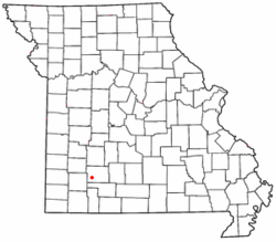
Plano is an unincorporated community on former U.S. Route 66, now Route 266 in Greene County, Missouri, United States. The community is part of the Springfield, Missouri Metropolitan Statistical Area.

A post office called Plano was established in 1895, and remained in operation until 1903. [1] The name most likely is a transfer from Plano, Texas. [2] Little remains of the original community. [3]

Related Research Articles

Turners, Missouri unincorporated community in Missouri

Turners or Turner is a small unincorporated community in Greene County, Missouri, United States. It lies on the southeast side of the James River floodplain approximately 3.5 miles east of U.S. Route 65 in east Springfield. The community lies at the intersection of Routes D and J near the confluence of Turner Creek with the James River. The old St. Louis - San Francisco Railroad passed through the community.

Heatonville, Missouri unincorporated community

Heatonville is a small unincorporated community in Lawrence County, Missouri, United States. It lies along former U.S. Route 66, approximately six miles (10 km) north-east of Mount Vernon.

Phelps, Missouri human settlement in Missouri, United States of America

Phelps is an unincorporated community in Lawrence County, Missouri, United States. It lies along former U.S. Route 66, twenty-one miles east of Carthage.

Rescue, Missouri unincorporated community in Lawrence County, Missouri, United States

Rescue is a small unincorporated community in western Lawrence County, Missouri, United States. It lies along Route 96, approximately eighteen miles east of Carthage.

Spencer, Missouri small unincorporated crossroads in eastern Lawrence County, Missouri, United States

Spencer is a small unincorporated crossroads in eastern Lawrence County, Missouri, United States. It lies along former U.S. Route 66 approximately six miles (10 km) west of Halltown.

Ebenezer is an unincorporated community in Greene County, Missouri, United States. It lies two miles north of McDaniel Lake north of Springfield and 1.25 miles east of Route 13. The community is at the head of the King Branch of the North Dry Sac River.

Olive is an unincorporated community in southeastern Dallas County, in the U.S. state of Missouri.

Cody is an unincorporated community in southeastern Greene County, in the U.S. state of Missouri.

Elwood or Elwood Siding is an unincorporated community in Greene County, in the U.S. state of Missouri. The community lies along the railroad southwest of the Springfield airport. The headwaters of Clear Creek are just to the northeast.

Galloway is a neighborhood of southeast Springfield, Missouri, United States. Galloway is located in a stream valley approximately one-half mile north of the U.S. Route 60 and U.S. Route 65 interchange and one mile south of Sequiota Park.

Hackney is an unincorporated community in northwest Greene County, in the U.S. state of Missouri. The community was a mill site on the north bank of a meander in the Little Sac River. The old iron Hackney Mill Bridge directly south of the community was constructed in 1895-96 and was replaced in 1996.

Harold is an unincorporated community in northwest Greene County, in the U.S. state of Missouri. Harold is located on Missouri Route 123, southeast of Walnut Grove and 1.5 miles east of Phenix.

Haseltine is an unincorporated community in Greene County, in the U.S. state of Missouri. The community location was west of Springfield on U.S. Route 266, adjacent to Interstate 44.

Hickory Barren is an unincorporated community in northern Greene County, in the U.S. state of Missouri. The community is on Missouri Route H, two miles north of Fellows Lake. Fair Grove is approximately four miles to the northeast.

Mentor is an unincorporated community in southern Greene County, in the U.S. state of Missouri. The community is located southeast of Springfield, south of U.S. Route 60, west of Missouri Route NN and one mile north of the Greene-Christian county line.

Palmetto is an unincorporated community in southeastern Greene County, in the U.S. state of Missouri. The community lies at an elevation of 1437 feet and is located near the headwaters of Turner Creek on the BNSF Railway, approximately two miles northwest of Rogersville. Henderson in western Webster County lies approximately 1.5 miles to the east along Missouri Route D.

Pearl is an unincorporated community in northwest Greene County, in the U.S. state of Missouri. Pearl is located on Missouri Route 123, four miles northwest of Willard. Cave Spring lies approximately one mile to the east.

Pickerel Creek is a stream in Christian and Greene counties in the Ozarks of southwest Missouri. The stream is a tributary to the Sac River.

Pond Creek is a stream in Greene County in the U.S. state of Missouri. It is a tributary of the Sac River.

Brookline Township is an inactive township in Greene County, in the U.S. state of Missouri.

References

  1. "Post Offices". Jim Forte Postal History. Retrieved 3 October 2016.
  2. "Greene County Place Names, 1928–1945 (archived)". The State Historical Society of Missouri. Archived from the original on 24 June 2016. Retrieved 3 October 2016.CS1 maint: BOT: original-url status unknown (link)
  3. http://route66news.com/2013/12/05/true-story-ruins-plano/

Coordinates: 37°11′34″N93°33′03″W / 37.1928°N 93.5508°W / 37.1928; -93.5508