
Guanacaste is a province of Costa Rica located in the northwestern region of the country, along the coast of the Pacific Ocean. It is bordered by Nicaragua to the north, Alajuela Province to the east, and Puntarenas Province to the southeast. It is the most sparsely populated of all the provinces of Costa Rica. The province covers an area of 10,141 km2 (3,915 sq mi) and as of 2010, had a population of 354,154, with annual revenue of $2 million.

Liberia is a district and the largest city in the Guanacaste Province of Costa Rica, located 215 kilometres (134 mi) northwest of the national capital, San José, in the canton with the same name, of which it is the head city or capital. It is a major center for the country's tourism industry.

Las Baulas de Guanacaste Marine National Park is a National Park of Costa Rica and a Ramsar Site. The park is managed by the Tempisque Conservation Area, and covers approximately a 167.3 square kilometres (64.6 sq mi) marine area of the Tamarindo Bay, next to the town of Tamarindo. It supports the largest nesting colony of leatherback sea turtles on the Pacific coast of the Americas. Female leatherbacks often come ashore at Playa Grande between October and May to lay their eggs.

The Nicoya Peninsula is a peninsula on the Pacific coast of Costa Rica. It is divided into two provinces: Guanacaste Province in the north, and the Puntarenas Province in the south. It is located at 10°N 85.4166667°W. It varies from 19 to 37 miles (60 km) wide and is approximately 75 miles (121 km) long, forming the largest peninsula in the country. It is known for its beaches and is a popular tourist destination.

Iguanita Wildlife Refuge is a wildlife refuge, part of the Guanacaste Conservation Area, in Guanacaste Province, northwestern Costa Rica.
Jacó is a district of the Garabito canton, in the Puntarenas province of Costa Rica. Jacó has a black sand beach that is 4 km (2.5 mi) long and is popular among surfers.

The Gulf of Papagayo is a large body of water off Guanacaste province and the northwestern coast of Costa Rica. The Gulf and its coastline are part of a major tourism project by Costa Rica's government. Among the most popular destinations on the Gulf of Papagayo are Ocotal Beach, Playas del Coco, Playa Hermosa, and Playa Panama. The Papagayo peninsula is the most developed area in the gulf region. The gulf waters are home to many wildlife including orcas.
Playa Negra is a beach in the Guanacaste Province of Costa Rica. It is south of the town of Tamarindo. Los Pargos, meaning "the snapper", is the name of the town closest to Playa Negra. It is south of Avellanas and north of Junquillal. It is accessed from Santa Cruz through 27 de Abril and then Paraiso.
Tamarindo River is a river in the Guanacaste Province of Costa Rica. The estuary is adjacent to the town of Tamarindo. The river spans 490 hectares and serves as the natural border between Tamarindo and Playa Grande. The estuary is home to much wildlife, including ospreys, herons and kingfishers in addition to howler monkeys and coatimundis. In particular, it hosts the American Crocodile, which draws tourists to the estuary. The river estuary is a popular place for surfing despite the local caiman population.

Nosara is a district of the Nicoya canton, in the Guanacaste province of Costa Rica.

Carrillo is a canton in the Guanacaste province of Costa Rica. The head city is in Filadelfia district.

Tourism in Costa Rica has been one of the fastest growing economic sectors of the country and by 1995 became the largest foreign exchange earner. Since 1999, tourism has earned more foreign exchange than bananas, pineapples and coffee exports combined. The tourism boom began in 1987, with the number of visitors up from 329,000 in 1988, through 1.03 million in 1999, over 2 million in 2008, to a historical record of 2.66 million foreign visitors in 2015. In 2012, tourism contributed with 12.5% of the country's GDP and it was responsible for 11.7% of direct and indirect employment. In 2009, tourism attracted 17% of foreign direct investment inflows, and 13% in average between 2000 and 2009. In 2010, the tourism industry was responsible for 21.2% of foreign exchange generated by all exports. According to a 2007 report by ECLAC, tourism contributed to a reduction in poverty of 3% in the country.

Peninsula Papagayo is located on the north Pacific coast of Costa Rica and is in the northwest province of Guanacaste. It is located in the Golfo de Papagayo, and was formed by volcanic activity as the Caribbean tectonic plate continuously overrode the Cocos Plate and by subsequent weather erosion. The 15 miles (24 km) of coastline contains 31 separate beaches. The larger Peninsula Santa Elena to the north protects the waters of the Papagayo Peninsula.

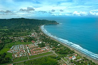
Puerto Carrillo is a district of the Hojancha canton, in the Guanacaste province of Costa Rica.

Playas del Coco is one of the oldest beach communities in Guanacaste Province, Costa Rica. This region is also one of the fastest growing areas of tourism in Costa Rica. It has long been a popular destination with both local Costa Ricans as well as visitors from other countries during the traditional holiday seasons. Local Costa Ricans refer to Playas del Coco affectionately as "El Coco", while travellers from outside of Costa Rica use the name "Coco Beach", when mentioning this attractive locale.
Sardinal is a district of the Carrillo canton, in the Guanacaste province of Costa Rica.
Las Catalinas is a beach town developed in 2006 along the shores of the Pacific Ocean in the Guanacaste Province of northwest Costa Rica. It was envisioned as a compact, car-free, and fully walkable town, based on the principles of New Urbanism. Las Catalinas was founded by Charles Brewer (businessman), the town's website claims to promote a 'healthy, sustainable, fulfilling and fun lifestyle'.
Punta Islita is a resort town with secluded beaches in the Nandayure Canton, Guanacaste Province of Costa Rica. The Punta Islita Airport is located in a nearby town of Corozalito.
Playa Coyote, also known as Puerto Coyote, is a beach at San Francisco de Coyote, in the canton of Nandayure, Guanacaste Province in Costa Rica. Located on the Nicoya Peninsula, it is situated at the Pacific Ocean at Ruta 160.
National Secondary Route 160, or just Route 160 is a National Road Route of Costa Rica, located in the Guanacaste, Puntarenas provinces. The road is between Naranjo ferry terminal and Route 21 in Nicoya peninsula, and again with Route 21 at Santa Cruz, Guanacaste.
