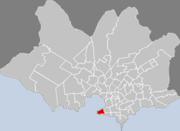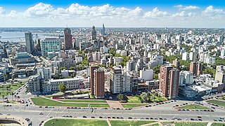
Montevideo is the capital and largest city of Uruguay. According to the 2011 census, the city proper has a population of 1,319,108 in an area of 201 square kilometers (78 sq mi). Montevideo is situated on the southern coast of the country, on the northeastern bank of the Río de la Plata.

Plaza San Martín is a park located in the Retiro neighbourhood of Buenos Aires, Argentina. Situated at the northern end of pedestrianized Florida Street, the park is bounded by Libertador Ave. (N), Maipú St. (W), Santa Fe Avenue (S), and Leandro Alem Av. (E). Its coordinates are 34°35′42″S58°22′32″W.

Lorenzo Coullaut Valera was a Spanish sculptor. Born in Marchena, he grew up in Nantes where his family had moved. He studied at the Livet Lyceum and returned to Spain in 1893. At Seville, he studied at the studios of Antonio Susillo and Agustí Querol Subirats.
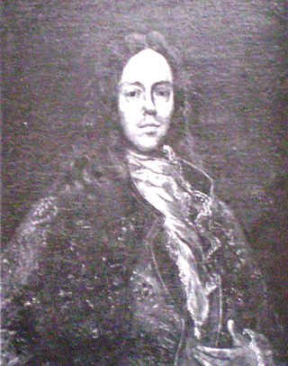
Bruno Mauricio de Zabala y Gortázar (1682–1736) was a Spanish soldier and colonial administrator who served as governor of the Governorate of the Río de la Plata from 1717 to 1734 and founded the city of Montevideo, capital of present-day Uruguay.

Puerta de la Ciudadela is one of the few remaining parts of the wall that surrounded the oldest part of the city of Montevideo, the citadel, which was torn down in 1829.This drawbridge over a moat was built in 1745 as the only entrance to the city. It is located by Plaza Independencia, in Ciudad Vieja.

Solís Theatre is Uruguay's most important and renowned theater. It opened in 1856. The building was designed by the Italian architect Carlo Zucchi. It is located in Montevideo's Old Town, right next to the Plaza Independencia. The theatre was named after the explorer Juan Díaz de Solís, who was the first European explorer to land in modern day Uruguay.
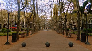
Plaza de la Constitución, also known as Plaza Matriz, is the oldest city square in Montevideo, Uruguay.

Plaza Independencia is the most important city square in Montevideo, Uruguay, laid out in the 19th century in the area occupied by the Citadel of Montevideo. In its center is a monument to General José Gervasio Artigas, and below it, his mausoleum.

Avenida 18 de Julio, or 18 de Julio Avenue, is the most important avenue in Montevideo, Uruguay. It is named after the date when the country's first Constitution was sworn in, on July 18, 1830.

The Estévez Palace is a building situated in Plaza Independencia, Montevideo, Uruguay, designed in a combination of Doric and Colonial styles by Manoel de Castel in 1873. It has served as the working place of the President of Uruguay and has been eventually converted to a museum, housing artifacts and mementos of the Uruguayan presidency and its office holders.
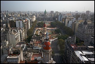
Plaza del Congreso is a public park facing the Argentine Congress in Buenos Aires. The plaza is part of a 3 hectare open space comprising three adjoining plazas to the east of the Congress building. The Kilometre Zero for all Argentine National Highways is marked on a milestone at the plaza.
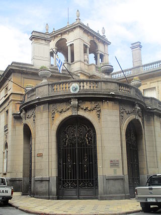
Palacio Taranco, located in front of the Plaza Zabala, in the heart of the Old City of Montevideo, Uruguay, is a palace erected in the early 20th century during a period in which the architectural style was influenced by French architecture. It was designed by French architects Charles Louis Girault and Jules Chifflot León, who also designed the Petit Palais and the Arc de Triomphe in Paris. This building contains European furniture and drapings and currently contains the Museum of Decorative Arts in Montevideo. The palace is often used as a meeting place by the Uruguayan government.

Parque Prado is the largest of Montevideo's six principal public parks. Established in 1873, it covers an area of 106 hectares and is located in the barrio of Prado. Located in the northern part of the city, the Miguelete Creek flows through the neighbourhood and park of the same name.

The Italian Hospital of Montevideo, whose official name is Ospedale italiano Umberto I, is a clinic and sanatorium founded in 1890 near Parque Batlle, Montevideo. It lies just to the north of the 1830 obelisk and the Hospital Pereira Rossell. The building, of the late neoclassical style, is the work of architect Luis Andreoni.

Plaza de Cagancha is a public square in barrio Centro of Montevideo, Uruguay. Located on 18 de Julio Avenue, the main avenue of the city, it originated in 1836 as the central space of the layout of the "Ciudad Nueva", outside the limits of the walled area of the colonial period.

Plaza Fabini also known as Plaza del Entrevero, is a public square in the central business district of Montevideo, Uruguay. Located on 18 de Julio Avenue, on its north side starts Libertador Avenue.

Libertador Avenue is a major avenue in Montevideo, Uruguay. It stretches north from the Legislative Palace in Aguada to Plaza Fabini in Centro, and is named after Juan Antonio Lavalleja, revolutionary figure and politician, who led the group of the Thirty-Three Orientals in the insurrection for the independence of Oriental Province.

Palacio Rinaldi is a building in Centro, Montevideo, Uruguay, located on the Plaza Independencia near its junction with the 18 de Julio Avenue, near the Palacio Salvo.

Plaza Francia is a public square in the barrio of Recoleta in Buenos Aires, Argentina. The nearby Plaza Intendente Alvear is commonly but mistakenly known by the same name. It was created by a Municipal Ordinance on October 19, 1909, as part of the changes introduced in the urban landscape on the occasion of the Argentina Centennial. Designed by French landscape architecture Carlos Thays, it is part of a broad set of squares including Plaza Intendente Alvear, Plaza San Martín de Tours, Plaza Juan XXIII, Plaza Ramón J. Cárcano, Plaza Dante and Plaza Rubén Darío, among others.


