Related Research Articles

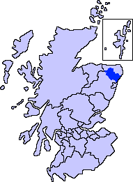
Buchan is a coastal district in the north-east of Scotland, bounded by the Ythan and Deveron rivers. It was one of the original provinces of the Kingdom of Alba. It is now one of the six committee areas of Aberdeenshire.

A staging area is a location in which organisms, people, vehicles, equipment, or material are assembled before use. It may refer to:

Colonel Sir John Sinclair, 1st Baronet,, was a Scottish politician, military officer and writer who was one of the first people to use the word "statistics" in the English language in his pioneering work, Statistical Accounts of Scotland, which was published in 21 volumes.

The River Ugie or Ugie Water is a river in North East Scotland; it flows into the North Sea on the east coast at Peterhead, north of Cruden Bay. There is considerable evidence of prehistoric settlement within the Ugie drainage basin, especially in the South Ugie Water catchment basin. For example, the Catto Long Barrow is found somewhat to the south of the Ugie Water mainstem.
Formartine is a committee area in Aberdeenshire, Scotland. This district extends north from the River Don to the River Ythan. It has a population of 36,478.

Maud is a village in the Buchan area of the Scottish county of Aberdeenshire, with a population of 780. Located 13 miles (21 km) west of Peterhead on the South Ugie Water, Maud rose to prosperity after 1863 as a railway junction of the Formartine and Buchan Railway that ran through Maud to Fraserburgh and Peterhead, but has always been the meeting place of six roads. It has had a variety of names:

The name Bullers of Buchan refers both to a collapsed sea cave and to the adjacent village, situated about 6 miles (9.7 km) south of Peterhead in Buchan, Aberdeenshire, Scotland.

Mintlaw(literally meaning a smooth, flat place) is a large village in Aberdeenshire, Scotland. It lies at the intersection of the A950 and A952 roads, west of Peterhead. The 2001 UK census records a population of 2,647 people.

Fetterangus is a small village in Aberdeenshire, Scotland, located just to the north of Mintlaw. Fetterangus is often called "Fishie", though the origin of this nickname is unknown.

New Pitsligo, also known as Cavoch, is a village in Aberdeenshire, Scotland, near Fraserburgh.

The A952 road is a main road in Aberdeenshire, Scotland. This roadway is a north–south connector that serves as an inland bypass to the more coastally aligned A90 road. It runs from Toll of Birness in the south to Cortes in the north, passing through the communities of Ardallie, Clola, Mintlaw and New Leeds. It has been noted that traffic accidents are most frequent at pronounced road bends along the A952.

Boddam is a coastal village in Aberdeenshire, Scotland. It is 29 miles (47 km) north of Aberdeen and 3 miles (4.8 km) south of Peterhead. The settlement of Stirling Village lies immediately to the west. Sea cliffs rise to 200 feet (61 m), south of the village: a coastal path leads along these to the Bullers of Buchan.

Hatton is a village in Aberdeenshire, Scotland that lies on the A90 road, approximately equidistant from both Ellon and Peterhead.

St Combs is a small fishing village in Aberdeenshire, Scotland, immediately southeast of Inverallochy. It has existed since at least the 17th century, and takes its name from a church to St Colm that used to exist in the area and was abandoned in 1607. Only a fragment of it remains. The remains of Lonmay Castle are also in the area. The village sits across Loch Strathbeg from Rattray.
Longmanhill is a Bronze Age long barrow situated atop a prominent rounded landform in northern Aberdeenshire, Scotland near Banff Bay. Due to the low-lying coastal plain characteristics, the elevation of Longmanhill affords a long-distance view as far as the Moray Firth.
Laeca Burn is a stream in northeastern Aberdeenshire, Scotland. There are numerous archaeological sites in the Laeca Burn watershed, "especially on the eastern side of Laeca Burn", where Catto Long Barrow is situated.
Skelmuir Hill is a landform in Aberdeenshire, Scotland. This is the location of a trig point or official government survey marker. Skelmuir Hill is the site of some ancient standing stones; it is in the vicinity of another ancient monument, Catto Long Barrow.
The Hill of Aldie is an elevated landform in the east of Aberdeenshire, Scotland. Nearby is the prehistoric monument Catto Long Barrow.
Morris Wells are a series of natural springs in eastern Aberdeenshire, Scotland. This water source has historically been a water supply for the town of Peterhead.
Bogbrae is a hamlet in northeastern Aberdeenshire, Scotland. This location was mentioned in the geographical literature as early as 1869, observed as a locus of filling of a natural moss or bog. There is considerable evidence of vicinity habitation by early man in the area near Bogbrae. Some of these nearby human traces are evident in Catto Long Barrow, a massive stone structure now surrounded by agricultural fields.
References
Notes
Bibliography
- F. C. Heath (1911) The Royal Engineers Journal, vol. XIV, Royal Engineers Institute, W. & J. Mackay & Co., Ltd
- C. Michael Hogan (2008)"Catto Long Barrow fieldnotes", Modern Antiquarian
| | This military-related article is a stub. You can help Wikipedia by expanding it. |