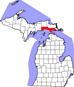
Pointe Aux Barques Township is a civil township of Huron County in the U.S. state of Michigan. The population was 10 at the 2010 census.

Lake St. Clair is a freshwater lake that lies between the Canadian province of Ontario and the U.S. state of Michigan. It was named after Clare of Assisi, on whose feast day it was navigated and christened by French Catholic explorers in 1679. It is part of the Great Lakes system, and along with the St. Clair River and Detroit River, Lake St. Clair connects Lake Huron with Lake Erie. It has a total surface area of about 430 square miles (1,100 km2) and an average depth of just 11 feet (3.4 m); to ensure an uninterrupted waterway, government agencies in both countries have maintained a deep shipping channel through the shallow lake for more than a century.

Grosse Pointe refers to an affluent coastal area adjacent to Detroit, Michigan, United States, that comprises five adjacent individual cities. From southwest to northeast, they are:
Jefferson Avenue is a 63.71-mile-long (102.53 km) scenic road along the eastern part of the Detroit metropolitan area in the southeastern part of the U.S. state of Michigan. It travels alongside Lake Erie, the Detroit River, and Lake St. Clair. This road also provides access to many recreational facilities in the area. West Jefferson Avenue is primarily a commercial, while East Jefferson Avenue contains a historic residential district.

Bois Blanc Island is an island in Lake Huron coterminous with Bois Blanc Township, Mackinac County, Michigan. The island covers about 34 sq mi (88 km2) and is about 12 miles (19 km) long, 6 miles (9.6 km) wide and has 6 lakes. It lies southeast of Mackinac Island and almost due north of the city of Cheboygan.

Bourg is an unincorporated community in Terrebonne Parish, Louisiana, United States. It is part of the Houma–Bayou Cane–Thibodaux Metropolitan Statistical Area.

The Atchafalaya Basin, or Atchafalaya Swamp, is the largest wetland and swamp in the United States. Located in south central Louisiana, it is a combination of wetlands and river delta area where the Atchafalaya River and the Gulf of Mexico converge. The river stretches from near Simmesport in the north through parts of eight parishes to the Morgan City southern area.

The Detroit International Riverfront is a tourist attraction and landmark of Detroit, Michigan extending from the Ambassador Bridge in the west to Belle Isle in the east, for a total of 5.5 miles. The International Riverfront encompasses a cruise ship passenger terminal and dock, a marina, a multitude of parks, restaurants, retail shops, skyscrapers, and high rise residential areas along with Cobo Center. The Marriott at the Renaissance Center and the Robert's Riverwalk Hotel are also situated along the International Riverfront. Private companies and foundations together with the city, state, and federal government have contributed several hundred million dollars toward the riverfront development. Key public spaces in the International Riverfront, such as the RiverWalk, Dequindre Cut Greenway and Trail, William G. Milliken State Park and Harbor, and a cruise ship passenger terminal and dock at Hart Plaza complement the architecture of the area. The area provides a venue for a variety of annual events and festivals including the Detroit Electronic Music Festival, Detroit Free Press International Marathon, the Detroit International Jazz Festival, Motor City Pride, the North American International Auto Show, and River Days.
The city of Sault Ste. Marie, Ontario, Canada contains a significant number of named residential neighbourhoods, including Bayview, Broadview Gardens, Brookfield, Buckley, Carpin Beach, Cedar Heights, East Korah, Eastside, Fort Creek, Grandview Gardens, Korah, Manitou Park, McQueen, Meadow Park, Nokomis Beach, Odena, The P Patch, Pointe aux Pins, Pointe des Chênes, Pointe Louise and Steelton.

The Pointe aux Barques Lighthouse ranks among the ten oldest lighthouses in Michigan. It is an active lighthouse maintained by the US Coast Guard remotely, located in Lighthouse County Park on Lake Huron near Port Hope, Michigan in Huron County. "Pointe aux Barques" means 'Point of Little Boats', a descriptor of the shallow shoals and reefs that lurk beneath these waves, presenting a hazard to boats as they round Michigan's Thumb.
The Milk River is a 1.7-mile-long (2.7 km) stream in Wayne County and Macomb County, Michigan, flowing into Lake St. Clair. It flows through the cities of Grosse Pointe Woods and St. Clair Shores.

The Thumb Area Underwater Preserve is a preservation area in Lake Huron in the U.S. state of Michigan. It is 276 square miles (710 km2) in size and is located off Michigan's Thumb north of Detroit.
Pointe-aux-Chênes is an unincorporated community located in Terrebonne Parish, Louisiana,United States. In Cajun French, the area is known as Pointe-aux-Chenes. The community shares a zip code with Montegut (70377) and has many residents of Chitimacha descent. In 1993, they established the independent Pointe-au-Chien Indian Tribe, which is one of three state-recognized Houma tribes.

The Grosse Pointe Academy is an independent day school located at 171 Lake Shore Drive in Grosse Pointe Farms, Michigan. Originally known as the Academy of the Sacred Heart, the campus buildings were designated a Michigan State Historic Site in 1977 and listed on the National Register of Historic Places in 1987. The school serves preschool through middle school.

Shediac Bay is a tidal embayment, an extension of the Northumberland Strait in New Brunswick, Canada.
The Pointe aux Chenes Formation is a geologic formation in Michigan. It preserves fossils dating back to the Silurian period.
Pointe-aux-Chenes Wildlife Management Area, also referred to as the Pointe-aux-Chenes WMA, is a 33,488 acres (13,552 ha) protected area located in Terrebonne and Lafourche Parish, Louisiana that is owned and managed by the Louisiana Department of Wildlife and Fisheries (LDWF).