
Saumarez is a Canadian parish in Gloucester County, New Brunswick. It was incorporated into the Regional Municipality of Grand Tracadie–Sheila on July 1, 2014. Its population in the 2011 Census was 6,920.

Bas-Caraquet is a Canadian village in Gloucester County, New Brunswick.
Le Goulet is a Canadian village in Gloucester County, New Brunswick.
Saint-Isidore is a village in Gloucester County, New Brunswick, Canada. It is bordered by the communities of Pont-Landry, Hacheyville, Bois-Gagnon and Tilley Road. The community is situated on the Acadian Peninsula. The current mayor is Oscar Roussel.

Point Escuminac is a cape located in eastern New Brunswick, Canada. Its geographic coordinates are 47º04'N, 64º48'W.

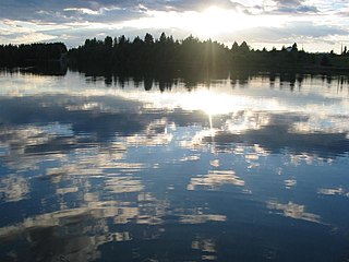
Lamèque Island is a Canadian island in the Gulf of St. Lawrence at the northeastern tip of Gloucester County, New Brunswick.
The Pokemouche River is in north eastern New Brunswick, Canada. The name is derived from the Algonquin language. Its headwaters are near the community of Paquetville, and it flows in an easterly direction approximately twenty kilometers where it empties into the Gulf of St. Lawrence at Inkerman Lake. Other communities along its watershed include Maltampec and Pokemouche. Its tributaries include South Branch Pokemouche River, Cowans Creek, and the Waugh River.
Kiwanis Park is a 3,500 seat baseball field located in Moncton, New Brunswick. The field was donated to the City of Moncton in 1953 by the local Kiwanis Club. It is the largest baseball field in Canada east of Quebec City. The field is the current home of the Moncton Fisher Cats and also, the Junior and Minor league Metro Mudcats. It has played host to many baseball tournaments including the 1975 Intercontinental Cup, the 1997 World Junior Baseball Championship, and the 2004 Baseball Canada Senior Championships.
The Maritime Plain is a physiographic province of the larger Appalachian division. The Maritime Plain runs around the coast of New Brunswick and Nova Scotia from the south shore of Chaleur Bay and includes Prince Edward Island and the Magdalen Islands. The Kouchibouguac National Park lies in the New Brunswick lowlands, part of the Maritime Plain.

The Moncton City Council is the governing body of the City of Moncton, New Brunswick, Canada. It consists of a mayor and ten councillors elected to four-year terms. The council is non-partisan with the mayor serving as the chairman, casting a ballot only in cases of a tie vote. There are four wards electing two councillors each with an additional two councillors selected at-large by the general electorate. Day-to-day operation of the city is under the control of a city manager.
Point de Bute is an unincorporated community in Westmorland County, New Brunswick, Canada.
Pokemouche 13 is the Statistics Canada census area designation for what is properly termed the Pokemouche Indian Reserve No. 13, located 64 km east of Bathurst, New Brunswick, Canada in Gloucester County near the community of Pokemouche. The reserve is under the jurisdiction of the Burnt Church First Nation and is 151.4 ha. in size. Nearby locatlies include Boudreau Road, Cowans Creek, Haut-Sainte-Rose, Landry, and Maltampec.
The Interprovinciale Bridge crosses the Restigouche River from Matapédia, Quebec to Flatlands, New Brunswick, connecting New Brunswick Route 11 to Quebec Route 132. It was built in 1974, and is approximately 370 metres long.

Shippegan is a Canadian parish in Gloucester County, New Brunswick.
Indian Island 28 is a Mi'kmaq First Nation reserve on Indian Island in Canada located in Kent County, New Brunswick.
Pont-Lafrance was a settlement in New Brunswick. It is now part of the Regional Municipality of Grand Tracadie–Sheila.

Caraquet is a town in Gloucester County, New Brunswick, Canada.
Route 160 is a 50 km (31 mi)-long east-west secondary highway in the northeast New Brunswick, Canada. In Saint-Isidore, the route is known as Boulevard des Fondateurs.
Evangeline is a community in the Canadian province of New Brunswick. The community is located mainly on Route 345.


