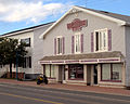
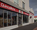
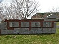
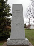
Name Address Coordinates Government recognition (CRHP № ) Image Captain Albert House Caraquet NB 47°47′37″N 64°56′02″W / 47.7937°N 64.9339°W / 47.7937; -64.9339 (Captain Albert House ) Caraquet municipality (8013 ) Albertine Basque House Tracadie-Sheila NB 47°30′57″N 64°54′59″W / 47.5158°N 64.9163°W / 47.5158; -64.9163 (Albertine Basque House ) Tracadie-Sheila municipality (5982 ) Upload Photo Arseneau House Tracadie-Sheila NB 47°31′06″N 64°54′50″W / 47.5182°N 64.9139°W / 47.5182; -64.9139 (Arseneau House ) Tracadie-Sheila municipality (6638 ) Upload Photo Rosa Assaff Building Bathurst NB 47°37′06″N 65°38′45″W / 47.6182°N 65.6459°W / 47.6182; -65.6459 (Rosa Assaff Building ) Bathurst municipality (10407 ) Upload Photo Assumption Academy Bathurst NB 47°36′35″N 65°37′59″W / 47.6097°N 65.633°W / 47.6097; -65.633 (Assumption Academy ) Bathurst municipality (5237 ) Upload Photo Baldwin House Bathurst NB 47°37′06″N 65°39′09″W / 47.6183°N 65.6524°W / 47.6183; -65.6524 (Baldwin House ) Bathurst municipality (15125 ) Upload Photo Bathurst Curling Club Bathurst NB 47°37′06″N 65°39′08″W / 47.6183°N 65.6522°W / 47.6183; -65.6522 (Bathurst Curling Club ) Bathurst municipality (5443 ) Upload Photo Théotime Blanchard House Caraquet NB 47°47′08″N 64°58′25″W / 47.7856°N 64.9737°W / 47.7856; -64.9737 (Théotime Blanchard House ) Caraquet municipality (8000 ) More images Block Wharf Tracadie-Sheila NB 47°31′41″N 64°53′37″W / 47.528°N 64.8935°W / 47.528; -64.8935 (Block Wharf ) Tracadie-Sheila municipality (10500 ) Upload Photo Boîte à Fleurs Tracadie-Sheila NB 47°31′22″N 64°54′39″W / 47.5228°N 64.9108°W / 47.5228; -64.9108 (Boîte à Fleurs ) Tracadie-Sheila municipality (5980 ) Dr. Bourgeois House Tracadie-Sheila NB 47°30′50″N 64°54′38″W / 47.5139°N 64.9106°W / 47.5139; -64.9106 (Dr. Bourgeois House ) Tracadie-Sheila municipality (8173 ) Upload Photo Café Royal Shippagan NB 47°44′37″N 64°42′26″W / 47.7435°N 64.7072°W / 47.7435; -64.7072 (Café Royal ) Shippagan municipality (14745 ) Caraquet Convent Caraquet NB 47°47′24″N 64°57′55″W / 47.7899°N 64.9654°W / 47.7899; -64.9654 (Caraquet Convent ) Caraquet municipality (7946 ) Causeway Park Bathurst NB 47°37′13″N 65°39′32″W / 47.6202°N 65.6589°W / 47.6202; -65.6589 (Causeway Park ) Bathurst municipality (12184 ) Upload Photo Château d'Acadie Tracadie-Sheila NB 47°30′52″N 64°54′41″W / 47.5144°N 64.9114°W / 47.5144; -64.9114 (Château d'Acadie ) Tracadie-Sheila municipality (7111 ) More images Collège de Caraquet Site Caraquet NB 47°47′21″N 64°57′52″W / 47.7892°N 64.9645°W / 47.7892; -64.9645 (Collège de Caraquet Site ) Caraquet municipality (8012 ) More images Corner Store Tracadie-Sheila NB 47°28′48″N 64°55′12″W / 47.4801°N 64.9199°W / 47.4801; -64.9199 (Corner Store ) Tracadie-Sheila municipality (7118 ) Upload Photo Daly Point Nature Reserve Bathurst NB 47°38′21″N 65°36′42″W / 47.6392°N 65.6117°W / 47.6392; -65.6117 (Daly Point Nature Reserve ) Bathurst municipality (5437 ) Upload Photo DeGrâce Residence Shippagan NB 47°44′48″N 64°42′44″W / 47.7468°N 64.7121°W / 47.7468; -64.7121 (DeGrâce Residence ) Shippagan municipality (12186 ) Upload Photo Flavien Doucet Residence Bathurst NB 47°36′58″N 65°39′08″W / 47.6161°N 65.6522°W / 47.6161; -65.6522 (Flavien Doucet Residence ) Bathurst municipality (6705 ) Upload Photo Nazaire Dugas House Caraquet NB 47°46′13″N 65°01′46″W / 47.7703°N 65.0294°W / 47.7703; -65.0294 (Nazaire Dugas House ) Caraquet municipality (8025 ) More images Duguay Residence Shippagan NB 47°44′41″N 64°42′48″W / 47.7446°N 64.7132°W / 47.7446; -64.7132 (Duguay Residence ) Shippagan municipality (12188 ) Upload Photo Église Saint-Pierre-aux-Liens Caraquet NB 47°47′24″N 64°57′51″W / 47.79°N 64.9642°W / 47.79; -64.9642 (Église Saint-Pierre-aux-Liens ) New Brunswick (2147 ) More images Elhatton's Funeral Home Bathurst NB 47°37′09″N 65°39′15″W / 47.6193°N 65.6541°W / 47.6193; -65.6541 (Elhatton's Funeral Home ) Bathurst municipality (15121 ) Upload Photo Entreprises Shippagan Shippagan NB 47°44′36″N 64°42′18″W / 47.7433°N 64.7051°W / 47.7433; -64.7051 (Entreprises Shippagan ) Shippagan municipality (12189 ) Father Lafrance Monument Tracadie-Sheila NB 47°30′46″N 64°54′43″W / 47.5129°N 64.912°W / 47.5129; -64.912 (Father Lafrance Monument ) Tracadie-Sheila municipality (6030 ) More images Alcide Ferguson House Tracadie-Sheila NB 47°28′52″N 64°55′10″W / 47.4811°N 64.9195°W / 47.4811; -64.9195 (Alcide Ferguson House ) Tracadie-Sheila municipality (8203 ) Upload Photo Former Bank of Montreal Building Shippagan NB 47°37′15″N 65°39′13″W / 47.6209°N 65.6536°W / 47.6209; -65.6536 (Former Bank of Montreal Building ) Shippagan municipality (10408 ) Upload Photo Former École des Mallet Shippagan NB 47°44′30″N 64°42′13″W / 47.7417°N 64.7036°W / 47.7417; -64.7036 (Former École des Mallet ) Shippagan municipality (12191 ) Former Foster Mill Site Tracadie-Sheila NB 47°28′22″N 64°55′33″W / 47.4729°N 64.9257°W / 47.4729; -64.9257 (Former Foster Mill Site ) Tracadie-Sheila municipality (6032 ) Upload Photo Former Head Office of the Fédération des Caisses populaires acadiennes Caraquet NB 47°47′22″N 64°57′57″W / 47.7895°N 64.9658°W / 47.7895; -64.9658 (Former Head Office of the Fédération des Caisses populaires acadiennes ) Caraquet municipality (8010 ) More images Founders' Cemetery Tracadie-Sheila NB 47°30′30″N 64°54′15″W / 47.5084°N 64.9042°W / 47.5084; -64.9042 (Founders' Cemetery ) Tracadie-Sheila municipality (7131 ) Upload Photo Founding Families Monument Tracadie-Sheila NB 47°30′50″N 64°54′41″W / 47.5139°N 64.9113°W / 47.5139; -64.9113 (Founding Families Monument ) Tracadie-Sheila municipality (8172 ) More images Fransblow Buildings Tracadie-Sheila NB 47°31′02″N 64°54′47″W / 47.5173°N 64.913°W / 47.5173; -64.913 (Fransblow Buildings ) Tracadie-Sheila municipality (7574 ) Upload Photo Gabriel Giraud Site Bas-Caraquet NB 47°47′57″N 64°52′38″W / 47.7993°N 64.8773°W / 47.7993; -64.8773 (Gabriel Giraud Site ) New Brunswick (6641 ) More images Gloucester Hotel Bathurst NB 47°37′12″N 65°39′23″W / 47.62°N 65.6564°W / 47.62; -65.6564 (Gloucester Hotel ) Bathurst municipality (5233 ) Upload Photo Herman J. Good V.C Branch No.18 Royal Canadian Legion War Museum Bathurst NB 47°37′47″N 65°40′02″W / 47.6297°N 65.6672°W / 47.6297; -65.6672 (Herman J. Good V.C Branch No.18 Royal Canadian Legion War Museum ) Bathurst municipality (5457 ) Upload Photo Greco Restaurant Shippagan NB 47°44′41″N 64°42′45″W / 47.7446°N 64.7124°W / 47.7446; -64.7124 (Greco Restaurant ) Shippagan municipality (12181 ) J. Harper and Gwendolyn Kent Home Bathurst NB 47°36′54″N 65°38′52″W / 47.615°N 65.6478°W / 47.615; -65.6478 (J. Harper and Gwendolyn Kent Home ) Bathurst municipality (9992 ) Upload Photo Heritage Trail Tracadie-Sheila NB 47°30′40″N 64°54′24″W / 47.5111°N 64.9068°W / 47.5111; -64.9068 (Heritage Trail ) Tracadie-Sheila municipality (9902 ) More images Holy Family Cemetery Bathurst NB 47°37′43″N 65°39′48″W / 47.6286°N 65.6633°W / 47.6286; -65.6633 (Holy Family Cemetery ) Bathurst municipality (9695 ) Upload Photo Hotel Dieu Hospital Bathurst NB 47°36′55″N 65°38′49″W / 47.6153°N 65.6469°W / 47.6153; -65.6469 (Hotel Dieu Hospital ) Bathurst municipality (5236 ) Upload Photo Hotel Paulin Caraquet NB 47°47′28″N 64°57′14″W / 47.791°N 64.954°W / 47.791; -64.954 (Hotel Paulin ) Caraquet municipality (7926 ) More images Joseph Kent Farm Bathurst NB 47°36′33″N 65°40′16″W / 47.6091°N 65.6711°W / 47.6091; -65.6711 (Joseph Kent Farm ) Bathurst municipality (5234 ) Upload Photo Loggie's Buildings Tracadie-Sheila NB 47°31′01″N 64°54′46″W / 47.517°N 64.9127°W / 47.517; -64.9127 (Loggie's Buildings ) Tracadie-Sheila municipality (8163 ) Upload Photo A & R Loggie's Tracadie-Sheila NB 47°31′03″N 64°54′41″W / 47.5176°N 64.9115°W / 47.5176; -64.9115 (A & R Loggie's ) Tracadie-Sheila municipality (7121 ) Upload Photo W. A. Losier House Tracadie-Sheila NB 47°30′36″N 64°54′33″W / 47.51°N 64.9093°W / 47.51; -64.9093 (W. A. Losier House ) Tracadie-Sheila municipality (8211 ) Upload Photo Louis Mailloux Monument Caraquet NB 47°47′30″N 64°56′41″W / 47.7916°N 64.9447°W / 47.7916; -64.9447 (Louis Mailloux Monument ) Caraquet municipality (8011 ) More images Maison de la fondue Tracadie-Sheila NB 47°30′44″N 64°54′39″W / 47.5121°N 64.9108°W / 47.5121; -64.9108 (Maison de la fondue ) Tracadie-Sheila municipality (7112 ) Upload Photo John Meahan House Bathurst NB 47°36′53″N 65°39′07″W / 47.6147°N 65.6519°W / 47.6147; -65.6519 (John Meahan House ) Bathurst municipality (6707 ) Upload Photo Miscou Island Lighthouse National Historic Site of Canada Miscou Island NB 48°00′22″N 64°29′27″W / 48.0061°N 64.4909°W / 48.0061; -64.4909 (Miscou Island Lighthouse National Historic Site of Canada ) Federal (16125 ,9728 ) More images Nepisiguit Centennial Museum/Cultural Centre Bathurst NB 47°37′04″N 65°39′22″W / 47.6179°N 65.656°W / 47.6179; -65.656 (Nepisiguit Centennial Museum/Cultural Centre ) Bathurst municipality (5480 ) Upload Photo Northern Light Bathurst NB 47°37′07″N 65°39′09″W / 47.6186°N 65.6525°W / 47.6186; -65.6525 (Northern Light ) Bathurst municipality (5460 ) Upload Photo O'Brien House Bathurst NB 47°37′03″N 65°38′52″W / 47.6174°N 65.6477°W / 47.6174; -65.6477 (O'Brien House ) Bathurst municipality (10421 ) Upload Photo Officers' Mess Bathurst NB 47°37′00″N 65°38′55″W / 47.6166°N 65.6485°W / 47.6166; -65.6485 (Officers' Mess ) Bathurst municipality (10376 ) Upload Photo Old Bathurst Post Office Bathurst NB 47°37′13″N 65°39′26″W / 47.6202°N 65.6571°W / 47.6202; -65.6571 (Old Bathurst Post Office ) New Brunswick (2282 ) More images Denis Ouellet House Tracadie-Sheila NB 47°28′53″N 64°55′12″W / 47.4813°N 64.92°W / 47.4813; -64.92 (Denis Ouellet House ) Tracadie-Sheila municipality (8194 ) Upload Photo Pallen House Bathurst NB 47°37′14″N 65°39′14″W / 47.6205°N 65.6539°W / 47.6205; -65.6539 (Pallen House ) Bathurst municipality (10604 ) Upload Photo Simonne Paulin House Sainte-Marie-Saint-Raphael NB 47°46′32″N 64°34′43″W / 47.7755°N 64.5787°W / 47.7755; -64.5787 (Simonne Paulin House ) Sainte-Marie-Saint-Raphael municipality (19987 ) Upload Photo Pavillon Irène Léger Shippagan NB 47°44′46″N 64°42′30″W / 47.746°N 64.7083°W / 47.746; -64.7083 (Pavillon Irène Léger ) Shippagan municipality (12183 ) Petite école Caraquet NB 47°47′09″N 64°58′22″W / 47.7857°N 64.9727°W / 47.7857; -64.9727 (Petite école ) Caraquet municipality (7995 ) Upload Photo Pointe-aux-Pères Site Bathurst NB 47°38′51″N 65°39′41″W / 47.6474°N 65.6614°W / 47.6474; -65.6614 (Pointe-aux-Pères Site ) New Brunswick (2668 ) Upload Photo Protestant Cemetery Tracadie-Sheila NB 47°30′34″N 64°54′32″W / 47.5094°N 64.909°W / 47.5094; -64.909 (Protestant Cemetery ) Tracadie-Sheila municipality (7114 ) Upload Photo Religious Hospitallers of St. Joseph Cemetery Tracadie-Sheila NB 47°30′45″N 64°54′30″W / 47.5126°N 64.9082°W / 47.5126; -64.9082 (Religious Hospitallers of St. Joseph Cemetery ) Tracadie-Sheila municipality (5974 ) More images Clovis T. Richard Home Bathurst NB 47°37′12″N 65°39′06″W / 47.62°N 65.6517°W / 47.62; -65.6517 (Clovis T. Richard Home ) Bathurst municipality (10607 ) Upload Photo Rioux Residence Shippagan NB 47°44′39″N 64°42′37″W / 47.7443°N 64.7104°W / 47.7443; -64.7104 (Rioux Residence ) Shippagan municipality (12187 ) Upload Photo Edmund Roussel House Tracadie-Sheila NB 47°28′51″N 64°55′12″W / 47.4807°N 64.92°W / 47.4807; -64.92 (Edmund Roussel House ) Tracadie-Sheila municipality (8187 ) Upload Photo Sacred Heart Cathedral Bathurst NB 47°37′04″N 65°39′19″W / 47.6178°N 65.6553°W / 47.6178; -65.6553 (Sacred Heart Cathedral ) Bathurst municipality (5225 ) Sainte-Anne Chapel Caraquet NB 47°46′25″N 65°00′44″W / 47.7737°N 65.0123°W / 47.7737; -65.0123 (Sainte-Anne Chapel ) Caraquet municipality (8014 ) Upload Photo Sainte-Famille Academy Tracadie-Sheila NB 47°30′46″N 64°54′33″W / 47.5129°N 64.9092°W / 47.5129; -64.9092 (Sainte-Famille Academy ) New Brunswick (6240 ),Tracadie-Sheila municipality (7113 ) More images St. George's Anglican Cemetery Bathurst NB 47°37′10″N 65°39′21″W / 47.6194°N 65.6558°W / 47.6194; -65.6558 (St. George's Anglican Cemetery ) Bathurst municipality (6450 ) Upload Photo St. George's Anglican Church Bathurst NB 47°37′02″N 65°39′10″W / 47.6172°N 65.6528°W / 47.6172; -65.6528 (St. George's Anglican Church ) Bathurst municipality (5969 ) Upload Photo Saint-Isidore Church Hautes-Terres NB 47°33′13″N 65°03′13″W / 47.5535°N 65.0535°W / 47.5535; -65.0535 (Saint-Isidore Church ) New Brunswick (2494 ) Upload Photo Saint John's United Church Shippagan NB 47°44′35″N 64°42′21″W / 47.743°N 64.7059°W / 47.743; -64.7059 (Saint John's United Church ) Shippagan municipality (12185 ) St-Joseph et St-Jean-Baptiste Church Tracadie-Sheila NB 47°30′48″N 64°54′44″W / 47.5134°N 64.9121°W / 47.5134; -64.9121 (St-Joseph et St-Jean-Baptiste Church ) Tracadie-Sheila municipality (7206 ) More images St. Joseph Shrine Tracadie-Sheila NB 47°31′17″N 64°54′12″W / 47.5215°N 64.9032°W / 47.5215; -64.9032 (St. Joseph Shrine ) Tracadie-Sheila municipality (7132 ) More images St. Luke's Cemetery Bathurst NB 47°37′36″N 65°39′56″W / 47.6267°N 65.6656°W / 47.6267; -65.6656 (St. Luke's Cemetery ) Bathurst municipality (10005 ) Upload Photo Sainte-Rose-De-Lima Church Sainte-Rose NB 47°37′27″N 64°59′05″W / 47.6241°N 64.9847°W / 47.6241; -64.9847 (Sainte-Rose-De-Lima Church ) New Brunswick (2322 ) Upload Photo Salon de Couture Modifique Tracadie-Sheila NB 47°31′02″N 64°54′46″W / 47.5171°N 64.9128°W / 47.5171; -64.9128 (Salon de Couture Modifique ) Tracadie-Sheila municipality (5972 ) Upload Photo Schryer House Bathurst NB 47°36′57″N 65°38′53″W / 47.6158°N 65.6481°W / 47.6158; -65.6481 (Schryer House ) Bathurst municipality (10377 ) Upload Photo Dr. Smith House Tracadie-Sheila NB 47°30′30″N 64°54′33″W / 47.5082°N 64.9093°W / 47.5082; -64.9093 (Dr. Smith House ) Tracadie-Sheila municipality (8216 ) Upload Photo Tabagie Centre-ville Shippagan NB 47°44′40″N 64°42′40″W / 47.7444°N 64.7111°W / 47.7444; -64.7111 (Tabagie Centre-ville ) Shippagan municipality (12182 ) Upload Photo Tower Shippagan NB 47°43′16″N 64°40′02″W / 47.7211°N 64.6673°W / 47.7211; -64.6673 (Tower (Big Shippagan Light) ) Federal (4741 ) Village Historique Acadien New Bandon-Salmon Beach NB 47°47′49″N 65°06′05″W / 47.797°N 65.1014°W / 47.797; -65.1014 (Village Historique Acadien ) New Brunswick (6222 ) Wade Surplus d'Armée Tracadie-Sheila NB 47°28′50″N 64°55′10″W / 47.4805°N 64.9194°W / 47.4805; -64.9194 (Wade Surplus d'Armée ) Tracadie-Sheila municipality (6686 ) Upload Photo Walker Trading Establishment Bathurst NB 47°39′25″N 65°37′22″W / 47.657°N 65.6228°W / 47.657; -65.6228 (Walker Trading Establishment ) New Brunswick (2544 ) Upload Photo Willis Farmhouse Bathurst NB 47°39′13″N 65°39′18″W / 47.6537°N 65.655°W / 47.6537; -65.655 (Willis Farmhouse ) Bathurst municipality (10449 ) Upload Photo