Ponta do Ouro

Last updated
Ponta do Ouro
Town
Ponta do Ouro in the morning.jpg
Ponta do Ouro
Etymology: Portuguese for "tip of gold"
Mozambique adm location map.svg
Red pog.svg
Ponta do Ouro
Coordinates: 26°50′56″S32°53′17″E / 26.849°S 32.888°E / -26.849; 32.888
Country Mozambique
Province Maputo
Time zone UTC+2:00 (CAT)

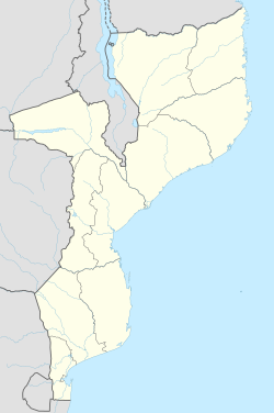
Ponta do Ouro (also Ponta d'Ouro) is a town in the extreme south of Mozambique, lying on the Mozambique Channel, south of Maputo and just north of the border with South Africa. The name is Portuguese for "tip of gold", referring to a cape at the southern part of the beach. It is known for its beach, dolphins, offshore diving and deep-sea fishing.

The currency is the metical, but the South African rand and the US dollar are also accepted. Shopping is very limited in Ponta. There is a petrol station, bank, pharmacy, hardware stores, bottle stores and other small shops in town. Fresh bread can be purchased at the local market. Basic food items like vegetables, fruits can be purchased at this market. No luxurious items are available anywhere in Ponta do Ouro. Holiday accommodation is readily available. There are 3 to 4 modern and comfortable resorts in Ponta on the beachfront and surrounding areas. Other resorts date from pre-war and – although quite primitive with limited facilities – are very popular with tourists due to reasonable pricing and excellent location on the beachfront. It is commonly referred to as 'Ponta' by visiting South Africans.

Ponta do Ouro is about 15 km away from the South African border and about 130 km south of Maputo. With the new[ as of? ] road connecting Maputo to Ponta do Ouro, the travel lasts about one hour.
Related Research Articles

<span class="mw-page-title-main">Mozambique</span> Country in Southeastern Africa

Mozambique, officially the Republic of Mozambique, is a country located in southeast Africa bordered by the Indian Ocean to the east, Tanzania to the north, Malawi and Zambia to the northwest, Zimbabwe to the west, and Eswatini and South Africa to the southwest. The sovereign state is separated from the Comoros, Mayotte and Madagascar by the Mozambique Channel to the east. The capital and largest city is Maputo.

<span class="mw-page-title-main">Convenience store</span> Small store that stocks a range of everyday items

A convenience store, convenience shop, bodega, corner store or corner shop is a small retail store that stocks a range of everyday items such as tea, coffee, groceries, fruits, vegetables, snacks, confectionery, soft drinks, ice creams, tobacco products, lottery tickets, over-the-counter drugs, toiletries, newspapers and magazines.

<span class="mw-page-title-main">Maputo</span> Capital and chief port of Mozambique

Maputo is the capital and largest city of Mozambique. Located near the southern end of the country, it is within 120 kilometres of the borders with Eswatini and South Africa. The city has a population of 1,088,449 distributed over a land area of 347.69 km2 (134.24 sq mi). The Maputo metropolitan area includes the neighbouring city of Matola, and has a total population of 2,717,437. Maputo is a port city, with an economy centered on commerce. It is also noted for its vibrant cultural scene and distinctive, eclectic architecture. Maputo was formerly named Lourenço Marques until 1976.

<span class="mw-page-title-main">Mbombela</span> City in Mpumalanga, South Africa

Mbombela, formerly Nelspruit, is a city in northeastern South Africa. It is the capital of the Mpumalanga province. Located on the Crocodile River, the city lies about 110 km (68 mi) by road west of the Mozambique border, 330 km (210 mi) east of Johannesburg and 82 km (51 mi) north of the Eswatini border. Mbombela was one of the host cities of the 2010 FIFA World Cup.

iSimangaliso Wetland Park South Africas third-largest protected area, spanning 280 km of coastline

iSimangaliso Wetland Park is situated on the east coast of KwaZulu-Natal, South Africa, about 235 km (146 mi) north of Durban by road. It is South Africa's third-largest protected area, spanning 280 km (170 mi) of coastline, from the Mozambican border in the north to Mapelane south of the Lake St. Lucia estuary, and made up of around 3,280 km2 of natural ecosystems, managed by the iSimangaliso Authority. The park includes:

The Lubombo Transfrontier Conservation Area was born out of the Peace Park Foundation’s vision to establish a network of transfrontier conservation areas in southern Africa. It straddles the border between South Africa’s KwaZulu-Natal province, southern Mozambique, and Eswatini.

<span class="mw-page-title-main">Malalane</span> Place in Mpumalanga, South Africa

Malalane, alternatively rendered Malelane, is a farming town in Mpumalanga, South Africa situated on the N4 national highway. The farms in the region produce sugarcane, subtropical fruit and winter vegetables. The town was proclaimed in 1949 after which it was named. The origin of the name is disputed but was corrupted from the Swazi. Either the expression "eMlalani" which means place of the palms, or the expression "lala" which means to sleep is accepted origins of the name. The town started as the first rest-stop between Lourenço Marques and Pretoria. As of July 2007 the town was officially renamed from "Malelane" to "Malalane" as part of the government's renaming scheme by the South African Geographical Names Council.

<span class="mw-page-title-main">Xai-Xai</span> Capital city of Gaza, Mozambique

Xai-Xai is a city in the south of Mozambique. Until 1975, the city was named João Belo. It is the capital of Gaza Province. As of 2007 it has a population of 116,343.

<span class="mw-page-title-main">Kosi Bay</span>

Kosi Bay is a series of four interlinked lakes in the Maputaland area of KwaZulu-Natal, South Africa.

<span class="mw-page-title-main">Inhambane</span> City in Inhambane Province, Mozambique

Inhambane, also known as Terra de Boa Gente, is a city located in southern Mozambique, lying on Inhambane Bay, 470 km northeast of Maputo. It is the capital of the Inhambane Province and, according to the 2017 census, has a population of 79,724, growing from 54,157 in the 1997 census.

Articles related to Mozambique include:

Zavora is a beach, north east of Maputo in Mozambique, in the district of Inharrime, province of Inhambane. It is located 420 km north east of Maputo, the capital of Mozambique, and 27 km east from the town of Inharrime. The capital of the province, the city of Inhambane, is approximately 2 hours drive away towards the North East.

<span class="mw-page-title-main">Tourism in Mozambique</span>

The tourism assets of Mozambique include the country's natural environment, wildlife, and cultural heritage, which provide opportunities for beach, cultural, and eco-tourism.

<span class="mw-page-title-main">Ponta do Ouro-Kosi Bay Transfrontier Conservation Area</span> Protected area in South Africa and Mozambique

Ponta do Ouro-Kosi Bay Transfrontier Conservation Area (TFCA) is a larger conservation area conceived as an extension of the existing conservation parkland area of the iSimangaliso Wetland Park, to extend north into a similar area on the Mozambique side of the border, and including several other parks in the process. The parks to be included are:

Maputo Special Reserve is a nature reserve in Mozambique.

<span class="mw-page-title-main">Mozambique–South Africa border</span> International border

The border between Mozambique and South Africa is divided into two segments, separated by the kingdom of Eswatini. The northern segment, which is 410 kilometres (255 mi) long, runs north–south along the Lebombo Mountains from Zimbabwe to Eswatini. The southern segment, which is 81 kilometres (50 mi) long, runs east–west across Maputaland from Eswatini to the Indian Ocean.

<span class="mw-page-title-main">Maputo–Katembe bridge</span> Bridge in Maputo Bay, Mozambique

The Maputo–Katembe bridge is a suspension bridge across Maputo Bay in southern Mozambique. The bridge connects the Mozambican capital Maputo, on the northern bank, with its disjunct suburb of Katembe on the southern bank. Construction work began in 2014 and the bridge officially opened 10 November 2018. The construction work was carried out by the Chinese China Road and Bridge Corporation; a large part of the project is financed by loans from the Chinese Exim Bank.

Katembe, also Catembe is an urban center in Mozambique. Located on the Maputo Bay, it is a suburb of Maputo, the national capital. The name also applies to the administrative district, of which the town is the headquarters.

<span class="mw-page-title-main">Delagoa</span> Marine ecoregion on the eastern coast of southern Africa

Delagoa is a marine ecoregion along the eastern coast of Africa. It extends along the coast of Mozambique and South Africa from the Bazaruto Archipelago to Lake St. Lucia in South Africa in South Africa's Kwazulu-Natal province. It adjoins the Bight of Sofala/Swamp Coast ecoregion to the north, and the Natal ecoregion to the south. It has Africa's southernmost tropical coral reefs and mangrove forests. It is the southernmost Indo-Pacific ecoregion, marking the transition from the tropical Indo-Pacific to Temperate Southern Africa.

References