Butler County is a county located in the southeast Ozark Foothills Region in the U.S. state of Missouri. As of the 2020 Census, the county's population was 42,130. The largest city and county seat is Poplar Bluff. The county was officially organized from Wayne County on February 27, 1849, and is named after former U.S. Representative William O. Butler (D-Kentucky), who was also an unsuccessful candidate for Vice President of the United States. The first meeting in the Butler County Courthouse was held on June 18, 1849.

Poplar Bluff is a city in Butler County in Southeast Missouri, United States. It is the county seat of Butler County and is known as "The Gateway to the Ozarks" among other names. The population was 16,225 at the 2020 census. The Poplar Bluff Micropolitan Statistical Area consists of all of Butler County. The city is at the crossroads of U.S. Route 60 and U.S. Route 67.
The Fawn River is a river in the north of the Unorganized Part of Kenora District in Northwestern Ontario, Canada. It is in the Hudson Bay drainage basin and is a right tributary of the Severn River. The Severn/Fawn basin is one of the last few remaining undammed and unregulated watersheds south of the 55th parallel in North America.
Poplar Level is a neighborhood five miles (8 km) southeast of downtown Louisville, Kentucky, United States. It is part of the larger Camp Zachary Taylor area.

Adams Lake Provincial Park is a provincial park in British Columbia, Canada. It encompasses three distinct parks: Adams Lake Provincial Park, Adams Lake Marine Provincial Park, and Adams Lake Marine Provincial Park.
Saddle Creek is the first shopping center in the nation developed as a lifestyle center. It is located in the eastern Memphis, Tennessee suburb of Germantown, and it includes national specialty shops and restaurants. About 70% of tenants are unique to the Memphis market. Crumbl Cookies, Evereve, and Fabletics are joining the center in 2022.

Clay Township is one of nine townships in Hamilton County, Indiana, United States. As of the 2010 census, its population was 83,293 and it contained 32,375 housing units. Since the annexation of Home Place, Indiana; Carmel is now completely coterminous with the township.

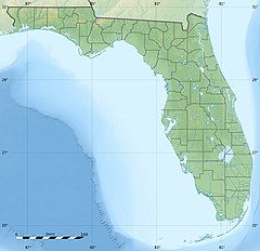
Poplar Bluff Township is one of ten townships in Butler County, Missouri, USA. As of the 2010 census, its population was 25,878.
Departure Lake is a dispersed rural community and unincorporated place in geographic Haggart Township, Cochrane District in Northeastern Ontario, Canada. It is located on Ontario Highway 11 between the communities of Strickland to the west and Smooth Rock Falls to the east.

Caledon State Park is a 2,579-acre (10.44 km2) state park located in King George, Virginia. As of 2010, the yearly visitation was 49,328. The property was initially owned by the Alexander brothers, founders of the city of Alexandria, and was established in 1659 as Caledon Plantation. Ownership passed, in 1974, to the Commonwealth of Virginia.
Stewarts Creek Wildlife Management Area is a 1,087-acre (4.40 km2) Wildlife Management Area (WMA) in Carroll County, Virginia. It lies along the Blue Ridge Mountains, with terrain that is rugged and steep; its lowest elevation is 1,580 feet (480 m) above sea level, while the highest is at 2,955 feet (901 m), near the Blue Ridge Parkway. Five sections of streams totaling 4.8 miles (7.7 km), including the headwaters of both the North and South forks of Stewarts Creek, lie within the area's boundaries; many of these contain populations of brook trout, and are bordered by thickets of rhododendrons. Most of the area is wooded, mainly with tulip poplar, yellow birch, oak, and hickory.

Swamp Creek is a tributary of the Sammamish River in Snohomish and King counties, in the U.S. state of Washington. It is also known as dxʷɬ(ə)q̓ab in Lushootseed, meaning "a wide place".
Waterford is a neighborhood in southeastern Lexington, Kentucky, United States. Its boundaries are Man o' War Boulevard to the north, Hickman Creek to the east, rural Fayette County to the west, and a combination of Poplar Springs Lane and Vermillion Peak Way to the south.
Poplar Creek is an unincorporated community in Montgomery County, Mississippi.
Nevisdale is an unincorporated community and coal town located in Whitley County, Kentucky, United States.
South Lima is a hamlet and census-designated place (CDP) in Livingston County, New York, United States. Its population was 240 as of the 2010 census. South Lima had a post office from January 10, 1854, until April 17, 2010; it still has its own ZIP code, 14558.
Munbura is a rural locality in the Mackay Region, Queensland, Australia. In the 2016 census Munbura had a population of 115 people.
Poplar is an unincorporated community in Mitchell County, North Carolina, United States. The community is located along North Carolina Highway 197 (NC 197), at the banks of the Hollow Poplar Creek and between the southern slopes of the Unaka Range and the North Toe River. It is also the last community along the CSX Blue Ridge Subdivision before crossing into Tennessee towards Erwin.
Friesville is an unincorporated community and census-designated place (CDP) in Blair County, Pennsylvania, United States. It was first listed as a CDP prior to the 2020 census.