
Lille is a city in the northern part of France, within French Flanders. Positioned along the Deûle river, near France's border with Belgium, it is the capital of the Hauts-de-France region, the prefecture of the Nord department, and the main city of the European Metropolis of Lille.

The demography of France is monitored by the Institut national d'études démographiques (INED) and the Institut national de la statistique et des études économiques (INSEE). As of 1 January 2021, 66,142,961 people lived in Metropolitan France, while 2,230,472 lived in overseas France, for a total of 68,373,433 inhabitants in the French Republic.

The Marquesas Islands are a group of volcanic islands in French Polynesia, an overseas collectivity of France in the southern Pacific Ocean. Their highest point is the peak of Mount Oave on Ua Pou island, at 1,230 m (4,035 ft) above sea level.
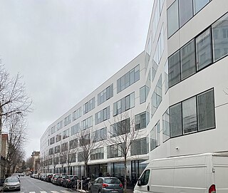
The National Institute of Statistics and Economic Studies, abbreviated INSEE or Insee, is the national statistics bureau of France. It collects and publishes information about the French economy and people and carries out the periodic national census. Headquartered in Montrouge, a commune in the southern Parisian suburbs, it is the French branch of Eurostat. The INSEE was created in 1946 as a successor to the Vichy regime's National Statistics Service (SNS). It works in close cooperation with the Institut national d'études démographiques (INED).
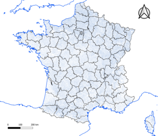
The commune is a level of administrative division in the French Republic. French communes are analogous to civil townships and incorporated municipalities in the United States and Canada, Gemeinden in Germany, comuni in Italy, or municipios in Spain. The UK equivalent are civil parishes. Communes are based on historical geographic communities or villages and are vested with significant powers to manage the populations and land of the geographic area covered. The communes are the fourth-level administrative divisions of France.

Papeete is the capital city of French Polynesia, an overseas collectivity of the French Republic in the Pacific Ocean. The commune of Papeete is located on the island of Tahiti, in the administrative subdivision of the Windward Islands, of which Papeete is the administrative capital. Both the President of French Polynesia and French High Commissioner reside in Papeete.

An aire urbaine is an INSEE statistical concept describing a core of urban development and the extent of its commuter activity. It was replaced by the concept "functional area", which uses the same definition as Eurostat's functional urban areas, in 2020.

In France, an urban unit is a statistical area defined by INSEE, the French national statistics office, for the measurement of contiguously built-up areas. According to the INSEE definition , an "unité urbaine" is a commune alone or a grouping of communes which: a) form a single unbroken spread of urban development, with no distance between habitations greater than 200 m and b) have all together a population greater than 2,000 inhabitants. Communes not belonging to an unité urbaine are considered rural.

In French Polynesia, there are two levels of administrative divisions: five administrative subdivisions and 48 communes. Many of the communes are further subdivided into communes associées. The breakdown into administrative subdivisions was as a result of the law #71-1028, dated December 24, 1971. The compositions of the administrative subdivisions and the communes were defined in the decrees #72-408 and #72-407 of May 17, 1972, respectively. These subdivisions were confirmed in the decree #2005-1611 of December 20, 2005. Below are several lists of the divisions, according to different sorting schemes.
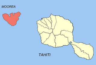
Moʻorea-Maiʻao is a commune of French Polynesia, an overseas territory of France in the Pacific Ocean. It consists of the island of Moʻorea and the much smaller atoll of Maiʻao, located 78 km (48 mi) southwest of Moʻorea, with both being part of the Windward Islands administrative subdivision. As of the 2022 census, Moorea-Maiao had a population of 18,201, of whom 17,858 lived on Mo'orea and 343 lived on Maiao.

Arutua, or Ngaru-atua is an atoll in the Tuamotu group in French Polynesia. It is located 40 km SW of Rangiroa. The closest land is Apataki Atoll, only 16 km to the East.
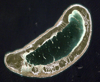
Fangatau, or Nakai-erua, is a small atoll in the Tuamotu group in French Polynesia. The nearest land is Fakahina Atoll, located 72 km to the ESE. This small atoll has an elongated shape. Its length is 8 kilometres, maximum width 3.5 kilometres. It has a total area of 22.2 square kilometres, land area 5.9 km2. Its reef encloses its lagoon completely. Anchorage is difficult. Fangatau Atoll has 150 inhabitants. Teana is the main village.

Chicourt is a commune in the Moselle department in Grand Est in north-eastern France.

Perquie is a commune, a small town located in the Landes department in Nouvelle-Aquitaine in southwestern France.
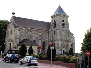
Bonneuil-en-France is a commune in the Val-d'Oise department in Île-de-France in northern France.

The 13th constituency of the Pas-de-Calais was a former French legislative constituency which existed until 2012. It was one of 14 French legislative constituencies in the Pas-de-Calais department (62) located in the Nord-Pas-de-Calais region.
Kolopopo is a village in Wallis and Futuna, which is a French island collectivity in the South Pacific containing 36 villages. It is located in Mua District on the southwest coast of Wallis Island. Its population according to the 2018 census was 99 people. The population has declined in this area due to lack of job opportunities and political tension on the main island. The currency used is Comptoirs Français du Pacifique (CFP) Franc.

Gambier is a commune of French Polynesia in the administrative subdivision of the Tuamotu-Gambier Islands. The commune includes the Gambier Islands as well as several atolls in the Tuamotu Archipelago. All the Tuamotu atolls belonging to the commune are uninhabited except for Marutea Sud, and are sometimes mistakenly included among the Gambier Islands themselves. The commune population was 1,570 at the 2022 census. Its total land area is 45.97 km2.

An aire d'attraction d'une ville is a statistical area used by France's national statistics office INSEE since 2020, officially translated as functional area in English by INSEE, which consists of a densely populated urban agglomeration and the surrounding exurbs, towns and intervening rural areas that are socioeconomically tied to the central urban agglomeration, as measured by commuting patterns. INSEE's functional area (AAV) is therefore akin to what is most often called metropolitan area in English.


