Division No. 1, Subdivision O is an unorganized subdivision on the Avalon Peninsula in Newfoundland and Labrador, Canada, in Division 1. It's divided into two parts, the northern portion touches Conception Bay. It includes the unincorporated communities of Marysvale and Salmonier Line.

Fortune is a Canadian town located in the province of Newfoundland and Labrador.
Baine Harbour is a Canadian community in the province of Newfoundland and Labrador northeast of Marystown.
Garden Cove is a local service district and designated place in the Canadian province of Newfoundland and Labrador. It is southeast of Swift Current. The residents of Sound Island moved without government assistance during a period around 1953. They moved to the mainland into Garden Cove and surrounding communities. Today Garden Cove has an active close community. There is a tour boat, Merasheen which is part of the Woody Island Resort hotel which gives people a Newfoundland outport experience. Garden Cove has hiking trails passing by Big Rock Hill and Placentiamans Point. There is an inshore fishery operating there. Some species caught are lobster, cod, mackerel, herring, crab, scallops, mussels, flounder and trout. Late in summer Tuna chase bill fish just off shore.
Red Harbour is a Canadian municipality of Newfoundland and Labrador. It is located 20 kilometres northeast of Marystown.
Darby's Harbour is a locality and former settlement located southwest of Swift Current in Paradise Sound, Placentia Bay, Newfoundland, Canada. It had a post office in 1940. The 1935 population was 21, but by 1990 it was uninhabited.

English Harbour East is a town in the Canadian province of Newfoundland and Labrador. It is located on the northeast side of Fortune Bay. Settled first by the Mi’kmaq of Newfoundland which used land on the "Neck" of the Harbour, they were joined in the early 1800s, by the English Dodge family and by Irishman Thomas Hynes Sr. European fishermen were first brought to the small community by English merchant family of Newman and Co. based in Harbour Breton, the firm of merchant John Gorman, and the Jersey firm of Nicholle and Co. The town had a population of 117 in the Canada 2021 Census.
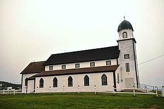
Harbour Buffett was established in 1836. It was a small place with ten families in the St. Mary's area by 1864. The Way Station became a Post Office in 1891.
Codroy is a community in the Codroy Valley of Newfoundland and Labrador, Canada.
Island Harbour is a designated place in the Canadian province of Newfoundland and Labrador.
Lobster Harbour may refer to either a settlement located in Notre Dame Bay or to one in White Bay, Newfoundland and Labrador.
Spanish Room is a local service district and designated place in the Canadian province of Newfoundland and Labrador.
Port Anne is a settlement in Newfoundland and Labrador.
Goose Cove, also known as North Harbour, is a settlement in Newfoundland and Labrador.
Boat Harbour is a settlement in Newfoundland and Labrador, Canada. The community had a population of 73 in the 2021 census.
Division No. 1, Subdivision B is an unorganized subdivision on the Avalon Peninsula in Newfoundland and Labrador, Canada. It is in Division 1 and contains the unorganized communities of Iona, Little Barasway, Placentia Junction, Point Verde and Ship Harbour.
Division No. 1, Subdivision C is an unorganized subdivision on the Avalon Peninsula in Newfoundland and Labrador, Canada. It is in Division 1 and contains the unincorporated communities of Cape St. Mary's, Cuslett, Gooseberry Cove, Great Barasway, Lears Cove, Patrick's Cove-Angels Cove, Ship Cove and Stoney House.
Division No. 1, Subdivision E is an unorganized subdivision on the Avalon Peninsula in Newfoundland and Labrador, Canada. It is in Division 1 and contains the unincorporated communities of Broad Cove, Dildo, Green's Harbour, Harnum Point, Hopeall, New Harbour and Reids Room.
Division No. 1, Subdivision L is an unorganized subdivision on the Avalon Peninsula in Newfoundland and Labrador, Canada. It is in Division 1 and contains the unincorporated communities of Bareneed, Black Duck Pond, Blow Me Down, Coley's Point South, Hibb's Cove, Pick Eyes, Port de Grave, Ship Cove and The Dock
Division No. 1, Subdivision U is an unorganized subdivision on the Avalon Peninsula in Newfoundland and Labrador, Canada, in Division 1. It contains the unincorporated communities of Admiral's Cove, Bauline East, Bauline South, Burnt Cove, Devils Kitchen, Flat Rock, St. Michaels and Seal Cove.
