Location | Rome |
---|---|
Coordinates | 41°54′38.66″N12°29′53.31″E / 41.9107389°N 12.4981417°E |
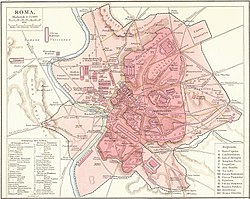
Porta Salaria was a gate in the Aurelian Walls of Rome, Italy. Constructed between 271 AD and 275 AD, it was demolished in 1921.
Porta Salaria was part of the Aurelian Walls built by emperor Aurelian in the 3rd century, including pre-existing constructions in order to hasten the works. Under it passed the Via Salaria nova, which joined the Via Salaria vetus (Old Via Salaria) outside the city. The gate had a single passage and was flanked by two semi-circular towers. The Horti Sallustiani were located in the city just inside the gate.
During the restoration by emperor Honorius in the early 5th century, the arch was strengthened in opus mixtum , and over it three large windows were opened.
The Goth king Alaric I entered Rome from this gate to begin the famous Sack of Rome. In 537, the area between Porta Salaria and Castro Pretorio was the location of the siege by the Goth king Witigis against the troops of Belisarius.
On September 20, 1870, the part of the Aurelian Walls between Porta Salaria and Porta Pia witnessed the end of the Papal States (see Capture of Rome). The gate was damaged by the artillery fire of the Italian troops, and the following year it was demolished. In 1873, it was rebuilt under the design of the architect Virginio Vespignani.
However, in 1921, it was again decided to demolish the gate to open the area to road traffic. The area is now occupied by Piazza Fiume ("Fiume square").
The 1921 demolition uncovered several funerary monuments of the sepulchres that flanked the old Via Salaria and that had been re-used to erect the towers. A copy of the sepulchre of Quintus Sulpicius Maximus, an 11-year-old boy, is now visible in Piazza Fiume (the original is the Musei Capitolini).
On right of the walls near the square are remains of 1st-century BC tombs.
The Porta Capena was a gate in the Servian Wall in Rome, Italy. The gate was located in the area of Piazza di Porta Capena, where the Caelian, Palatine and Aventine hills meet. Probably its exact position was between the entrance of Via di Valle delle Camene and the beginning of Via delle Terme di Caracalla, facing the curved side of the Circus Maximus.
The Servian Wall is an ancient Roman defensive barrier constructed around the city of Rome in the early 4th century BC. The wall was built of volcanic tuff and was up to 10 m (33 ft) in height in places, 3.6 m (12 ft) wide at its base, 11 km (6.8 mi) long, and is believed to have had 16 main gates, of which only one or two have survived, and enclosed a total area of 246 hectares. In the 3rd century AD it was superseded by the construction of the larger Aurelian Walls as the city of Rome grew beyond the boundary of the Servian Wall.
The Aurelian Walls are a line of city walls built between 271 AD and 275 AD in Rome, Italy, during the reign of the Roman Emperor Aurelian. They superseded the earlier Servian Wall built during the 4th century BC.
Esquilino is the 15th rione, or administrative division, of Rome, Italy, identified by the initials R. XV, and is Located within the Municipio I. It is named after the Esquiline Hill, one of the Seven Hills of Rome.
Sallustiano is the 17th rione of Rome, Italy, identified by the initials R. XVII. It is located within the Municipio I and the name refers to the ancient Gardens of Sallust, which were located here.
Castro Pretorio is the 18th rione of Rome, Italy, identified by the initials R. XVIII, and it is located within the Municipio I. The rione takes its name by the ruins of the Castrum Praetorium, the barracks of the Praetorian Guard, included in the Aurelian Walls.
The Gardens of Sallust was an ancient Roman estate including a landscaped pleasure garden developed by the historian Sallust in the 1st century BC. It occupied a large area in the northeastern sector of Rome, in what would become Region VI, between the Pincian and Quirinal hills, near the Via Salaria and later Porta Salaria. The modern rione is now known as Sallustiano.
The Porta del Popolo, or Porta Flaminia, is a city gate of the Aurelian Walls of Rome that marks the border between Piazza del Popolo and Piazzale Flaminio.
The Porta San Sebastiano is the largest and one of the best-preserved gates passing through the Aurelian Walls in Rome (Italy).
The Via del Corso is a main street in the historical centre of Rome. It is straight in an area otherwise characterized by narrow meandering alleys and small piazzas. Considered a wide street in ancient times, the Corso is approximately 10 metres wide, and it only has room for two lanes of traffic and two narrow sidewalks. The northern portion of the street is a pedestrian area. The length of the street is roughly 1.5 kilometres.
Porta Pinciana is a gate of the Aurelian Walls in Rome.
Porta San Pancrazio is one of the southern gates of the Aurelian walls in Rome, Italy.
The Porta Latina is a single-arched gate in the Aurelian Walls of ancient Rome.
The Porta Asinaria is a gate in the Aurelian Walls of Rome. Dominated by two protruding tower blocks and associated guard rooms, it was built between 271 and 275 AD, at the same time as the Wall itself. Unlike most of the other gates, it was not rebuilt or fortified by Honorius or restored by Theoderic.
The Porta Nomentana was one of the gates in the Aurelian Walls of Rome, Italy. It is located along viale del Policlinico, around 70 m east of Porta Pia. It is now blocked and merely a boundary wall for the British Embassy.
The Janiculum walls are a stretch of defensive walls erected in 1643 by Pope Urban VIII as a completion of the Leonine wall and for a better protection of the area of Rome rising on the right bank of the Tiber.
Porta Ardeatina was one of the gates of the Aurelian Walls in Rome (Italy). The gate was built in the time of Nero. It stands at an angle in the Aurelian Walls.
Pinciano is the 3rd quartiere of Rome (Italy), identified by the initials Q. III. The name derives from the Pincian Hill. It belongs to the Municipio II.
Salario is the 4th quarter of Rome (Italy), identified with the initials Q. IV.