Porta Viminale

Last updated
Porta Viminale around 1800 Porta Viminale.jpg
Porta Viminale around 1800

The Porta Viminale (Porta Viminalis) was a gateway in the Servian Wall of ancient Rome, at the centre of the most exposed stretch of the wall between the Porta Collina and the Porta Esquilina. These three gates and the Porta Querquetulana were the oldest in the wall.

Their construction dates back to a very ancient period, around 200 years before the construction of the Servian Wall in 378 BC. It seems that the four original gates can be dated to the time of the enlargement of the city by King Servius Tullius, which added to the territory of the city, in addition to the hills already inserted between the initial seven hills, the Quirinal (Collis Quirinali), the Viminal, the Esquiline, and the Caelian (then called Querquetulanus, meaning covered with oak woods). [1] The first defensive bulwark that connected the hills is obviously of the same period, the agger built along the whole stretch of about 1,300 metres (4,300 ft) from Porta Collina to Esquiline, to try to defend the most vulnerable part of the city. [1]

According to scholars, a further clue to the antiquity of these gates is also provided by their name, which derives directly from the name of the hill to which they gave access, rather than being the adjective of some monument, such as a temple or altar, located there, which could only be after the incorporation of the area into the urban perimeter.

The Servian Wall at the Termini Station Servian Wall-Termini Station.jpg
The Servian Wall at the Termini Station

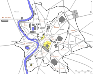
The Porta Viminale opened approximately in the center of the long stretch of walls still existing in Piazza dei Cinquecento (the most impressive find still visible), on the right side of those leaving Termini Station. [1] The garden that surrounds the walls covers the embankment of the ancient agger -- the slight slope on the flank of the square is but a faint reminder -- whose retaining wall is still visible in the basement of the station building.

The identification of the road or roads to which the gate gave access is still a topic of discussion among scholars. The Via Collatina and the Via Tiburtina have been suggested, or perhaps that it did not open onto any important road. The destruction carried out in the imperial era for the construction of the Baths of Diocletian, then by Pope Sixtus V for the urban renewal of the area, and finally for the construction of the station after 1856, have erased good part of the traces, not only of the walls but also of the gates (perhaps there was also a Porta Collatina near Via del Castro Pretorio, or in the railway station area), and of the original roads around the adjacent perimeter.

Work for the construction of the Termini station, however, had at least the merit of bringing to light the remains of the walls, which until 1892 had remained buried under an accumulation of debris, called "Monte della Giustizia", resulting from the work for the construction of the nearby Baths of Diocletian.

Related Research Articles

<span class="mw-page-title-main">Porta Capena</span>

The Porta Capena was a gate in the Servian Wall in Rome, Italy. The gate was located in the area of Piazza di Porta Capena, where the Caelian, Palatine and Aventine hills meet. Probably its exact position was between the entrance of Via di Valle delle Camene and the beginning of Via delle Terme di Caracalla, facing the curved side of the Circus Maximus.

<span class="mw-page-title-main">Baths of Diocletian</span> Ancient Roman bath, a landmark of Rome, Italy

The Baths of Diocletian were public baths in ancient Rome. Named after emperor Diocletian and built from AD 298 to 306, they were the largest of the imperial baths. The project was originally commissioned by Maximian upon his return to Rome in the autumn of 298 and was continued after his and Diocletian's abdication under Constantius, father of Constantine.

<span class="mw-page-title-main">Servian Wall</span> Defensive barrier around the ancient city of Rome

The Servian Wall is an ancient Roman defensive barrier constructed around the city of Rome in the early 4th century BC. The wall was built of volcanic tuff and was up to 10 m (33 ft) in height in places, 3.6 m (12 ft) wide at its base, 11 km (6.8 mi) long, and is believed to have had 16 main gates, of which only one or two have survived, and enclosed a total area of 246 hectares. In the 3rd century AD it was superseded by the construction of the larger Aurelian Walls as the city of Rome grew beyond the boundary of the Servian Wall.

<span class="mw-page-title-main">Monti (rione of Rome)</span> Rione of Rome in Lazio, Italy

Monti is the 1st rione of Rome, identified by the initials R. I, located in Municipio I. The name literally means "mountains" in Italian and comes from the fact that the Esquiline, the Viminal Hills, and parts of the Quirinal and the Caelian Hills belonged to this rione: currently, however, the Esquiline Hill belongs to the rione Esquilino.

<span class="mw-page-title-main">14 regions of Augustan Rome</span> Administrative subdivisions of ancient Rome

In 7 BC, Augustus divided the city of Rome into 14 administrative regions. These replaced the four regiones—or "quarters"—traditionally attributed to Servius Tullius, sixth king of Rome. They were further divided into official neighborhoods.

<span class="mw-page-title-main">Esquilino (rione of Rome)</span> Rione of Rome in Lazio, Italy

Esquilino is the 15th rione, or administrative division, of Rome, identified by the initials R. XV, and is Located within the Municipio I. It is named after the Esquiline Hill, one of the Seven Hills of Rome.

<span class="mw-page-title-main">Castro Pretorio</span> Rione of Rome in Lazio, Italy

Castro Pretorio is the 18th rione of Rome (Italy), identified by the initials R. XVIII, and it is located within the Municipio I. The rione takes its name by the ruins of the Castrum Praetorium, the barracks of the Praetorian Guard, included in the Aurelian Walls.

Campus Esquilinus was an area on the Esquiline Hill in ancient Rome. It was the site of many extravagant buildings as well as baths and gardens. The Campus Esquilinus was also the site of executions and burials, though it was eventually turned into a park by Augustus.

<span class="mw-page-title-main">Pincian Hill</span> Hill in Rome, Italy

The Pincian Hill is a hill in the northeast quadrant of the historical centre of Rome. The hill lies to the north of the Quirinal, overlooking the Campus Martius. It was outside the original boundaries of the ancient city of Rome, and was not one of the Seven hills of Rome, but it lies within the wall built by Roman Emperor Aurelian between 270 and 273.

<span class="mw-page-title-main">Aqua Julia</span>

The Aqua Julia is a Roman aqueduct built in 33 BC by Agrippa under Augustus to supply the city of Rome. It was repaired and expanded by Augustus from 11–4 BC.

<span class="mw-page-title-main">Roma Termini railway station</span> Railway station in Rome, Italy

Roma Termini is the main railway station of Rome, Italy. It is named after the district of the same name, which in turn took its name from ancient Baths of Diocletian, which lies across the street from the main entrance. It is Italy's busiest railway station and the fifth-busiest in Europe, with a traffic volume of approximately 150 million passengers per year, and with 850 trains in transit per day.

<span class="mw-page-title-main">Gardens of Maecenas</span>

The Gardens of Maecenas, or Horti Maecenatis, constituted the luxurious ancient Roman estate of Gaius Maecenas, an Augustan-era imperial advisor and patron of the arts. The property was among the first in Italy to emulate the style of Persian gardens. The walled villa, buildings, and gardens were located on the Esquiline Hill, atop the agger of the Servian Wall and its adjoining necropolis, as well as near the Horti Lamiani.

<span class="mw-page-title-main">Porta Esquilina</span>

The Porta Esquilina was a gate in the Servian Wall, of which the Arch of Gallienus is extant today. Tradition dates it back to the 6th century BC, when the Servian Wall was said to have been built by the Roman king Servius Tullius. However modern scholarship and evidence from archaeology indicate a date in the fourth century BC. The archway of the gate was rededicated in 262 as the Arch of Gallienus.

<span class="mw-page-title-main">Porta Collina</span> Landmark in ancient Rome

The Colline Gate was a landmark in ancient Rome, supposed to have been built by Servius Tullius, semi-legendary king of Rome 578–535 BC. The gate stood at the north end of the Servian Wall, and past it were two important streets, the Via Salaria and Via Nomentana. Within this area the Alta Semita linked the Quirinal with the Porta Carmentalis. Several temples were located near the gate, including temples of Venus Erycina and Fortuna. To a person facing the gate in the 3rd century AD, the Gardens of Sallust would have been on the left, with the Baths of Diocletian on the right.

<span class="mw-page-title-main">Janiculum walls</span>

The Janiculum walls are a stretch of defensive walls erected in 1643 by Pope Urban VIII as a completion of the Leonine wall and for a better protection of the area of Rome rising on the right bank of the Tiber.

<span class="mw-page-title-main">Porta Ardeatina</span> Gate of the Aurelian walls, a landmark of Rome, Italy

Porta Ardeatina was one of the gates of the Aurelian Walls in Rome (Italy).

<span class="mw-page-title-main">Regio I Porta Capena</span> Historical region of Rome

The Regio I Porta Capena is the first regio of imperial Rome, under Augustus's administrative reform. Regio I took its name from the Porta Capena, a gate of the Servian Walls, through which the Appian Way entered the city prior to the construction of the Aurelian Walls.

<span class="mw-page-title-main">Porta Caelimontana and Porta Querquetulana</span>

Porta Caelimontana and Porta Querquetulana were two city gates that opened in the Servian Wall in Rome (Italy); only the first one is still existing.

References

  1. 1 2 3 Strabo, Geography, V,3.7

Bibliography

41°54′09″N12°30′04″E / 41.9025°N 12.5011°E / 41.9025; 12.5011