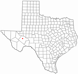
Pecos County is a county located in the U.S. state of Texas. As of the 2010 census, its population was 15,507. The county seat is Fort Stockton. The county was created in 1871 and organized in 1875. It is named for the Pecos River. It is one of the nine counties that comprise the Trans-Pecos region of West Texas.

Jeff Davis County is a county in the U.S. state of Texas. As of the 2010 census, its population was 2,342. Its county seat is Fort Davis. The county is named for Jefferson Davis, who served as the 23rd United States Secretary of War in the 1850s, and then, during the American Civil War, as President of the Confederate States of America. Jeff Davis County is easily recognizable for its unique shape; it is a pentagon which has no north-south nor east-west boundaries, save for a six mile line serving as its southern boundary. It also is the only county in the United States that touches a foreign country (Mexico) at a single point. Jeff Davis is also one of the nine counties that compose the Trans-Pecos region of West Texas.

Brewster County is a county located in the western part of the U.S. state of Texas. As of the 2010 census, the population was 9,232. Its county seat and only city is Alpine. The county is named for Colonel Henry Percy Brewster, a Secretary of War for the Republic of Texas.

Larimer County is one of the 64 counties in the U.S. state of Colorado. As of the 2010 census, the population was 299,630. The county seat and most populous city is Fort Collins. The county was named for William Larimer, Jr., the founder of Denver.

El Paso County is one of the 64 counties of the U.S. state of Colorado. The 2017 census estimate recorded an approximate population of 699,232 for El Paso County. The Census Bureau's 2017 estimate indicates it is the second-most populous county in Colorado, after the City and County of Denver. The county seat is Colorado Springs, the second most populous city in Colorado.
Big Spring is a city in and the county seat of Howard County, Texas, United States, at the crossroads of U.S. Highway 87 and Interstate 20. With a population of 27,282 as of the 2010 census, it is the largest city between Midland to the west, Abilene to the east, Lubbock to the north, and San Angelo to the south. Big Spring was established as the county seat of Howard County in 1882; it is the largest community in the county.
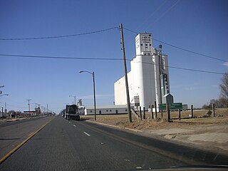
Farwell is a city in and the county seat of Parmer County, Texas, United States. The population was 1363 at the 2010 census. The city is located on the Texas-New Mexico border with the city of Texico, New Mexico across the border.
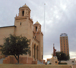
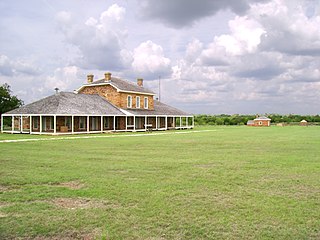
Fort Stockton is a city in and the county seat of Pecos County, Texas, United States. It is located on Interstate 10, Future Interstate 14, U.S. Highways 67, 285, and 385, and the Santa Fe Railroad, 329 mi (529 km) northwest of San Antonio and 240 mi (390 km) east of El Paso.

Fort Davis National Historic Site is a United States National Historic Site located in the unincorporated community of Fort Davis, Jeff Davis County, Texas. Located within the Davis Mountains of West Texas, the historic site was established in 1961 to protect one of the best remaining examples of a United States Army fort in the southwestern United States.

Divide is a census-designated place and a U.S. Post Office in Teller County, Colorado, United States. The population as of the 2010 Census was 127.
Divide sits on the north slope of Pikes Peak on U.S. Highway 24. Ute Pass is immediately west of town. The Divide Post Office has the ZIP Code 80814.

Comanche National Grassland is a National Grassland located in southeastern Colorado, United States. It is the sister grassland of Cimarron National Grassland and contains both prairie grasslands and canyons. It is separated into two sections, each operated by a local ranger district, one of which is in Springfield and the other of which is in La Junta. The grassland is administered by the Forest Service together with the Pike and San Isabel National Forests, and the Cimarron National Grassland, from common headquarters located in Pueblo, Colorado.

Greenhorn Mountain is the highest summit of the Wet Mountains range in the Rocky Mountains of North America. The prominent 12,352-foot (3,765 m) peak is located in the Greenhorn Mountain Wilderness of San Isabel National Forest, 5.2 miles (8.4 km) southwest by west of the Town of Rye, Colorado, United States, on the boundary between Huerfano and Pueblo counties. The summit of Greenhorn Mountain is the highest point in Pueblo County, Colorado. The peak's summit rises above timberline, which is about 11,500 feet (3,500 m) in south-central Colorado.
Fort Richardson was a United States Army installation located in present-day Jacksboro, Texas. Named in honor of Union General Israel B. Richardson, who died in the Battle of Antietam during the American Civil War, it was active from 1867 to 1878. Today, the site, with a few surviving buildings, is called Fort Richardson State Park, Historic Site and Lost Creek Reservoir State Trailway. It was designated a National Historic Landmark in 1963 for its role in securing the state's northern frontier in the post-Civil War era.

Before it was founded, the site of modern-day Colorado Springs, Colorado, was part of the American frontier. Old Colorado City, built in 1858 during the Pike's Peak Gold Rush was the Colorado Territory capital. The town of Colorado Springs, was founded by General William Jackson Palmer as a resort town. Old Colorado City was annexed into Colorado Springs. Railroads brought tourists and visitors to the area from other parts of the United States and abroad. The city was noted for junctions for seven railways: Denver and Rio Grande (1870), Denver and New Orleans Manitou Branch (1882), Colorado Midland (1886-1918), Colorado Springs and Interurban, Atchison, Topeka, and Santa Fe (1889), Rock Island (1889), and Colorado Springs and Cripple Creek Railways. It was also known for mining exchanges and brokers for the Cripple Creek Gold Rush.

Cherry Spring is an unincorporated farming and ranching community established in 1852 in Gillespie County, in the U.S. state of Texas. It is located on Cherry Spring Creek, which runs from north of Fredericksburg to Llano. The creek was also sometimes known as Cherry Springs Creek by residents. The community is located on the old Pinta Trail.
The Cherry Spring School was added to the National Register of Historic Places Listings in Gillespie County, Texas on May 6, 2005. The school was designated a Recorded Texas Historic Landmark in 1985.

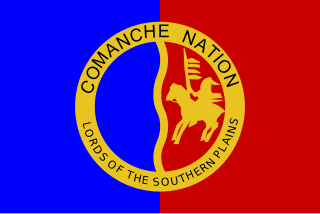
Glenn Springs is an uninhabited place in the state of Texas, United States, which is of historical importance. The Glenn Springs area was a natural spring providing water for Apache and Kiowa routing the Grand Indian Crossing passage at Boquillas. The Comanche tribes beseech the fresh water crossing on the Comanche Trail during their equine incursions from and to the Mexican Plateau, Sierra Madre Oriental, and the Trans-Mexican Volcanic Belt regions of Mexico.
This is a compendium of information on springs in Travis County, Texas, especially those with prehistoric or historic links to Texas Native Americans. Information is based primarily on Gunnar Brune’s report to the Texas Water Development Board, “Major and Historical Springs of Texas”, and his book, Springs of Texas. Additional sources are cited with associated springs.
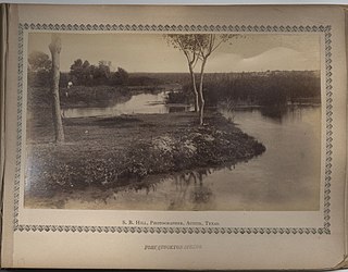
Comanche Springs was an aquifer of six artesian springs located in the Trans-Pecos region of West Texas. The groundwater source originated from a Comanchean limestone fault combined within the bountiful Edwards Aquifer and the Glass Mountains.