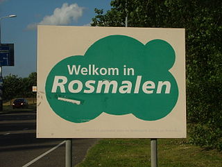
Rosmalen is a town in the province of North Brabant, in the south of the Netherlands. The town is located 6 kilometers east of the city of 's-Hertogenbosch and has been part of that municipality since 1996. Its population is around 37,240 on 1 January 2021. In 2005 the town began construction of a new neighbourhood, De Groote Wielen, to include 5,000 homes and other buildings.
Paderborn is a Kreis (district) in the east of North Rhine-Westphalia, Germany. Neighboring districts are Gütersloh, Lippe, Höxter, Hochsauerland, and Soest.

L'Estaque is a village in southern France, just west of Marseille. Administratively, it belongs to the commune of Marseille.

Partizánske District is a district in the Trenčín Region of Western Slovakia. It had been established in 1996, district area was previously a part of Topoľčany District. Partizánske district consists of 23 municipalities, from which 1 has a town status. Its main economic and cultural center is its seat Partizánske. Industry is a dominant branch. Density of population is ca. 1.5 times higher, than average is Slovakia.
The Rosmalen Grass Court Championships, branded by its sponsored name as the Libéma Open since 2018,, is a professional tennis tournament held in the town of Rosmalen, on the outskirts of the city of 's-Hertogenbosch in the Netherlands. The men's and women's tennis matches are played on grass courts at the Autotron convention center. It is classified as an ATP 250 event on the men's ATP Tour and a WTA 250 event on the women's WTA Tour.

Gwernesney is a village in Monmouthshire in southeast Wales.

Lowfield Heath Windmill is a Grade II listed post mill at Charlwood, Surrey, England, which has been restored to working order.

Bocking Windmill or Bocking Churchstreet Windmill is a grade I listed post mill at Bocking, Essex, England which has been restored.

The Saint Lambertchurch is a Catholic church in Rosmalen, North Brabant, Netherlands. The name of the church refers to Lambert of Maastricht, the Seventh-Century Bishop of Maastricht.
Mala Draguša is a village in the municipality of Blace, Serbia. According to the 2002 census, the village has a population of 157 people.
Ćuštica is a village in the municipality of Knjaževac, Serbia. According to the 2002 census, the village has a population of 253 people.
The city of Leeuwarden, Friesland, the Netherlands has had at least 130 windmills over the centuries. Only one, the Froskepôlemolen survives today within Leeuwarden. Six other mills which have stood in Leeuwarden survive elsewhere in the Netherlands. The mills had a wide range of industrial and agricultural uses. The industrial uses include the processing of bark for tanning leather, the fulling of cloth, the production of cement, the production of dyes, the extraction of oil, the grinding of tobacco to produce snuff, the production of gunpowder, and the sawing of timber. Agricultural uses include the milling of buckwheat, oats, rye and wheat, the processing of chicory, the production of pearl barley, and the pumping of water.
Molenhoek is a neighbourhood in the village of Rosmalen, North Brabant, Netherlands. The neighbourhood can be found south of the railway track Tilburg - Nijmegen which passes through the municipality Rosmalen is part of, namely, 's-Hertogenbosch. Before 1900 Molenhoek was a hamlet, like all other neighbourhoods of Rosmalen south of the railway track. The Post mill Rosmalen, which was built in 1732, can be found in the neighbourhood Molenhoek.
Rosmalen Noord is a borough in the municipality of 's-Hertogenbosch, the capital of North Brabant. It's located in the north of Rosmalen, north of railway track Tilburg - Nijmegen, south of De Groote Wielen, east of the Rijksweg 2, the highway from Maastricht to Amsterdam.
Ballard is an unincorporated community in northeast Bates County, in the U.S. state of Missouri and is part of the Kansas City metropolitan area.

Batenburg Windmill is a post mill in Batenburg, Gelderland, Netherlands which was built in the 18th century and is under repair as of February 2014. The mill is listed as a Rijksmonument.
Farewell is an unincorporated community in southern Oregon County, in the U.S. state of Missouri.
Pondfork is an unincorporated community in northwest Ozark County, Missouri, United States. Pondfork lies on the Hay Hollow tributary to Pond Fork Creek, which lies to the west. The community is approximately three miles west-southwest of Thornfield. Access is via Missouri Route D, from Missouri Route 95 to the southeast. Pondfork lies within the Mark Twain National Forest.
Adelbert is an extinct town in Washington County, in the U.S. state of Missouri. The site is adjacent to the Missouri Pacific Railroad line on the west side of Mill Creek and one mile north of Mineral Point and southeast of Fountain Farm. Cadet lies approximately two miles to the northeast on Missouri Route 47.
