Topeka is the capital city of the U.S. state of Kansas and the seat of Shawnee County. It is along the Kansas River in the central part of Shawnee County, in northeast Kansas, in the Central United States. As of the 2020 census, the population of the city was 126,587. The Topeka metropolitan statistical area, which includes Shawnee, Jackson, Jefferson, Osage, and Wabaunsee Counties, had a population of 233,870 in the 2010 census.

The North Loop is a neighborhood in the Central community of Minneapolis.

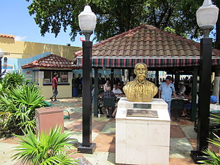
Little Havana is a neighborhood of Miami, Florida, United States. Home to many Cuban exiles, as well as many immigrants from Central and South America, Little Havana is named after Havana, the capital and largest city in Cuba.
Kirkwood is a national historic designated neighborhood on the east side of Atlanta, Georgia, United States. It is a historic streetcar suburb situated entirely in DeKalb County, bordered by the neighborhoods of Lake Claire, East Lake, Edgewood, and Oakhurst. Kirkwood is bound on the north by DeKalb Avenue, on the south by Memorial Drive and Interstate 20, on the west by Montgomery Street, and on the east by 1st Ave. A large part of the neighborhood is listed on the National Register of Historic Places as Kirkwood Historic District.

City Point is an area in what is now The Hill neighborhood of the city of New Haven, Connecticut, located in the southwestern portion of the city. The City Point area was, when settled and through the 18th century, a relatively narrow peninsula extending south into New Haven Harbor, located where the West River empties into the harbor. Areas adjacent to the original peninsula have since been filled in, broadening its shoulders, and Interstate 95 has cut across it. The Oyster Point Historic District is a 26-acre (11 ha) historic district encompassing an area of relatively old buildings in City Point south of I-95.

Kensington is a neighborhood in Philadelphia that belongs to Lower Northeast. As with all neighborhoods in the city, the lack of any official designation means the boundaries of the area vary between sources over time and are disputed among locals. Kensington, as most long-term residents view it, refers generally to the area consisting of Kensington, East Kensington, West Kensington, and Harrowgate. The adjacent Fairhill and Norris Square neighborhoods are more separate but may be included in Kensington; Fishtown and South (Olde) Kensington were historically included. The most conservative boundaries of the neighborhood, shown in the map below, are Front Street and 5th Street to the west, the Amtrak train tracks to the North, Trenton Avenue, the Trenton Avenue train tracks, and Frankford Avenue to the east, and Cecil B. Moore Avenue to the south.

The Swiss Avenue Historic District is a residential neighborhood in East Dallas, Dallas, Texas (USA). It consists of installations of the Munger Place addition, one of East Dallas' early subdivisions. The Swiss Avenue Historic District is a historic district of the city of Dallas, Texas. The boundaries of the district comprise both sides of Swiss Avenue from Fitzhugh Street, to just north of La Vista, and includes portions of Bryan Parkway. The District includes the 6100-6200 blocks of La Vista Drive, the west side of the 5500 block of Bryan Parkway the 6100-6300 blocks of Bryan Parkway, the east side of the 5200-5300 block of Live Oak Street, and the 4900-6100 blocks of Swiss Avenue. The entire street of Swiss Avenue is not included within the bounds of the Swiss Avenue Historic District. Portions of the street run through Dallas' Peaks Suburban Addition neighborhood and Peak's Suburban Addition Historic District. 5215 Swiss was built in 1914 and was the home of J. P. Cranfield
South Portland is a long, narrow neighborhood just south of Downtown Portland, Oregon, hemmed in between the Willamette River and the West Hills. It stretches from I-405 and the Marquam Bridge on the north, to SW Canby St. and the Sellwood Bridge in the south. The Willamette forms the eastern boundary, and SW Barbur Blvd. most of the western boundary. In addition to Downtown to the north, other bordering neighborhoods are Southwest Hills, Homestead, Hillsdale, and South Burlingame to the west, and Hosford-Abernethy, Brooklyn, and Sellwood-Moreland across the river on the east.

Baker is a neighborhood in Denver, Colorado, United States.

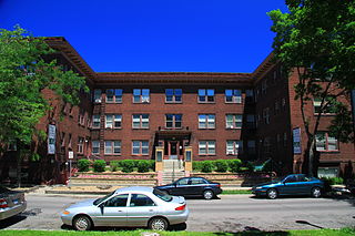
Stevens Square is the southernmost neighborhood of the Central community in Minneapolis. Although one of the densest neighborhoods in Minneapolis today, the land was originally occupied by a few large mansions. Today, the area is composed mostly of old brownstone apartment buildings or mansions that have been subdivided into apartments, giving the neighborhood a heavy population density within its small geographical area; a short and wide neighborhood, it is nearly a mile long but only three blocks tall. Much of the neighborhood is a National Historic District, and five of the apartments were listed on the National Register of Historic Places in 1993.

Herron–Morton Place is a historic district in Indianapolis, Indiana, United States. The boundaries of the neighborhood are East 16th Street on the south, East 22nd Street on the north, North Pennsylvania Street on the west, and Central Avenue on the east.

The Montford Area Historic District is a mainly residential neighborhood in Asheville, North Carolina that is included in the National Register of Historic Places.

Summerville,, is a large, affluent residential area and historic district located northwest of downtown Augusta, Georgia. The district is site of the historic homes of John Milledge, George Walton, and Thomas Cumming.

The Virginia Park Historic District is located on the north side of New Center, an area in Detroit, Michigan, along both sides of Virginia Park Street from Woodward Avenue to the John C. Lodge Freeway access road. The district was listed on the National Register of Historic Places in 1982.

The Drake Park Neighborhood Historic District is located adjacent to Drake Park near the historic downtown area in Bend, Oregon, United States. Because of the unique and varied architecture in the Drake Park neighborhood and its close association with the early development of the city of Bend, the area was listed on the National Register of Historic Places in 2005.

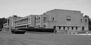
Vollintine Hills Historic District is a historic district located in the Midtown area of Memphis, Tennessee, notable for its cohesive collection of 78 post-World War II Minimal Traditional and ranch-style houses built around a former synagogue. "The neighborhood represents the efforts of members of an Orthodox religious group to accommodate their beliefs by developing a synagogue and housing for the congregation within easy walking distance."

Rosedale Park is a historic district located in Detroit, Michigan. It is roughly bounded by Lyndon, Outer Drive, Grand River Avenue, Southfield Freeway, Glastonbury Avenue, Lyndon Street and Westwood Drive. It was listed on the National Register of Historic Places in 2006. The Rosedale Park district has the largest number of individual properties of any district nominated to the National Register of Historic Places in Michigan, with 1533.

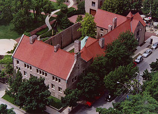
Prairie Avenue is a north–south street on the South Side of Chicago, which historically extended from 16th Street in the Near South Side to the city's southern limits and beyond. The street has a rich history from its origins as a major trail for horseback riders and carriages. During the last three decades of the 19th century, a six-block section of the street served as the residence of many of Chicago's elite families and an additional four-block section was also known for grand homes. The upper six-block section includes part of the historic Prairie Avenue District, which was declared a Chicago Landmark and added to the National Register of Historic Places.

The McClellan Heights Historic District is a 188.2-acre (76.2 ha) historic district in Davenport, Iowa, United States. It was listed on the National Register of Historic Places in 1984, at which time it included 354 buildings deemed to contribute to the historic character of the area.

The Chestnut Hill–Plateau Historic District is a historic area in the Highland Park neighborhood of Richmond, Virginia. It is also known as 'Highland Park Southern Tip' on city neighborhood maps.


