Praz de Lys-Sommand

Last updated
Praz de Lys - Sommand
Praz de Lys - Haut Fleury.JPG
One of the main buildings in the centre of Praz de Lys. With the resort's highest point, Haut Fleury, and the chairlift leading up to it, in the background.
Alps location map.png
Red pog.svg
Praz de Lys - Sommand
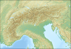
Location within Alps
LocationSommand
Nearest major city Mieussy
Coordinates 46°08′49″N6°35′26″E / 46.146956°N 6.590595°E / 46.146956; 6.590595
Vertical600 m (2,000 ft)
Top elevation2,000 m (6,600 ft)
Base elevation1,500 m (4,900 ft)
Trails 53
Website www.prazdelys-sommand.com

Praz de Lys - Sommand is a twinned ski resort starting at a high altitude and composed of Sommand resort and Praz de Lys resort both linked by ski trails and chair lifts over and around their dividing mountains. Sommand sits high above its village of Mieussy and Praz de Lys sits above Taninges. The ski resort of Les Gets is also nearby Praz de Lys, about 15 minutes drive. It was opened in approximately 1978.

Contents

There are 24 ski lifts, 6 chairlifts, beginner's areas in both sides with a child-safe moving carpet lift, and a Snowpark and Boarder cross ski areas on the Sommand side.

Sommand and Praz de Lys permit only low impact minimal infrastructure development to preserve the natural environment and views.[ citation needed ] The focus is on enjoyment of nature, and new permitted development uses traditional savoyard chalet construction and is within zoned areas naturally screened by pine forests.

Downhill skiing is available at all levels from black runs through gentle family runs. The area also offers cross country ski trails, and walking trails, and maintains a family-oriented focus.
Winter

Ski area

Alpine skiing

Praz de Lys
TrailNameLengthLifts
H1Chevaly650 mTéléskis de Chevaly
H2Chevaly300 mTapis de Beuloz
I1Jora520 mTéléski de Jora
A1Les Têtras3380 mTélésiège de Praz l'Évêque
A4Les Prèses600 mTélésiège de Praz l'Évêque
B2Retour Hôtel260 mTéléski de Hôtel
B3Accès Planey260 mTéléski de Planey
C1Hôtel1050 mTéléski de Hôtel
F1Piste du Lac4160 mTélésiège du Haut Fleury
J1Brésy1200 mTéléski de Brésy
K2Marmotte2600 mTélésiège de Véran
L3La Traverse1100 mTélésiège de Brésy
L4Accès Véran500 mTélésiège de Roy
M1Les Betex550 mTéléski de Betex
A2Les Mouflons3120 mTélésiège de Praz l'Évêque
A3Les Chamois1430 mTélésiège de Praz l'Évêque
J2Brésy1300 mTéléski de Brésy
K1Véran1430 mTélésiège de Véran
L1Roy1820 mTélésiège de Roy
L2La Face1500 mTélésiège de Roy
B1Planey1000 m Japan road sign 215.svg Téléski de Planey
Sommand
PisteNameLengthLifts
O3Retour Station - Retour FleuryTéléskis de Fleury
S1Tapis de la Mary90 mTapis de la Mary
U3Retour StationTéléski de Mouille Noire
D1Pierres Rouges1200 mTélésiège de Pierres Rouges
K3Accès SommandTélésiège de Pierres Rouges
N1Buchilles 1600 mTéléski de Buchilles
02Les Flattes600 mTéléski de Fleury
P2Accès Fleury Japan road sign 215.svg Téléski de Crinta
Q1Farquet 1300 mTéléski de Farquet
Q2Farquet 2300 mTéléski de Farquet
T1Col de Sommand2000 mTélésiège du Col de Sommand
T2Les Mottes2100 mTélésiège du Col de Sommand
T3LiaisonTélésiège du Col de Sommand
U2Les Sapins700 mTéléski de Mouille Noire
V2Ima1500 m Japan road sign 215.svg Téléski de Platière
W3Les Granges1200 m Japan road sign 215.svg Téléski d'Echeru
D2Boarder Cross600 mTélésiège de Pierres Rouges
N2Buchilles 2520 mTéléski de Buchilles
O1Fleury400 mTéléski de Fleury
P1Snow Park500 m Japan road sign 215.svg Téléski de Crinta
U1Mouille Noire580 mTéléski de Mouille Noire
V1La Platière1350 m Japan road sign 215.svg Téléski de Platière
W1Roche Pallud1000 m Japan road sign 215.svg Téléski d'Echeru
F4Le Vélard2000 mTélésiège du Haut Fleury
F5La Combe Perret1500 mTélésiège du Haut Fleury
W2Echeru800 m Japan road sign 215.svg Téléski d'Echeru

Nordic skiing

Praz de Lys
TrailNameLengthNotes
APiste d'initiation1200 m
CLe Jora5000 m
BLes Betex2500 m
DLa Savolière5000 m
ELes Lys10 000 m
FMolly8000 m
NLes Lys10 500 mJonction de Praz de Lys à Sommand

- 2 pistes d'initiation - 3 pistes vertes - 3 pistes bleus - 4 pistes rouges - 3 pistes noires

60 km of cross country skiing.

  • Winter snow shoeing trails

30 km of snow trails

Nearby peaks

Summer activities

In summer the twinned station often sees road cycle racing including the Tour de France. The annual Col du Ramaz is a race to the top of the pass that lies between the two resorts starting at Mieussy. In winter there is a cross country ski race of the same name.

The area is a protected development nature reserve known for its views to Mont Blanc Massif range.[ citation needed ] Many hiking trails are available through maps distributed by the tourist offices based in Mieussy or Taninges. Some of the walks include the easy family walk to lac de Roy, the mountain peak of pic de Marcelly, the pointe Chalune, Pointe d'Uble.

In summertime the main chairlift is open to the Haute Fleury for walking and further hiking.

Panoramic view of the plateau of Praz-de-Lys, seen from Planey Panorma Praz-de-Lys.JPG
Panoramic view of the plateau of Praz-de-Lys, seen from Planey

Related Research Articles

<span class="mw-page-title-main">Serre Chevalier</span> French ski resort in the Alps

Serre Chevalier is a major ski resort in Southeastern France, near the Italian border, located in the Hautes-Alpes department, Provence-Alpes-Côte d'Azur region. Situated to the northeast of Écrins National Park in the French Alps, the resort encompasses a large skiing area, with 250 km (155 mi) of slopes and favourable weather, boasting 300 days of sunshine a year. In Serre Chevalier, 80 km (50 mi) of the slopes are covered by snow cannons to supplement natural snowfall. The resort is owned by Compagnie des Alpes.

<span class="mw-page-title-main">Portes du Soleil</span> Skisports destination in the Alps

Les Portes du Soleil is a major skisports destination in the Alps, encompassing thirteen resorts between Mont Blanc in France and Lake Geneva in Switzerland. With more than 650 km of marked pistes and about 200 lifts in total, spread over 14 valleys and about 1,036 square kilometres (400 sq mi), Portes du Soleil ranks among the two largest ski areas in the world. Almost all of the pistes are connected by lifts – a few marginal towns can be reached only by the free bus services in the area. The highest elevation accessible on skis is 2260 m and the lowest is 930 m. As with many other Alpine ski resorts, the lower slopes of the Portes du Soleil have snow-making facilities to extend the ski season by keeping the lower slopes open during the warmer months.

<span class="mw-page-title-main">Cypress Mountain Ski Area</span> Ski resort in British Columbia, Canada

Cypress Mountain is a ski area in West Vancouver, British Columbia, Canada, located in the southern section of Cypress Provincial Park, operated under a BC Parks Park Use Permit.

<span class="mw-page-title-main">Verbier</span> Swiss village

Verbier is a village located in south-western Switzerland in the canton of Valais. It is a holiday resort and ski area in the Swiss Alps and is recognised as one of the premier off-piste resorts in the world. Some areas are covered with snow all year. Skiers have settled in the Verbier area in order to take advantage of the steep slopes, varied conditions, and resort culture.

<span class="mw-page-title-main">Snowbasin</span> Ski resort in Utah, United States

Snowbasin Resort is a ski resort in the western United States, located in Weber County, Utah, 33 miles (53 km) northeast of Salt Lake City, on the back (east) side of the Wasatch Range.

<span class="mw-page-title-main">Les Gets</span> Commune in Auvergne-Rhône-Alpes, France

Les Gets is a commune in the Haute-Savoie department in the Auvergne-Rhône-Alpes region in south-eastern France.

<span class="mw-page-title-main">Flaine</span>

Flaine is a ski area in the Haute Savoie region of the French Alps, and is a part of the linked Grand Massif domain. It is in the territory of the communes of Magland and Arâches-la-Frasse. Flaine is linked to Samoëns, Morillon, Les Carroz and Sixt-Fer-à-Cheval, with 267 km of pistes in total. It featured the first 8-seater high speed chairlift, Les Grands Vans, and the first snow cannons to be installed in Europe. Flaine is often called the "big snowy bowl" due to it having one of the best snow records in the Alps. It is a modern, car-free resort with a wealth of amenities, all in close proximity to the accommodation.

<span class="mw-page-title-main">Formigal Ski Resort</span>

Formigal, officially Aramón Formigal-Panticosa, is a ski resort in the Aragon Pyrenees of northeastern Spain, near the town of Sallent de Gallego in the upper Tena Valley in the province of Huesca. The nearest international airports are in Zaragoza, Spain and Lourdes, France.

Belleayre Mountain, in Catskill Park, New York, United States, is a ski resort owned and operated by the Olympic Regional Development Authority or ORDA. It is the only Catskill resort that contains a gondola and attracts many new visitors from New York City. Skier and snowboarder visits have grown from 70,000 in 1995 to more than 175,000 in 2007.

Val Cenis is a ski and mountain resort situated in the Haute-Maurienne region of the French Alps, close to the Italian border. It is composed of five villages; Lanslebourg, Lanslevillard, Termignon, Sollières-Sardières and Bramans. The villages sit between 1200m and 1500m, respectively, and lifts climb to a maximum altitude of 2740m. The resort is not very well known due to its location at the end of a valley and difficulty of access and attracts a mainly French, Italian, Belgian and Dutch contingent each winter. It is a lot quieter than larger ski resorts in the French Alps and does not normally suffer from long lift queues. It is ideally located in the Maurienne region with good transport links in and out of Modane, Lyon, Geneva and Chambery.

<span class="mw-page-title-main">Mieussy</span> Commune in Auvergne-Rhône-Alpes, France

Mieussy is a commune in the Haute-Savoie department in the Auvergne-Rhône-Alpes region of France. It is a traditional Alpine farming village in the Vallée du Giffre, around 35 kilometers east of Geneva. The area is known for its scenic views, skiing, and local foods. It is host to the "Foire d' Automne", a harvest festival which runs for two days in October.

<span class="mw-page-title-main">Taninges</span> Commune in Auvergne-Rhône-Alpes, France

Taninges is a commune in the Haute-Savoie department in the Auvergne-Rhône-Alpes region in south-eastern France.

<span class="mw-page-title-main">Snow King Mountain</span> Resort in Wyoming

Snow King Mountain is a summer and winter resort in the western United States, in Jackson, Wyoming. The mountain is Jackson's original 1936 ski hill, located on the southeast edge of the city, and was the first ski area in Wyoming. Locals sometimes refer to Snow King as "The Town Hill," and it offers skiing, hiking, an alpine slide, and many other attractions. The ski season runs from December to late March, and has a summer season that runs from June to October. Skiing is offered after the closure of lifts, until the snow is gone thanks to a boot pack trail on the west side of the resorts Runs. Hiking trails are offered all over the mountain.

<span class="mw-page-title-main">Lac de Roy</span> Natural freshwater lake in Haute-Savoie

Lac de Roy is a lake in Haute-Savoie, France. It is located 2 km west of le Praz de Lys ski resort, in the commune of Taninges.

<span class="mw-page-title-main">Glencoe Ski area</span>

Glencoe Mountain Resort is a ski area that operates on the mountain Meall a' Bhuiridh in some of the most dramatic mountain scenery in Scotland. The ski area is located adjacent to the A82 road, 13 miles from the village of Glencoe, Highland, approximately 29 miles south of Fort William and 92 miles north of Glasgow.

<span class="mw-page-title-main">Speikboden (South Tyrol)</span> Mountain in Italy

Speikboden is a massif in the Central Eastern Alps located between the three valleys Weißenbach, Mühlwald and Ahrntal. Running in a south-easterly direction, it forms the eastern part of an outlier of the western Zillertal Alps. Its highest point, likewise named Speikboden, is 2,517 m. Further well-known peaks in this massif include Seewassernock (2,516 m), Große Nock (2,400 m), Kleine Nock (2,227 m) and Gornerberg (2,475 m).

<span class="mw-page-title-main">Monterosa Ski</span> Ski area in the Alps

The Monterosa Ski is an Italian ski resort, at the foot of Monte Rosa the second tallest mountain in the Alps, which links three valleys, located largely in the Aosta Valley and the remainder in Piedmont. Much of the area consists of easy and intermediate skiing, but the area around the Passo dei Salati and especially the steep slopes in Alagna Valsesia are a major and very famous destination for freeride skiers and snow-boarders.

<span class="mw-page-title-main">Damüls-Mellau (Ski Area)</span> Ski resort Vorarlberg, Austria

Damüls-Mellau is a ski area in Vorarlberg, Austria. It is most popular for its snow safety. In 2006, the village Damüls was awarded the honorary title 'snowiest village of the world'.

<span class="mw-page-title-main">Jahorina Ski Resort</span> Ski resort in Bosnia and Herzegovina

Jahorina Ski Resort, officially named Olympic Center Jahorina, is a mountain resort and the largest and most popular winter tourism resort in Bosnia and Herzegovina.

This glossary of skiing and snowboarding terms is a list of definitions of terms and jargon used in skiing, snowboarding, and related winter sports.

References