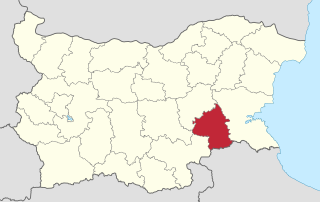
Priseltsi (Bulgarian : Приселци) is a village in South- East Bulgaria, situated in Obshtina Nessebar, in the Burgas region.

Bulgarian, is an Indo-European language and a member of the Southern branch of the Slavic language family.

A village is a clustered human settlement or community, larger than a hamlet but smaller than a town, with a population ranging from a few hundred to a few thousand. Though villages are often located in rural areas, the term urban village is also applied to certain urban neighborhoods. Villages are normally permanent, with fixed dwellings; however, transient villages can occur. Further, the dwellings of a village are fairly close to one another, not scattered broadly over the landscape, as a dispersed settlement.
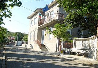
Priseltsi is 10 minutes drive from Obzor, a seaside town with much development in progress. It is known for its clean fresh air. There are quite a few new, high quality houses that have been recently built or renovated and some older ones in need of repair. A small church has been built and paid for by the local inhabitants. Pavements are currently being upgraded at the north end of the village. There is one small shop and plenty of farm animals running free. A cultural centre has been opened at the north end of the village - its expected to run traditional folk dancing evening and various outdoor activities.

Obzor is a small town and seaside resort on the Black Sea coast of Bulgaria. It is part of Nesebar municipality, Burgas Province.

A church building or church house, often simply called a church, is a building used for Christian religious activities, particularly for Christian worship services. The term is often used by Christians to refer to the physical buildings where they worship, but it is sometimes used to refer to buildings of other religions. In traditional Christian architecture, the church is often arranged in the shape of a Christian cross. When viewed from plan view the longest part of a cross is represented by the aisle and the junction of the cross is located at the altar area.
Coordinates: 42°49′00″N27°49′00″E / 42.8166666767°N 27.8166666767°E

A geographic coordinate system is a coordinate system that enables every location on Earth to be specified by a set of numbers, letters or symbols. The coordinates are often chosen such that one of the numbers represents a vertical position and two or three of the numbers represent a horizontal position; alternatively, a geographic position may be expressed in a combined three-dimensional Cartesian vector. A common choice of coordinates is latitude, longitude and elevation. To specify a location on a plane requires a map projection.
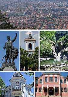
Capital: Nesebar | ||
| Towns | 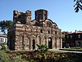 | |
| Villages | ||
| Landmarks | ||
| Culture | ||
| Notable people | ||
| This Burgas Province, Bulgaria location article is a stub. You can help Wikipedia by expanding it. |