Pudur (S)

Last updated
Pudur (S)
town
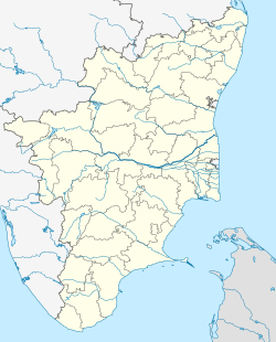
India Tamil Nadu location map.svg
Red pog.svg
Pudur (S)
Location in Tamil Nadu, India
Coordinates: 9°01′30″N77°11′00″E / 9.02500°N 77.18333°E / 9.02500; 77.18333 Coordinates: 9°01′30″N77°11′00″E / 9.02500°N 77.18333°E / 9.02500; 77.18333
CountryFlag of India.svg  India
State Tamil Nadu
District Tirunelveli
Population (2001)
  Total 11,095
Languages
  Official Tamil
Time zone IST (UTC+5:30)

Pudur (S) is a panchayat town in Tirunelveli district in the Indian state of Tamil Nadu.

Tirunelveli district District in Tamil Nadu, India

Tirunelveli district is a district of Tamil Nadu state in South India. It is the largest district in terms of area with Tirunelveli as its headquarters. Tirunelveli District was formed on 1 September 1790 by the British East India Company, and comprised the present Tirunelveli and Thoothukudi districts and parts of Virudhunagar and Ramanathapuram district. As of 2011, the district had a population of 3,077,233.

India Country in South Asia

India, also known as the Republic of India, is a country in South Asia. It is the seventh largest country by area and with more than 1.3 billion people, it is the second most populous country as well as the most populous democracy in the world. Bounded by the Indian Ocean on the south, the Arabian Sea on the southwest, and the Bay of Bengal on the southeast, it shares land borders with Pakistan to the west; China, Nepal, and Bhutan to the northeast; and Bangladesh and Myanmar to the east. In the Indian Ocean, India is in the vicinity of Sri Lanka and the Maldives, while its Andaman and Nicobar Islands share a maritime border with Thailand and Indonesia.

Tamil Nadu State in Southern India

Tamil Nadu, formerly Madras State, is one of the 29 states of India. Its capital and largest city is Chennai. Tamil Nadu lies in the southernmost part of the Indian subcontinent and is bordered by the union territory of Puducherry and the South Indian states of Kerala, Karnataka, and Andhra Pradesh. It is bounded by the Eastern Ghats on the north, by the Nilgiri Mountains, the Meghamalai Hills, and Kerala on the west, by the Bay of Bengal in the east, by the Gulf of Mannar and the Palk Strait on the southeast, and by the Indian Ocean on the south. The state shares a maritime border with the nation of Sri Lanka.

Demographics

As of 2001 India census, [1] Pudur (S) had a population of 11,095. Males constitute 49% of the population and females 51%. Pudur (S) has an average literacy rate of 63%, higher than the national average of 59.5%: male literacy is 74%, and female literacy is 52%. In Pudur (S), 12% of the population is under 6 years of age.

Census Acquiring and recording information about the members of a given population

A census is the procedure of systematically acquiring and recording information about the members of a given population. The term is used mostly in connection with national population and housing censuses; other common censuses include agriculture, business, and traffic censuses. The United Nations defines the essential features of population and housing censuses as "individual enumeration, universality within a defined territory, simultaneity and defined periodicity", and recommends that population censuses be taken at least every 10 years. United Nations recommendations also cover census topics to be collected, official definitions, classifications and other useful information to co-ordinate international practice.

Related Research Articles

Birwadi city in Maharashtra, India

Birwadi is a census town in Raigad district in the state of Maharashtra, India.

Chandapur city in Odisha, India

Chandapur is a census town in Nayagarh district in the state of Odisha, India.

Desur town panchayat in Tamil Nadu, India

Desur is a Town panchayat in Tiruvanamalai district in the Indian state of Tamil Nadu.

Kalappanaickenpatti Town Panchayat in Tamil Nadu, India


Kalappanaickenpatti is a panchayat town in Namakkal district in the Indian state of Tamil Nadu

Karumathampatti is a Town Panchayat suburb of Coimbatore city in the state of Tamil Nadu, India. It is one of the most developing suburb in Coimbatore about 25 km away from the city centre. It is situated in between NH47 which connects the city of Coimbatore with Salem - Erode - Tirupur and also in between the State Highway 165 connects Annur - Kamanaikenpalayam. Nearby places are Somanur-3 km, Avinashi-10 km, Tirupur-20 km, Sulur-15km, Annur-16km.Coimbatore -27,Mettupalayam-40,Palladam-19. Karumathampatti lies near the junction of two major roads, NH47(Coimbatore - Salem) and Karumathampatti - Annur road.

Madathukulam municipality in Tamil Nadu, India

Madathukulam is a municipality in Tirupur district in the Indian state of Tamil Nadu.

Naravarikuppam city in Tamil Nadu, India

Naravarikuppam is a town in Thiruvallur district in the Indian state of Tamil Nadu.also called redhills

Neiyyur city in Tamil Nadu, India

Neyyoor is a panchayat town in Kanniyakumari district in the Indian state of Tamil Nadu.

Peerkankaranai neighbourhood in Chennai, Tamil Nadu, India

Peerkankaranai is a town in Southern part of the metropolitan city of Chennai in the Indian state of Tamil Nadu.

R. Pudupatti city in Tamil Nadu, India

R. Pudupatti is a panchayat town in Rasipuram taluk in Namakkal district in the Indian state of Tamil Nadu.

Seerapalli city in Tamil Nadu, India

Seerapalli is a panchayat town in Namakkal district in the Indian state of Tamil Nadu. In Seerapalli there is very old Shiva temple of 1000 years old.

Thenkarai, Coimbatore Suburb in Coimbatore, Tamil Nadu, India

Thenkarai is a suburban area in Coimbatore City Municipal Corporation, in the Indian state of Tamil Nadu. It is in the western suburbs of Coimbatore. It recently merged with the Coimbatore Corporation limits. Thenkarai is one of the town panchayats in Coimbatore and consists of small villages such as Sennanur, Mathipalayam, Karadimadai, Thaneer Panthal, Appachimaar Kovil, Challikkuzhi and Krishnavarayam Pudur.

V. Pudur Panchayat town in Tamil Nadu, India

V. Pudur is a panchayat town in Thoothukudi district in the Indian state of Tamil Nadu.

Vadipatti Panchayat town in Tamil Nadu, India

Vadipatti is a panchayat town in the Madurai district in the Indian state of Tamil Nadu. Population of the town is 21,833.

Vellottamparappu is a panchayat town in Erode district in the Indian state of Tamil Nadu.

Vengathur is a census town in Thiruvallur district in the Indian state of Tamil Nadu.

Venkatapur, Bhatkal, Karnataka town in Karnataka, India

Venkatapur is a census town in Bhatkal Taluk in Uttara Kannada district of Karnataka.

Fatehabad, Haryana Town in Haryana, India

Fatehabad is a town and a municipal committee in Fatehabad district in the state of Haryana, India.

Kerura City in Karnataka, India

Kerur is a City in Bagalkot district in Karnataka, which located on NH 218. It has an average elevation of 617 meters (2024 feet). It's a birthplace of Jagadish Shettar, a former Chief Minister of Karnataka. Kerur is a Town Panchayat city in district of Bagalkot, Karnataka. The Kerur city is divided into 16 wards for which elections are held every five years. The Kerur Town Panchayat has population of 19,731 of which 9,929 are males while 9,802 are females as per report released by Census India 2011.

Pudur or 46 Pudur is a village in the Modakurichi taluk of Erode district in the south Indian state of Tamil Nadu.

References

  1. "Census of India 2001: Data from the 2001 Census, including cities, villages and towns (Provisional)". Census Commission of India. Archived from the original on 2004-06-16. Retrieved 2008-11-01.