
The Arctic Archipelago, also known as the Canadian Arctic Archipelago, is an archipelago lying to the north of the Canadian continental mainland, excluding Greenland and Iceland.
Shirase Coast is the north segment of the relatively ill-defined coast along the east side of Ross Ice Shelf and Ross Sea, lying between the north end of Siple Coast and Cape Colbeck. Named by NZ-APC in 1961 after Lieutenant Nobu Shirase (1861-1946), leader of the Japanese expedition, whose ship Kainan Maru sailed near this coast in January 1912. Landings were made at Kainan Bay and at the Bay of Whales, the origin of a 160-mile journey southeast on Ross Ice Shelf. From 76°56′S155°55′W, another party landed for a sledge trip to the edge of the Queen Alexandra Range.

HMS Sterlet was a second-batch S-class submarine built during the 1930s for the Royal Navy. Completed in 1938, the boat fought in the Second World War. The submarine is one of the 12 boats named in the song Twelve Little S-Boats. Thus far she has been the only ship of the Royal Navy to be named Sterlet.
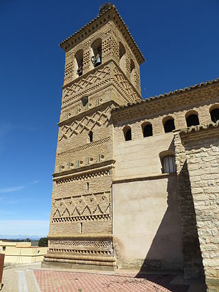
Torralba de Aragón is a municipality located in the province of Huesca, Aragon, Spain. According to the 2004 census (INE), the municipality had a population of 115 inhabitants.
This is a list of the extreme points and extreme elevations in Scotland.
Gaspar, Santa Catarina is a municipality in the state of Santa Catarina in the South region of Brazil.
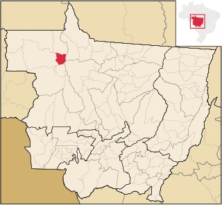
Juruena is a municipality in the state of Mato Grosso in the Central-West Region of Brazil.
General Vedia is a village and municipality in Chaco Province in northern Argentina. This village is also known as "La cuna del escudo chaqueño" whose translation is "The Cradle of the Chaqueños shield"
Irazusta is a village and municipality in Entre Ríos Province in north-eastern Argentina.
Udeva is a village in Järva Parish, Järva County in northern-central Estonia.
Tohera is a village in Tori Parish, Pärnu County in southwestern Estonia.

The borders of the oceans are the limits of Earth's oceanic waters. The definition and number of oceans can vary depending on the adopted criteria. The principal divisions of the five oceans are the Pacific Ocean, Atlantic Ocean, Indian Ocean, Southern (Antarctic) Ocean, and Arctic Ocean. Smaller regions of the oceans are called seas, gulfs, bays, straits, and other terms. Geologically, an ocean is an area of oceanic crust covered by water.

Pottinger Point is a low-lying, ice-free promontory 4 km (2.5 mi) east of Round Point, about 500 m long, on the north coast of King George Island in the South Shetland Islands of Antarctica. It was named by the United Kingdom Antarctic Place-Names Committee (UK-APC) in 1960 for Captain Pottinger, Master of the Tartar from London, who visited the South Shetland Islands in 1821–22.
Duncan Peninsula is an ice-covered peninsula, 30 nautical miles (56 km) long, which forms the eastern part of Carney Island, along the coast of Marie Byrd Land. It was delineated from aerial photographs taken by U.S. Navy Operation Highjump in January 1947, and was named by the Advisory Committee on Antarctic Names for Admiral Donald B. Duncan, U.S. Navy, Vice Chief of Naval Operations under Admiral Robert Carney during the International Geophysical Year period of 1957–58.
Glass Point is a point 4.5 nautical miles (8 km) southwest of False Round Point on the north coast of King George Island, South Shetland Islands. It was named by the UK Antarctic Place-Names Committee in 1960 for R.H. Glass, Master of the Francis Allyn from New London, Connecticut, who visited the South Shetland Islands in 1873–75 and 1877–79. In 1877–78 he rescued from Potter Cove the sole survivor of the sealing crew from the Florence.
Stapleton Glacier is a glacier about 6 nautical miles (11 km) long flowing east from King Peninsula just north of Morelli Glacier. Named by Advisory Committee on Antarctic Names (US-ACAN) after Jo Anne Stapleton, United States Geological Survey (USGS), Reston, Virginia, geographer and map specialist, participated in Antarctic map production from the 1980s to the present, part of the USGS team that compiled the 1:5,000,000-scale Advanced Very High Resolution Radiometer maps of Antarctica and the 1: 250,000-scale Landsat TM image maps of the Siple Coast area.
Tasiujaq is an Inuit reserved land in Nunavik, in northern Quebec. Like all Inuit reserved lands in Quebec, it has no resident population and is associated with a nearby northern village of the same name: Tasiujaq.