Puerto Rico Highway 3(PR-3) at nearly 100 miles long, is the second-longest highway on Puerto Rico. It connects the San Juan neighborhood of Río Piedras to downtown Salinas indirectly around the eastern coast of the island. Highway 3 ranges from a three lane urban avenue in San Juan to a one lane rural road past Fajardo. While other roads connect San Juan, it runs the coastline of Puerto Rico east of San Juan, beginning in Río Piedras near Santurce and goes to Fajardo where it goes south paralleling the coastline to Humacao and Maunabo. It goes up to a mountain-scenic route and goes west to Salinas, where it meets PR-1.
Puerto Rico Highway 115 (PR-115) is a highway which follows the west coastline of Puerto Rico from south Añasco at PR-2 to near downtown Aguadilla, where it becomes Puerto Rico Highway 111 after intersecting PR-2 again, and is the primary route to the town of Rincón, Puerto Rico, a tourist and frequent destination of surfers.

Puerto Rico Highway 111 (PR-111) is a highway connecting Aguadilla, Puerto Rico at Puerto Rico Highway 2 and Puerto Rico Highway 115 to Utuado, Puerto Rico at Puerto Rico Highway 140.

Puerto Rico Highway 344 (PR-344) is a rural road in Hormigueros, Puerto Rico, beginning from near the municipality's small downtown and ending at PR-348 near the border with San Germán in barrio Rosario. It has narrow lanes, and after about five kilometers becomes one of the most dangerous highways in Puerto Rico, as it goes near a precipice with little or no safety barriers. It serves as a route to Mayagüez via PR-348 which ends in Puerto Rico Alt Route 2.
Puerto Rico Highway 149 (PR-149) is a secondary highway in Puerto Rico that connects the towns of Manatí in the north coast of Puerto Rico, from PR-22 to Juana Díaz in the south coast, ending at PR-1.
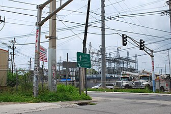
Puerto Rico Highway 156 (PR-156) is a long east–west highway which connects Caguas to Orocovis, passing through Aguas Buenas, Comerío and Barranquitas. This route extends from its junction with PR-1 in downtown Caguas to PR-5155 in downtown Orocovis.

Puerto Rico Highway 185 (PR-185) is a main highway that connects Canóvanas, Puerto Rico to Juncos, Puerto Rico and is about 25 kilometers long. It begins in downtown of Canóvanas, very close to Puerto Rico Highway 3 and ends in Puerto Rico Highway 952 and Puerto Rico Highway 30 in Juncos.
Puerto Rico Highway 165 (PR-165) is the road that goes from Naranjito to Guaynabo. The highway passes by Toa Alta, Toa Baja, Dorado, Levittown, Cataño and Guaynabo.

Puerto Rico Highway 130 (PR-130) is the main north–south route within the municipality of Hatillo, Puerto Rico.
Puerto Rico Highway 693 (PR-693) is a road located between the municipalities of Dorado, Puerto Rico and Vega Alta, passing through downtown Dorado. It begins at its intersection with PR-2 and PR-165 in Río Lajas and ends at PR-690 in Sabana. It is a short divided highway in southern Dorado, which serves as an alternate route for PR-165 west of Río de la Plata.

Puerto Rico Highway 128 (PR-128) is a road that travels from Yauco, Puerto Rico to Lares. This highway extends from PR-2 in Yauco and ends at PR-111 near downtown Lares.

Puerto Rico Highway 155 (PR-155) is a rural road that goes from Coamo, Puerto Rico to Vega Baja through Orocovis and Morovis. It extends from PR-14 in downtown Coamo to PR-2 east of downtown Vega Baja.

Puerto Rico Highway 108 (PR-108) is a road that travels from Mayagüez, Puerto Rico to Añasco. It begins at its intersection with PR-105 in downtown Mayagüez and ends at its junction with PR-109 in eastern Añasco, near Las Marías and San Sebastián. Near this road is located the Mayagüez Zoo.
Puerto Rico Highway 180 (PR-180) is a bypass located near downtown Salinas, Puerto Rico. This road extends from PR-1, near PR-52, to PR-701 and is known as Avenida Pedro Albizu Campos.

Puerto Rico Highway 192 (PR-192) is the main access to downtown Naguabo, Puerto Rico. This road extends from PR-31 between Río and Maizales barrios to PR-3 in Húcares.

Puerto Rico Highway 144 (PR-144) is a rural road that travels from Jayuya, Puerto Rico to Ciales. This road extends from PR-140 in Collores and ends at PR-149 in Toro Negro.

Puerto Rico Highway 141 (PR-141) is a road that travels from Jayuya, Puerto Rico to northeastern Utuado. This highway begins at PR-144 in downtown Jayuya and ends at PR-140 in Mameyes Abajo.
Puerto Rico Highway 194 (PR-194) is a road located in Fajardo, Puerto Rico, passing through its downtown. This highway begins at its intersection with PR-3 and PR-53 in Quebrada Vueltas and ends at its junction with PR-3 and PR-940 in Quebrada Fajardo.

Puerto Rico Highway 193 (PR-193) is a road located in Luquillo, Puerto Rico, passing through its downtown. This highway begins at PR-3 southeast of downtown Luquillo and returns again to PR-3 near Playa Fortuna.
Puerto Rico Highway 187 (PR-187) is a road that travels from Río Grande, Puerto Rico to Carolina, passing through Loíza. This highway begins at its intersection with PR-3 and PR-66 in Guzmán Abajo and ends at PR-26 in Isla Verde.