
The Duwamish River is the name of the lower 12 miles (19 km) of Washington state's Green River. Its industrialized estuary is known as the Duwamish Waterway. In 2009, the Duwamish Longhouse and Cultural Center was opened on the west bank of the river as part of the tribe's reassertion of its historic rights in the area and its continuing struggle for federal recognition of tribal status.
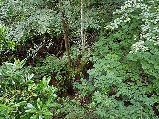
Fauntleroy Creek is a stream in the Fauntleroy neighborhood of West Seattle, Washington, United States. It flows for about a mile from its headwaters in the 32-acre (129,000 m2) ravine of Fauntleroy Park to its outlet just south of the state ferry terminal on Puget Sound's Fauntleroy Cove, dropping 300 feet (100 m) vertically along the way. It currently supports cutthroat trout and coho salmon.

The Cedar River is a river in the U.S. state of Washington. About 45 miles (72 km) long, it originates in the Cascade Range and flows generally west and northwest, emptying into the southern end of Lake Washington. Its upper watershed is a protected area called the Cedar River Watershed, which provides drinking water for the greater Seattle area.

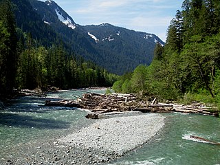
The White River is a white, glacial river in the U.S. state of Washington. It flows about 75 miles (121 km) from its source, the Emmons Glacier on Mount Rainier, to join the Puyallup River at Sumner. It defines part of the boundary between King and Pierce counties.
The Puyallup River is a river in the U.S. state of Washington. About 45 miles (72 km) long, it is formed by glaciers on the west side of Mount Rainier. It flows generally northwest, emptying into Commencement Bay, part of Puget Sound. The river and its tributaries drain an area of about 948 square miles (2,460 km2) in Pierce County and southern King County.

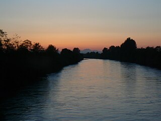
The Necanicum River is a river on the Pacific coast of northwest Oregon in the United States, approximately 21 miles (34 km) long. It drains a timber-producing area of the Northern Oregon Coast Range northwest of Portland. It forms the first estuary south of the mouth of the Columbia River along the Oregon Coast, reaching the Pacific Ocean at Seaside in Clatsop County.

Oncorhynchus is a genus of ray-finned fish in the subfamily Salmoninae of the family Salmonidae, native to coldwater tributaries of the North Pacific basin. The genus contains twelve extant species, namely six species of Pacific salmon and six species of Pacific trout, all of which are migratory mid-level predatory fish that display natal homing and semelparity.
Puget Sound salmon recovery is a collective effort of federal, state and local authorities and non-profit coalitions of universities, scientists, business and industry aimed at restoring Pacific salmon and anadromous forms of Pacific trout (Oncorhynchus) within the Puget Sound region. The Puget Sound lies within the native range of the Pacific Salmon (Oncorhynchus) and two sea-run forms of Pacific trout, the coastal rainbow trout or steelhead and coastal cutthroat trout. Populations of Oncorhynchus have seen significant declines since the middle of the 19th century due to over fishing, habitat loss, pollution and disease. Salmon species residing in or migrating through the Puget Sound to spawning streams include Chum, Coho, Chinook, Sockeye, and Pink salmon. Pacific salmon require freshwater rivers for spawning and most major tributaries of the Puget Sound have salmon, steelhead and cutthroat trout spawning runs.

Nooksack Salmon Enhancement Association (NSEA) was formed in 1990 as a non-profit organization with an overall goal of seeing an increase in returning natural spawning salmon to the over 1,600 km of rivers and streams in Whatcom County, Washington in the United States. The association was formed as part of Washington State's Regional Fisheries Enhancement Groups Program established by the Washington State Legislature in 1990 to involve local communities, citizen volunteers, and landowners in the state's salmon recovery efforts. NSEA is one of 14 groups in Washington State each with the common goal of restoring salmonid populations and habitat within their region.

Lagunitas Creek is a 24 miles (39 km)-long northward-flowing stream in Marin County, California. It is critically important to the largest spawning runs of endangered coho salmon in the Central California Coast Coho salmon Evolutionary Significant Unit.
The Baker River is an approximately 30-mile (48 km), southward-flowing tributary of the Skagit River in northwestern Washington in the United States. It drains an area of the high North Cascades in the watershed of Puget Sound north of Seattle, and east of Mount Baker. With a watershed of approximately 270 square miles (700 km2) in a complex of deep valleys partially inside North Cascades National Park, it is the last major tributary of the Skagit before the larger river reaches its mouth on Skagit Bay. The river flows through Concrete, Washington, near its mouth and has two hydroelectric dams owned by Puget Sound Energy.

Daylighting is the opening up and restoration of a previously buried watercourse, one which had at some point been diverted below ground. Typically, the rationale behind returning the riparian environment of a stream, wash, or river to a more natural above-ground state is to reduce runoff, create habitat for species in need of it, or improve an area's aesthetics. In the United Kingdom, the practice is also known as deculverting.

Redwood Creek is a mostly perennial stream in Marin County, California. 4.7 miles (7.6 km) long, it drains a 7-square-mile (18 km2) watershed which includes the Muir Woods National Monument, and reaches the Pacific Ocean north of the Golden Gate at Muir Beach.

The Elwha Ecosystem Restoration Project is a 21st-century project of the U.S. National Park Service to remove two dams on the Elwha River on the Olympic Peninsula in Washington state, and restore the river to a natural state. It is the largest dam removal project in history and the second largest ecosystem restoration project in the history of the National Park Service, after the Restoration of the Everglades. The controversial project, costing about $351.4 million, has been contested and periodically blocked for decades. It has been supported by a major collaboration among the Lower Elwha Klallam Tribe, and federal and state agencies.

Fauntleroy Park is a 32.9-acre (13.3 ha) park in the Fauntleroy neighborhood of Seattle, Washington. Fauntleroy Creek begins here. Nearby Lincoln Park was called Fauntleroy Park until 1922.

Boeing Creek is a stream in the U.S. state of Washington, located in the city of Shoreline, just north of Seattle. It is about 1.6 miles (2.6 km) long and empties into Puget Sound. The creek is heavily modified along its course, and in many places has been diverted into culverts. The watershed of Boeing Creek is about 11.2 square miles (29 km2) in size, with two main tributaries aside from the mainstem. The creek takes its name from William Boeing, who built a mansion along the creek in 1913. Despite the river modifications and stormwater pollution, the creek supports a variety of riparian habitats, native animals and fishes.
The Donovan Creek Estuary lies on the Quilcene bay on the coast of Jefferson County, Washington in north-west Washington state on the Olympic Peninsula.
The Big Quilcene Estuary lies on the Quilcene bay on the coast of Jefferson County, Washington in north-west Washington state on the Olympic Peninsula.
The Little Quilcene Estuary lies on the Quilcene bay on the coast of Jefferson County, Washington in north-west Washington state on the Olympic Peninsula.
Illabot Creek is a designated National Wild and Scenic River in Northern Washington which provides a spawning and rearing habitat for summer and fall chinook, coho, chum and pink salmon; as well as steelhead and bull trout. The creek is in the Skagit River watershed. Puget Sound Chinook, steelhead and bull trout are listed under the Endangered Species Act. Illabot Creek also supports the highest density of chum and pink salmon in the Skagit River watershed. The creek area also provides habitat for wintering bald eagles that are attracted to the salmon, part of one of the largest concentration of wintering bald eagles in the continental United States.
