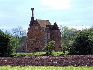
Pulloxhill Grange was a priory in Bedfordshire, England. It is a Grade II listed building. [1]
Bedfordshire is a county in the East of England. It is a ceremonial county and a historic county, covered by three unitary authorities: Bedford, Central Bedfordshire, and Luton.
England is a country that is part of the United Kingdom. It shares land borders with Wales to the west and Scotland to the north-northwest. The Irish Sea lies west of England and the Celtic Sea lies to the southwest. England is separated from continental Europe by the North Sea to the east and the English Channel to the south. The country covers five-eighths of the island of Great Britain, which lies in the North Atlantic, and includes over 100 smaller islands, such as the Isles of Scilly and the Isle of Wight.
In 1535, Dunstable Priory received from Woburn Abbey 5s. for land it held in Pulloxhill. In 1291, the value of the abbey's estates in Pulloxhill was £7 2s. 5d. In 1330, the abbey claimed sac and soc in Pulloxhill. In 1547, after the Dissolution of the monasteries, Pulloxhill Grange, was granted to Sir William Pagett. [2]
The Priory Church of St Peter with its monastery was founded in 1132 by Henry I for Augustinian Canons in Dunstable, Bedfordshire, England. St Peter’s today is only the nave of what remains of an originally much larger Augustinian priory church. The monastic buildings consisted of a dormitory for the monks, an infirmary, stables, workshops, bakehouse, brewhouse and buttery. There was also a hostel for pilgrims and travellers, the remains of which is known today as Priory House. Opposite the Priory was one of the royal palaces belonging to Henry I, known as Kingsbury.
Woburn Abbey occupying the east of the village of Woburn, Bedfordshire, England, is a country house, the family seat of the Duke of Bedford. Although it is still a family home to the current duke, it is open on specified days to visitors, along with the diverse estate surrounding it, including the historic landscape gardens and deer park, as well as more recently added attractions including Woburn Safari Park, a miniature railway and a garden/visitor centre.
Grove is a tiny village in the parish of Slapton, Buckinghamshire, England. It is on the border with Bedfordshire, just to the north of Mentmore. It is the size of some hamlets, but it is distinct as a village because it had its own parish church. The place name is fairly self-explanatory, as it means 'grove', or a copse of trees. It was recorded in the Domesday Book of 1086 as Grova, and was considered a separate village even then.
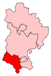
South West Bedfordshire is a constituency represented in the House of Commons of the UK Parliament. As with all constituencies of the UK Parliament, it elects one Member of Parliament by the first past the post system of election.
Mid Bedfordshire is a constituency represented in the House of Commons of the UK Parliament since 2005 by Nadine Dorries, of the Conservative Party. Apart from four early years, the constituency has returned a Conservative since its creation in 1918.
Luton North is a constituency represented in the House of Commons of the UK Parliament since 1997 by Kelvin Hopkins, elected as a member of the Labour Party. In November 2017, Hopkins was suspended from the Labour Party due to allegations of sexual misconduct, thus he currently sits as an Independent.
Beadlow Priory was a monastic foundation established between 1140 and 1146 by Robert D'Albini for a community of Benedictine monks.
Turvey Abbey is located in the village of Turvey in the English county of Bedfordshire. It is dated 1605 on the north facade and 1608 on the south facade. The building is stone, with a tile roof. A dovecote, which no longer belongs to the Abbey, is a Grade II listed building.
Amesbury Abbey was a Benedictine abbey of women at Amesbury in Wiltshire, England, founded by Queen Ælfthryth in about the year 979 on what may have been the site of an earlier monastery. That foundation was dissolved in 1177 by Henry II, who founded in its place a house of the Order of Fontevraud, known as Amesbury Priory.
The Priory of St. Andrews of the Ards (Blackabbey) was a Benedictine Abbey at Stogursey in Somerset.
Wardon or Warden Abbey, Bedfordshire, was one of the senior Cistercian houses of England, founded about 1135 from Rievaulx Abbey. It is a Grade I listed building.
Hurley Priory is a former Benedictine priory in the village of Hurley on the banks of the River Thames in the English county of Berkshire.
Dunstable Friary was a Dominican friary in Dunstable, Bedfordshire, England. It was located to the west of the Watling Street, between the present-day High Street South and the road that is called Friary Field.
Grovebury Priory, also known as La Grave or Grava was a priory in Leighton Buzzard, Bedfordshire, England. It was established in 1164 and disestablished in 1414.
Melchbourne Preceptory was a priory in Melchbourne, Bedfordshire, England. It was established in the 12th century and disestablished around 1550.
Millbrook Priory was a priory in Bedfordshire, England. It was established in 1097 and disestablished in 1143.
Priory Cottages is a 14th-century manor house and former monastic grange which had the status of a priory at Steventon in the English county of Oxfordshire.
Wanborough Grange refers to an existing late medieval barn and formerly its surrounding monastic grange in Wanborough, Surrey, England.
Pulloxhill Marsh is a 5.1 hectare biological Site of Special Scientific Interest in Pulloxhill in Bedfordshire. It was notified in 1985 under Section 28 of the Wildlife and Countryside Act 1981, and the local planning authority is Central Bedfordshire Council.
Coordinates: 51°59′40″N0°27′12″W / 51.994315°N 0.453444°W
A geographic coordinate system is a coordinate system that enables every location on Earth to be specified by a set of numbers, letters or symbols. The coordinates are often chosen such that one of the numbers represents a vertical position and two or three of the numbers represent a horizontal position; alternatively, a geographic position may be expressed in a combined three-dimensional Cartesian vector. A common choice of coordinates is latitude, longitude and elevation. To specify a location on a plane requires a map projection.
This article about a Bedfordshire building or structure is a stub. You can help Wikipedia by expanding it. |
This article about a British Christian monastery, abbey, priory or other religious house is a stub. You can help Wikipedia by expanding it. |