Pumpkinvine Creek

Last updated
Confluence of Pumpkinvine Creek and the Etowah River Confluence of Pumpkinvine Creek and Etowah rivers, April 2017.jpg
Confluence of Pumpkinvine Creek and the Etowah River

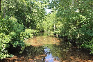
Pumpkinvine Creek is a stream in the U.S. state of Georgia. [1] It is a tributary of the Etowah River.

U.S. state constituent political entity of the United States

In the United States, a state is a constituent political entity, of which there are currently 50. Bound together in a political union, each state holds governmental jurisdiction over a separate and defined geographic territory and shares its sovereignty with the federal government. Due to this shared sovereignty, Americans are citizens both of the federal republic and of the state in which they reside. State citizenship and residency are flexible, and no government approval is required to move between states, except for persons restricted by certain types of court orders. Four states use the term commonwealth rather than state in their full official names.

Georgia (U.S. state) State of the United States of America

Georgia is a state in the Southeastern United States. It began as a British colony in 1733, the last and southernmost of the original Thirteen Colonies to be established. Named after King George II of Great Britain, the Province of Georgia covered the area from South Carolina south to Spanish Florida and west to French Louisiana at the Mississippi River. Georgia was the fourth state to ratify the United States Constitution, on January 2, 1788. In 1802–1804, western Georgia was split to the Mississippi Territory, which later split to form Alabama with part of former West Florida in 1819. Georgia declared its secession from the Union on January 19, 1861, and was one of the original seven Confederate states. It was the last state to be restored to the Union, on July 15, 1870. Georgia is the 24th largest and the 8th most populous of the 50 United States. From 2007 to 2008, 14 of Georgia's counties ranked among the nation's 100 fastest-growing, second only to Texas. Georgia is known as the Peach State and the Empire State of the South. Atlanta, the state's capital and most populous city, has been named a global city. Atlanta's metropolitan area contains about 55% of the population of the entire state.

Etowah River river in Georgia

The Etowah River is a 164-mile-long (264 km) waterway that rises northwest of Dahlonega, Georgia, north of Atlanta. On Matthew Carey's 1795 map the river was labeled "High Town River". On later maps, such as the 1839 Cass County map, it was referred to as "Hightower River", a name that was used in most early Cherokee records.

Pumpkinvine might be the English translation of a Cherokee name. [2]

See also

Related Research Articles

Noonday Creek

Noonday Creek is a 20.2-mile-long (32.5 km) stream in Cobb and Cherokee counties in the U.S. state of Georgia. The stream begins near Kennesaw Mountain and ends at Lake Allatoona.

Muckalee Creek is a creek in southwest Georgia. It originates southeast of Buena Vista and flows south-southeast for 76.3 miles (122.8 km) and into Kinchafoonee Creek north of Albany, just upstream of that creek's confluence with the Flint River.

Vickery Creek river in the United States of America

Vickery Creek is a 26.5-mile-long (42.6 km) stream in Forsyth and Fulton counties in Georgia. The creek mouth into the Chattahoochee River is located at the southern border of Roswell where State Route 9 crosses the river. Its source is located just north of the intersection of Georgia State Route 9 and Georgia State Route 20, in Forsyth County, about 1 mile directly south of downtown Cumming. People guarding waters and falls are there from when it opens to when it closes. Much of the land east of the creek and west of Grimes Bridge Road in Roswell forms the Vickery Creek unit of the Chattahoochee River National Recreation Area.

Little River (Etowah River tributary)

The Little River is a 29.3-mile-long (47.2 km) tributary of the Etowah River in the U.S. state of Georgia in the United States.

Salacoa Creek is a tributary of the Coosawattee River in Georgia, United States.

The Ellijay River is a 15.1-mile-long (24.3 km) river in Georgia. It ends in the town of Ellijay at its confluence with the Cartecay River, forming the Coosawattee River.

Little Satilla River (Satilla River) river in the United States of America

The Little Satilla River is a 28.4-mile-long (45.7 km) freshwater tributary of the Satilla River in the U.S. state of Georgia. It should not be confused with the tidal Little Satilla River that is 20 miles (32 km) to the southeast and is an inlet of the Atlantic Ocean.

Spring Creek is a 76.5-mile-long (123.1 km) tributary of the Flint River in southwest Georgia in the United States.

Willeo Creek

Willeo Creek is a 6.7-mile-long (10.8 km) stream in the U.S. state of Georgia, and is located in the north-northwestern part of metro Atlanta. It is a significant tributary of the Chattahoochee River, into which it flows at Bull Sluice Lake, just upstream from Morgan Falls Dam and downstream from the Chattahoochee Nature Center. Together, the two streams form nearly all of the county line between Fulton to the east and Cobb to the west.

Connesena Creek river in the United States of America

Connesena Creek is a stream in Bartow County, in the U.S. state of Georgia. It is a tributary to the Etowah River.

Pettit Creek river in the United States of America

Pettit Creek is a stream in Bartow County, Georgia.

Stamp Creek river in the United States of America

Stamp Creek is a stream in the U.S. state of Georgia.

Talking Rock Creek is a stream in the U.S. state of Georgia.

Baldridge Creek river in United States of America

Baldridge Creek is a stream in Forsyth County in the U.S. state of Georgia. It empties into Lake Lanier. The stream headwaters arise northeast of Coal Mountain and the stream flows southeast paralleling US 19. Previous to the creation of the lake the stream entered the Chattahoochee River at the Forsyth-Hall county line at 34°10′42″N84°04′17″W.

Amicalola Creek is a stream in the U.S. state of Georgia. It is a tributary to the Etowah River. Amicalola Falls, a tall waterfall on its course, lends its name to Amicalola Falls State Park.

Boardtown Creek is a stream in the U.S. state of Georgia. It is a tributary to the Ellijay River.

Canton Creek is a stream in the U.S. state of Georgia. It is a tributary to the Etowah River.

Cooper Creek is a stream in the U.S. state of Georgia. It is a tributary to the Toccoa River.

Drowning Bear Creek is a stream in the U.S. state of Georgia. It is a tributary to the Conasauga River.

Walnut Creek is a 30-mile-long (48 km) tributary of the South River in the U.S. state of Georgia. It originates in the city of Hampton in Henry County and flows into South River, which is a branch of the Ocmulgee River.

References

  1. U.S. Geological Survey Geographic Names Information System: Pumpkinvine Creek
  2. "Bartow County". Calhoun Times. September 1, 2004. p. 24. Retrieved 24 April 2015.

Coordinates: 34°07′26″N84°48′12″W / 34.12389°N 84.80333°W / 34.12389; -84.80333

Geographic coordinate system Coordinate system

A geographic coordinate system is a coordinate system that enables every location on Earth to be specified by a set of numbers, letters or symbols. The coordinates are often chosen such that one of the numbers represents a vertical position and two or three of the numbers represent a horizontal position; alternatively, a geographic position may be expressed in a combined three-dimensional Cartesian vector. A common choice of coordinates is latitude, longitude and elevation. To specify a location on a plane requires a map projection.