Related Research Articles
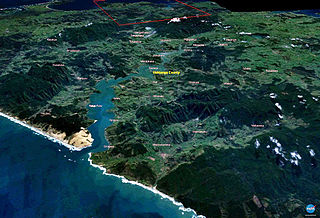
The Hokianga is an area surrounding the Hokianga Harbour, also known as the Hokianga River, a long estuarine drowned valley on the west coast in the north of the North Island of New Zealand.
The Maungataniwha Range is a volcanic mountain range located in Northland Region of New Zealand. The Mangamukas, as it is known by the local residents and many Northlanders because of the name of the settlement and river on the southern side, separates Kaitaia and the Aupouri Peninsula from the rest of Northland. The highest point in the Maungataniwha Ranges is Raetea at 744m. The range is home to many kauri trees and part of the range is a part of Northland Forest Park.
Mangamuka is a district in Northland, New Zealand, at the junction of the Mangamuka and Opurehu Rivers. State Highway 1 runs through the area, and the settlement of Mangamuka Bridge lies at the point where the highway crosses the Mangamuku River. The river runs into the upper Hokianga Harbour. Just to the north west, the highway runs through Mangamuka Gorge in the Maungataniwha Range. Umawera lies to the south east.
Waimā is a community in the south Hokianga area of Northland, New Zealand. State Highway 12 runs through the area. The Waima River flows through the Waima Valley into the Hokianga Harbour. Rawene is to the north west, and Kaikohe is to the north east.
The Castaly River is a river of New Zealand. It is in north Canterbury, northwest of the township of Parnassus, and flows generally east for 8 kilometres (5 mi) before joining the Leader River, itself a tributary of the Waiau River.
The Goulter River is a river in the Marlborough region of New Zealand. It rises in the Richmond Range near Lake Chalice. The lake was formed by a landslip about 2000 years ago, which dammed the river. The lake has no outlet, but water seeps through the landslip rubble into the Goulter. The river flows counter-clockwise around Mount Patriarch to join the Wairau River.
The Mowamba River, a perennial river of the Snowy River catchment, is located in the Snowy Mountains region of New South Wales, Australia.
The Manawapou River is a river of the Taranaki Region of New Zealand's North Island. It flows southwest, from its origins in rough hill country to the northeast of Hāwera, to reach the South Taranaki Bight between Hāwera and Patea.
The Marchburn River is a river of Marlborough Region, New Zealand.
The Mason River is a river of the north Canterbury region of New Zealand's South Island. It flows south from the Amuri Range, at the foot of the Mason Hills before turning southwest to reach the Waiau River just to the west of the township of Waiau.
The Ohuri River is a river of the Northland Region of New Zealand. It flows north to reach the Waima River five kilometres southeast of Rawene.
The Omanaia River is a river of the Northland Region of New Zealand's North Island. It flows northwest from the Waima Forest, first as a stream and then as a silty arm of the Hokianga Harbour. The township of Rawene stands at the point where the river meets the main waters of the harbour.
The Opouteke River is a river of the Northland Region of New Zealand's North Island. It flows generally east, reaching the Mangakahia River just north of Pakotai and 30 kilometres north of Dargaville.
The Otaua River is a river of the Northland Region of New Zealand's North Island. It is a tributary of the Punakitere River, which it reaches 5 kilometres (3 mi) south of the latter's outflow into the Waima River
The Towy River is a river of the north Canterbury region of New Zealand's South Island. It flows generally east from its origins in the Amuri Range to reach the Charwell River 25 kilometres (16 mi) northeast of Waiau.
The Tummil River is a river of the Marlborough Region of New Zealand's South Island. It flows northwest from rough hill country north of Mount Horrible to reach the Avon River southwest of Blenheim.
The Waikākaho River is a river of the Marlborough Region of New Zealand's South Island. It flows south from its sources southeast of Havelock to reach the Wairau River 5 kilometres (3 mi) west of Tuamarina.

The Bryant Range is a range of low mountains in the northern South Island of New Zealand. They form part of the boundary of the Nelson and Tasman Districts with Marlborough Region, as well as forming the western boundary of Mount Richmond Forest Park The range is traversed by State Highway 6 at the Rai Saddle close to its northern end.
The Paranui River is a river of the Northland Region of New Zealand's North Island. It flows north from its sources around Paranui to reach the Taipa River 5 kilometres (3 mi) from Taipa.
Taheke or Tāheke is a village and rural community in the Far North District and Northland Region of New Zealand's North Island. It is located west of Kaikohe and east of Waima on State Highway 12.
References
"Place name detail: Punakitere River". New Zealand Gazetteer. New Zealand Geographic Board . Retrieved 12 July 2009.
35°27′S173°39′E / 35.450°S 173.650°E