Qafë Prush | |
---|---|
![]() Aerial view of December 2017 | |
Traversed by | SH23 |
Location | Albania–Kosovo border |
Range | List of mountains in Albania |
Coordinates | 42°18′52″N20°22′57″E / 42.31444°N 20.38250°E |
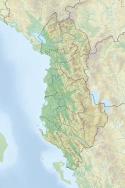
![]() |
Qafa e Prushit is a mountain pass [1] through the Albanian mountains along the border between Albania and Kosovo. A border crossing point is present here.
Kukës is a city in the Republic of Albania. The city is the capital of the surrounding municipality of Kukës and county of Kukës, one of 12 constituent counties of the republic. It spans 8.2 square kilometres (3.2 sq mi) and had a total population of 16,719 people as of 2011.
Dajti is a mountain located in central Albania, just east of the capital, Tirana. Part of the Skanderbeg Mountains range, it stretches from Shkalla e Tujanit in the northwest to Qafa e Priskës in the southeast, at a length of 8 km (5.0 mi) and a width of 5 km (3.1 mi). Its highest peak, Maja e Dajtit, reaches a height of 1,613 m (5,292 ft). Other peaks include Maja e Cem Rrumit 1,571 m (5,154 ft) and Maja e Tujanit 1,531 m (5,023 ft).
The Accursed Mountains, also known as the Albanian Alps, is a mountain range in coastal Southeast Europe adjacent to the Adriatic Sea. It is the southernmost subrange of the 1,000-kilometre-long (621 mi) Dinaric Alps range (Dinarides), extending from northern Albania to southern Kosovo and northeastern Montenegro. Maja Jezercë, standing at 2,694 m (8,839 ft), is the highest point of the Accursed Mountains and of all Dinaric Alps, and the fifth highest peak in Albania. The range includes the mountain Zla Kolata, which, at 2,534 m (8,314 ft), is the tallest mountain in Montenegro. The range also includes the mountain Gjeravica, which, at 2,656 m (8,714 ft), is the second tallest mountain in Kosovo. One of the southernmost glacial masses in Europe was discovered in the Albanian part of the range in 2009.
Radika is a river in southern Kosovo and western North Macedonia, a 70 km (43 mi)-long right tributary to the Black Drin river.
Qafë Thanë is a mountain pass on the shores of Lake Ohrid in Albania. It is located in the southeastern Albanian mountains, close to the border between Albania and North Macedonia. The border crossing point between the two countries is also named Qafë Thanë, and is a "primary gateway" between the two countries.
The 41st Infantry Division "Firenze" was an infantry division of the Royal Italian Army during World War II. The Firenze was formed on 15 September 1939 in Florence and named for the city. The division recruited primarily in Tuscany. After the announcement of the Armistice of Cassibile on 8 September 1943 the division resisted German attempts to disbanded it and on 28 September 1943 the division dissolved itself and formed partisan formations, which joined the Albanian National Liberation Army.
Tërbaç is a community in the Vlorë County, southwestern Albania. At the 2015 local government reform it became part of the municipality Himarë.
The Kabashi are an Albanian tribe, or fis, from the Pukë region. It is considered part of the "seven tribes of Puka" that inhabit the region. Durham said of them: "Puka group ... sometimes reckoned a large tribe of seven bairaks. Sometimes as a group of tribes".
Dhëmbel is a massif situated on the border between Gjirokastër and Përmet municipalities, in southern Albania. Part of the Trebeshinë-Dhëmbel-Nemërçkë mountain range, it rises at an elevation of 2,050.7 m (6,728 ft) and stretches approximately 10–12 km (6.2–7.5 mi) from Gryka e Këlcyrës in the north to Qafa e Dhëmbelit in the south.
Lumë is a region that extends itself in northeastern Albania and southwest Kosovo whose territory is synonymous with the historic Albanian tribe (fis) of the same name. It includes the village with the same name, Lumë, which is located in Albania. Luma is surrounded by Has region, Fan and Orosh (west), Reçi and M’Ujë e m’Uja, Upper Reka, Gora (east), Opoja and Vërrini of Prizren. The region itself also includes the small Arrëni tribe in the west and the Morina tribe in the east.
Maja e Thatë is a 2,406-metre-high (7,894 ft) mountain peak of the Albanian Alps in Albania. It is located within Valbonë Valley National Park, roughly 2 km (1 mi) northwest of Valbonë and rises more than 1,500 m (4,921 ft) above the village. The mountain's southern and western lower slopes are relatively rich in beech and pine forests, while the higher slopes consist of very steep dolomite and limestone rock walls, suitable for mountaineering and rock climbing.
Qafë e Vranicës is a mountain pass through the Albanian mountains along the border between Albania and Montenegro. A new border crossing point between the two countries is planned to be open at the pass.
Qafa e Morinës is a mountain pass through the Albanian mountains along the border between Albania and Kosovo. There is a border crossing point here between the two countries.
The Llogara Pass ; is a high mountain pass within the Ceraunian Mountains along the Albanian Riviera. It connects the Dukat Valley in the north with Himarë in the south. Orikum is the nearest city on the northern side of the pass and the village of Dhërmi in the south.
Mali i Gjerë is a massif located between the municipalities of Sarandë and Gjirokastër, in southern Albania. It constitutes the watershed boundary of the Delvina basin and the Drino valley as well as the waters that flow into the Adriatic and Ionian seas. The highest point is Maja e Frashërit, reaching a height of 1,789 m (5,869 ft). Other peaks include Maja e Kikshajt 1,782 m (5,846 ft), Maja e Nikollasit 1,584 m (5,197 ft), Maja e Bidos 1,543 m (5,062 ft), Maja e Pilloit 1,592 m (5,223 ft), etc.
The National Road 6 leads from Milot to Peshkopi.
The Bualli Pass is an 842 metre high mountain pass in Albania. It is part of the National Road 6, which links the Albanian coast to Mat District and the Dibër valley. The west end of the pass is in the watershed of the Mat river and the eastern part is in the watershed of the Drin. Immediately east of the highest point of the pass is the town of Bulqizë.
Kollata is a massif in the Albanian Alps, located between Kukaj stream and Valbonë pass in the west, the upper Valbonë Valley in the south, Cerem basin in the east and extending beyond the state border with Montenegro to the north. Its highest peak, Maja e Kollatës, reaches a height of 2,553 m (8,376 ft). On the Montenegrin side rise two smaller peaks that overlap into the Albanian territory, Zla Kolata 2,535 m (8,317 ft) and Dobra Kolata 2,525 m (8,284 ft).
Nemërçka is a mountain chain situated along the boundary between Gjirokastër and Përmet municipalities, in southern Albania and northern Greece. Part of the Trebeshinë-Dhëmbel-Nemërçkë mountain range, its highest peak, Maja e Papingut, reaches a height of 2,482 m (8,143 ft), making it the highest peak in the Southern Mountain Region. Other notable peaks include Maja e Gatakut 2,269 m (7,444 ft), Maja e Qesarit 2,253 m (7,392 ft), Maja e Poliçanit 2,138 m (7,014 ft), etc.
Bytyçi or Bytyqi, Bityçi and Bitiçi refers to an Albanian tribe or fis centred in the southeastern Highlands of Gjakova. The surname derived from the Albanian tribe that is found throughout Albania and Kosovo.