Bacúrov is a village and municipality of the Zvolen District in the Banská Bystrica Region of Slovakia

This is a list of the extreme points of Azerbaijan, the points that are farther north, south, east or west than any other location.

Počarová is a village and municipality in Považská Bystrica District in the Trenčín Region of north-western Slovakia.

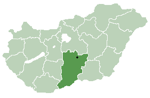
Felsőlajos is a village in Bács-Kiskun county, in the Southern Great Plain region of Hungary.

Tivadar is a village in Szabolcs-Szatmár-Bereg county, in the Northern Great Plain region of eastern Hungary.
Montanejos is a municipality in the comarca of Alto Mijares, Castellón, Valencia, Spain.

Şükürçü is a village in the Ismailli Rayon of Azerbaijan. The village forms part of the municipality of Kəlbənd.

Dərəkərkənc is a village in the Shamakhi Rayon of Azerbaijan.

Agadzhaly is a village in the Imishli Rayon of Azerbaijan.

Guseinbeyly is a village in the Imishli Rayon of Azerbaijan.
Şirvanmeşə is a village in the municipality of Topçu in the Ismailli Rayon of Azerbaijan.

Czarkowy Grąd is a village in the administrative district of Gmina Szczytno, within Szczytno County, Warmian-Masurian Voivodeship, in northern Poland. It lies approximately 8 kilometres (5 mi) south-east of Szczytno and 48 km (30 mi) south-east of the regional capital Olsztyn.

Pöide is a village in Saaremaa Parish, Saare County, on the eastern part of Saaremaa Island, Estonia.
Kakuvälja is a village in Haljala Parish, Lääne-Viru County, in northeastern Estonia.
Arumetsa is a village in Häädemeeste Parish, Pärnu County in southwestern Estonia.

Tujnica is a village in the municipality of Maglaj, Bosnia and Herzegovina.

Xankəndi is a village in the Shamakhi Rayon of Azerbaijan.
Enyovche is a village in Ardino Municipality, Kardzhali Province, southern-central Bulgaria. It covers an area of 2.015 square kilometres and in 2007 had a population of 264.
Yeniçelik is a village in the District of Vezirköprü, Samsun Province, Turkey.
Staritsa is the name of several inhabited localities in Russia.


