Queer Creek is a stream in Matanuska-Susitna Borough, Alaska, in the United States. [1] It is 4 miles (6.4 km) in length. [2]

Matanuska-Susitna Borough is a borough located in the U.S. state of Alaska.
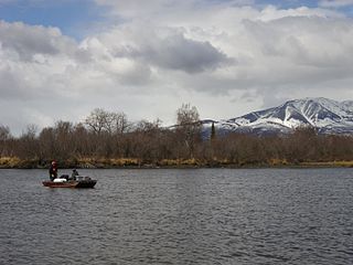
Queer Creek is a stream in Matanuska-Susitna Borough, Alaska, in the United States. [1] It is 4 miles (6.4 km) in length. [2]
Matanuska-Susitna Borough is a borough located in the U.S. state of Alaska.

Petersville is a census-designated place (CDP) in Matanuska-Susitna Borough, Alaska, United States. It is part of the Anchorage, Alaska Metropolitan Statistical Area. The population was four at the 2010 Census, down from 27 in 2000.

Alcan Border, also known as Port Alcan, is a census-designated place in the Southeast Fairbanks Census Area in the U.S. state of Alaska. Part of the Unorganized Borough, Alcan Border is the site of the Alcan - Beaver Creek Border Crossing, the main U.S. port of entry for persons arriving in Alaska by road. The population was 33 at the 2010 census, up from 21 in 2000.

The Yentna River is a river in South Central Alaska, formed by its East Fork and West Fork at 62°16′50″N151°46′26″W, flows South-East to Susitna River, 30 miles (48 km) North-West of Anchorage, Alaska; Cook Inlet Low.

Birch Creek is a 150-mile (240 km) tributary of the Yukon River in the U.S. state of Alaska. Beginning at the confluence of Ptarmigan and Eagle creeks near Porcupine Dome, it flows southwest, then south under the Steese Highway and into the Steese National Conservation Area. It then turns east, then north, again passing under the Steese Highway and entering the Yukon Flats National Wildlife Refuge. Turning northwest, it ends where it splits into two distributaries, Lower Mouth Birch Creek and Upper Mouth Birch Creek, near Birch Creek, Alaska. The distributaries flow into the Yukon River at separate locations downstream of Fort Yukon.

Riverside Gardens is a neighborhood of Louisville, Kentucky centered along Campground Road and Lees Lane. In 2007, the first stretch of the proposed 110-mile Louisville Loop bike and pedestrian trail was completed to Lees Lane in Riverside Gardens from Riverview Park. The project included a $2 million bridge over Mill Creek. The concrete trail is expected to be connected to Shawnee Park by spring of 2008. In the future, a wharf and riverfront park is planned for Riverside Gardens.

The Augustine Band of Cahuilla Indians is a federally recognized Cahuilla band of Native Americans based in Coachella, California. They are one of the smallest tribal nation in the United States, consisting of only eight members, only one of whom is an adult. As of the 2010 census, the tribe had expanded its members to eleven.
Alexander Creek, also known as Taguntna Creek, is a stream from Alexander Lake which merges with the big Susitna River near the village of Alexander Creek, Alaska also known as Alexander, Alaska, an Alaska Native and Alaska Bush community, in Matanuska-Susitna Borough, Alaska.

Potts Creek is an unincorporated community in Alleghany County, Virginia, United States. It is also the name of a watercourse in the same area, Potts Creek (watercourse). It is located about 1 mile north of the Craig County line, 6 miles north of Paint Bank, and 18 miles south of Covington all via Virginia State Route 18.

Prospect Creek is a very small settlement approximately 180 miles (290 km) north of present-day Fairbanks and 25 miles (40 km) southeast of present-day Bettles, Alaska. Years ago it was home to numerous mining expeditions and the camp for the building of the Trans-Alaska Pipeline System (TAPS). Today, it is the location of Pump Station 5 of the TAPS. Prospect Creek is also home to the United States record for lowest temperature. On January 23, 1971 the record low temperature of −79.8 °F (−62.1 °C) was recorded. Wildlife can be found there even with its extreme changes in temperature; local fauna include anything from black and brown bears to bald eagles. The elevation of Prospect Creek is 643 feet (196 m) above sea level. Nearby Moore Creek is widely known for its gold and quartz mining and sits alongside Prospect Creek in Alaska’s Innoko Mining District. The Innoko Mining District is famous for its findings of large quartz.

Isabel Pass is a gap in the eastern section of the Alaska Range which serves as a corridor for the Richardson Highway about 11 miles from Paxson.

Delphos is an unincorporated community in Colusa County, California. It lies at an elevation of 75 feet. The community developed along the Southern Pacific Railroad.
Payne's Creek is a 33.7-mile-long (54.2 km) natural watercourse in Tehama County, California. The creek was apparently originally called Paines Creek according to an 1879 land survey map of the area. The town of Paynes Creek was named after the creek. The creek most likely was named after James S. Payne, the proprietor of a local sawmill.
Long Branch is an unincorporated community in Caroline County, in the U.S. state of Virginia.
The Nippersink Creek flows for 23 miles in the Illinois River / Fox River watershed, mostly in McHenry County, Illinois, but enters the Fox river / Chain O'Lakes in Lake County, Illinois.
Another River is a stream in Kenai Peninsula Borough, Alaska, in the United States.
Atlasta Creek is a stream in Valdez–Cordova Census Area, Alaska, in the United States.
Jacumba Valley is a valley in San Diego County, California. Its head is at 32°37′00″N116°10′07″W Carrizo Creek has its source in Jacumba Valley, 1.2 miles north of the California-Mexico State boundary, at 32°38′09″N116°07′05″W at an elevation of 3,210 feet, on the west side of the divide between Jacumba Valley and the valley of upper Boulder Creek. Carrizo Creek flows west then north northwest through Jacumba Valley to its mouth at the head of Carrizo Gorge.
Boulder Creek is a 5 mile long tributary stream of Myer Creek in Imperial County, California. It has its source at 32°37′39″N116°05′59″W. The mouth of Boulder Creek is at its confluence with Myer Creek at an elevation of 1,775 feet / 541 meters in In-Ko-Pah Gorge.
The Chulitna River is a 110 km long right tributary of the Susitna River in southern part of interior Alaska. Three forks converge to form the river, which itself flows into the Susitna River near Talkeetna.
Coordinates: 62°11′25″N150°11′15″W / 62.19028°N 150.18750°W

A geographic coordinate system is a coordinate system that enables every location on Earth to be specified by a set of numbers, letters or symbols. The coordinates are often chosen such that one of the numbers represents a vertical position and two or three of the numbers represent a horizontal position; alternatively, a geographic position may be expressed in a combined three-dimensional Cartesian vector. A common choice of coordinates is latitude, longitude and elevation. To specify a location on a plane requires a map projection.
| This article related to a river in Alaska is a stub. You can help Wikipedia by expanding it. |