| Quizer River | |
|---|---|
 | |
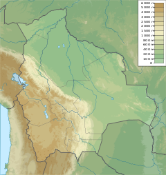 | |
| Location | |
| Country | Bolivia |
The Quizer River is a river of Bolivia.
| Quizer River | |
|---|---|
| | |
| | |
| Location | |
| Country | Bolivia |
The Quizer River is a river of Bolivia.

Bolivia, officially the Plurinational State of Bolivia, is a landlocked country located in western-central South America. It is bordered by Brazil to the north and east, Paraguay to the southeast, Argentina to the south, Chile to the southwest and Peru to the west. The seat of government and executive capital is La Paz, while the constitutional capital is Sucre. The largest city and principal industrial center is Santa Cruz de la Sierra, located on the Llanos Orientales, a mostly flat region in the east of the country.

The Amazon river dolphin, also known as the boto, bufeo or pink river dolphin, is a species of toothed whale which is native to and is exclusively of South America classified in the family Iniidae. Three subspecies are currently recognized: I. g. geoffrensis, I. g. boliviensis and I. g. humboldtiana while position of Araguaian river dolphin within the clade is still unclear. The three subspecies are distributed in the Amazon basin, the upper Madeira River in Bolivia, and the Orinoco basin, respectively.

Santa Cruz is the largest of the nine constituent departments of Bolivia, occupying about one-third (33.74%) of the country's territory. With an area of 370,621 km2 (143,098 sq mi), it is slightly smaller than Japan or the US state of Montana. It is located in the eastern part of the country, sharing borders in the north and east with Brazil and with Paraguay in the south.
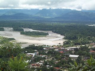
Chapare (Spanish: [t͡ʃaˈpa.ɾe], also called The Chapare, is a rural province in the northern region of Cochabamba Department in central Bolivia. The majority of the territory consists of valley rainforests that surround the area's main waterway, the Chapare River, which is also a tributary of the Amazon River. The provincial capital is Sacaba, 11 km east of Cochabamba. Its principal town is Villa Tunari, a popular tourist destination.
The Communist Party of Bolivia is a communist party in Bolivia. It was founded in 1950 by Raúl Ruiz González and other former members of the Revolutionary Left Party (PIR). It remained small and did not hold its first national party congress until 1959.

The Beni River is a river in the north of Bolivia.

Los Andes is one of the twenty provinces in the central parts of the Bolivian La Paz Department. The province was legally founded on November 24, 1917, during the presidency of José Gutiérrez Guerra. The Spanish name of the province means "The Andes", referring to its position within the Cordillera Real which is part of the Bolivian Andes mountain range. The capital of the province is Pucarani, which has a population of 918 as of the 2001 census. Pucarani is situated in the Altiplano west of the Cordillera Real offering a view of some of its highest mountains such as Ch'iyar Juqhu, Chachakumani, Kunturiri, Wayna Potosí and Chacaltaya.

Omasuyos or Uma Suyu is a province in the La Paz Department in Bolivia. Its capital is Achacachi.

Bernardino Bilbao is a province in the Northern parts of the Bolivian department of Potosí. It has its name after Bernardino Bilbao Rioja, Bolivian general and politician.
Villa Tunari or Tunari is a location in the department of Cochabamba, Bolivia. It is the seat of the Villa Tunari Municipality, the third municipal section of the Chapare Province. According to the census 2012 the population was 3,213 in the town which is an increment from 2,510 registered during the 2001 census.

Guaporé River is a river in western Brazil and northeastern Bolivia. It is 1,260 km (780 mi) long; 920 km (570 mi) of the river forms the border between Brazil and Bolivia.
Pomabamba is the largest of 4 districts in the Pomabamba Province of the Ancash Region in Peru.
The Ferguson River originates on the eastern bank of Ferguson Lake within the northern Hearne Domain, Western Churchill province of the Churchill craton, the northwest section of the Canadian Shield in Nunavut's Kivalliq Region.

Desaguadero Municipality is the fourth municipal section of Ingavi Province in La Paz Department, Bolivia. Its capital is Desaguadero.
The Río Blanco (Bolivia) is a river of Bolivia.

Quime Municipality is the second municipal section of the Inquisivi Province in the La Paz Department in Bolivia, located south-east of the city of La Paz. Its seat is Quime. The coordinates are 16° 59' 0" South, 67° 13' 0".
Baures Municipality is a municipality of the Beni Department, Bolivia.
San Ramón Municipality is a municipality of the Beni Department, Bolivia.

Santa Victoria Oeste is a municipality and head of the Santa Victoria Department, at the northwest corner of the province of Salta, Argentina, between mountains and valleys on the border with the Plurinational State of Bolivia, 540 km from the city of Salta.
Qunchupata is an archaeological zone in Peru. It is located in the Ayacucho Region, Huamanga Province, Ayacucho District. The site was declared a National Cultural Heritage (Patrimonio Cultural) of Peru by Resolución Directional Nacional No. 458-98-INC on December 15, 1998.
Coordinates: 16°28′32″S62°28′09″W / 16.47544°S 62.46927°W