Qurayyat Salim | |
|---|---|
  Qurayyat Salim Location in Jordan | |
| Coordinates: 31°51′N35°58′E / 31.850°N 35.967°E | |
| Country |  Jordan Jordan |
| Governorate | Amman Governorate |
| Time zone | UTC + 2 |
Qurayyat Salim is a town in the Amman Governorate of north-western Jordan. [1]
Qurayyat Salim | |
|---|---|
| Qurayyat Salim Location in Jordan | |
| Coordinates: 31°51′N35°58′E / 31.850°N 35.967°E | |
| Country | Jordan |
| Governorate | Amman Governorate |
| Time zone | UTC + 2 |
Qurayyat Salim is a town in the Amman Governorate of north-western Jordan. [1]
In Qurayyat Salim, there is a local steppe climate. Most rain falls in the winter. The Köppen-Geiger climate classification is BSk. The average annual temperature in Qurayyat Salim is 16.2 °C (61.2 °F). About 289 mm (11.38 in) of precipitation falls annually.
| Climate data for Qurayyat Salim | |||||||||||||
|---|---|---|---|---|---|---|---|---|---|---|---|---|---|
| Month | Jan | Feb | Mar | Apr | May | Jun | Jul | Aug | Sep | Oct | Nov | Dec | Year |
| Mean daily maximum °C (°F) | 11.5 (52.7) | 13.1 (55.6) | 16.2 (61.2) | 21.9 (71.4) | 26.7 (80.1) | 29.3 (84.7) | 30.6 (87.1) | 30.9 (87.6) | 29.7 (85.5) | 26.3 (79.3) | 19.6 (67.3) | 13.4 (56.1) | 22.4 (72.4) |
| Mean daily minimum °C (°F) | 2.7 (36.9) | 3.5 (38.3) | 5.4 (41.7) | 8.6 (47.5) | 12.0 (53.6) | 14.8 (58.6) | 16.7 (62.1) | 16.8 (62.2) | 15.0 (59.0) | 12.2 (54.0) | 8.3 (46.9) | 4.2 (39.6) | 10.0 (50.0) |
| Average precipitation mm (inches) | 65 (2.6) | 62 (2.4) | 54 (2.1) | 14 (0.6) | 4 (0.2) | 0 (0) | 0 (0) | 0 (0) | 0 (0) | 5 (0.2) | 27 (1.1) | 58 (2.3) | 289 (11.4) |
| Source: Climate-Data.org, Climate data | |||||||||||||

Falls Township is a suburban Philadelphia township in Bucks County, Pennsylvania, United States. The population was 34,300 at the 2010 census. Portions of Fairless Hills and Levittown, Pennsylvania, are located in the township. Portions of Falls Township are called Morrisville and Yardley, due to the location of the Morrisville Post Office outside the Borough of Morrisville in Falls Township. As originally chartered in 1692, the villages of Morrisville and Tullytown were part of Falls Township. Morrisville was granted borough status in 1804. Tullytown was established as a borough in 1891.
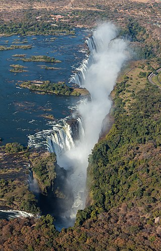
Victoria Falls is a waterfall on the Zambezi River, located on the border between Zambia and Zimbabwe. It is one of the world's largest waterfalls, with a width of 1,708 m (5,604 ft). The region around it is inhabited by several species of plants and animals.

Al-Jawf Province, also spelled Al-Jouf, is one of the provinces of Saudi Arabia, located in the north of the country, partially bordered by Jordan to the west. It is one of the earliest inhabited regions of Arabian Peninsula, with evidence of human habitation dating back to the Stone Age and the Acheulean tool culture. Human settlement continued unbroken throughout the Copper Age, a period that saw the kingdom of Qidar fight against the Assyrian state for its independence. It is also in this period that references to Arabs first appear in historical texts. A Christian kingdom later emerged under the rule of the Bani Kalb tribe and survived until the arrival of Islam and the Islamic conquest of Al-Jawf. Following the region's Islamization it fell under the control of the Tayy tribe. Al-Jawf was incorporated into the third Saudi state at the time of its formation in 1932. In the 20th century the region was a site of conflict between the Al-Rashid family and the Al-Shaalan family, though it eventually came under the rule of King Abdulaziz bin Abdul Rahman Al Saud.
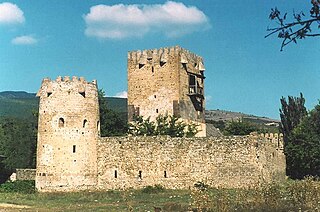
Shida Kartli is a landlocked administrative region (Mkhare) in eastern Georgia. It comprises a central part of the historical-geographic province of Shida Kartli. With an area of 5,729 square kilometres (2,212 sq mi), Shida Kartli is the 8th largest Georgian region by land area. With 284,081 inhabitants, it is Georgia's seventh-most-populous region. Shida Kartli's capital and largest city, Gori, is the 5th largest city in Georgia.

A semi-arid climate, semi-desert climate, or steppe climate is a dry climate sub-type. It is located on regions that receive precipitation below potential evapotranspiration, but not as low as a desert climate. There are different kinds of semi-arid climates, depending on variables such as temperature, and they give rise to different biomes.

Zgharta, also spelled Zghorta, is a city in North Lebanon, with an estimated population of around 50,000. It is the second biggest city in Northern Lebanon after Tripoli. Zgharta is officially the Zgharta-Ehden municipality.

Al-Seeb, As Seeb or As Sib is a coastal fishing province, located several kilometres northwest of Muscat, in northeastern Oman. At the 2020 census, it had a population of 470,878.
Turaif is a town in Northern Borders Province, Saudi Arabia, close to the border with Jordan. Turaif is located at a bend in Highway 85 as it turns west to Jordan. It is located at around 31°40′39″N38°39′11″E. As of 2010, it has a population of 48,929. The city of Turaif is one of the cities that have been established because of the presence of the Trans-Arabian Pipeline.
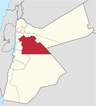
Amman Governorate, officially known as Muhafazat al-Asima, is one of the governorates in Jordan. The governorate's capital is the city of Amman, which is also the country's capital. The administrative center of the governorate as well as all government offices and parliament are located in the Abdali district.

Rolley Lake Provincial Park is a provincial park in British Columbia, Canada. It is located on Rolley Lake in the Stave Falls area of Mission, British Columbia. The area was inhabited by the Sto:lo people, homesteaded in 1888 by James and Fanny Rolley, and later used for logging operations. The park now provides campsites, use of the lake, and hiking, with an area of 115 hectares.
Qurayat is a city located in Al Jawf Province, in northern Saudi Arabia, inside the King Salman Royal Natural Reserve. It is 30 kilometres (19 mi) from border of Jordan. Qurayat had a population of 167,080 at the 2022 Census. It is a small city with a very big market. Qurayyat is known for its olives and salt.
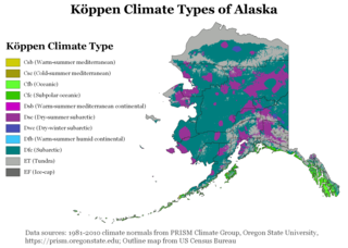
The climate of Alaska is determined by average temperatures and precipitation received statewide over many years. The extratropical storm track runs along the Aleutian Island chain, across the Alaska Peninsula, and along the coastal area of the Gulf of Alaska which exposes these parts of the state to a large majority of the storms crossing the North Pacific. The climate in Juneau and the southeast panhandle is a mid-latitude oceanic climate, in the southern sections and a subarctic oceanic climate in the northern parts. The climate in Southcentral Alaska is a subarctic climate due to its short, cool summers. The climate of the interior of Alaska is best described as extreme and is the best example of a true subarctic climate, as the highest and lowest recorded temperatures in Alaska have both occurred in the interior. The climate in the extreme north of Alaska is an Arctic climate with long, cold winters, and cool summers where snow is possible year-round.

Tropical savanna climate or tropical wet and dry climate is a tropical climate sub-type that corresponds to the Köppen climate classification categories Aw and As. The driest month has less than 60 mm (2.4 in) of precipitation and also less than mm of precipitation.

A tropical rainforest climate or equatorial climate is a tropical climate sub-type usually found within 10 to 15 degrees latitude of the equator. There are some other areas at higher latitudes, such as the coast of southeast Florida, United States, and Okinawa, Japan that fall into the tropical rainforest climate category. They experience high mean annual temperatures, small temperature ranges, and rain that falls throughout the year. Regions with this climate are typically designated Af by the Köppen climate classification. A tropical rainforest climate is typically hot, very humid, and wet with no dry season.

Qurayyat is a small fishing town 83 km southeast of Muscat, Oman, adjacent to the towns of Sur, Diman Wa Tayeen and Aamerat.
Qurayyat may refer to:
Letymvou is a village in the Paphos District of Cyprus, located 12 km north of Paphos. It's located 383m above sea level. It receives 620 mm of rainfall annually. From a transport view, Letymbou is connected with the village Kourdaka in the east with the village Pitargou in the south east and with the village Kallepia in the south west.
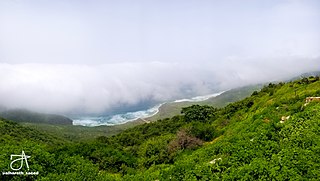
Hawf is a district of the Al Mahrah Governorate, Yemen. As of 2003, the district had a population of 5,143 inhabitants. The Hawf Area was nominated to be a natural UNESCO World Heritage Site in August 2002. Currently, it is listed as a tentative World Heritage Site. It's around 2 hours away from Omani bordering town of Sarfait and it is 180 km away from Salalah, that is one of the biggest cities of Oman.
Seoul, the capital of South Korea, features a dry-winter humid continental climate (Dwa) in the 0°C isotherm according to the Köppen climate classification. If the -3°C isotherm is used, the climate is a dry-winter humid subtropical climate (Cwa) and there are four highly distinct seasons. In summer the influence of the North Pacific high-pressure system brings hot, humid weather with temperatures soaring as high as 35 °C (95 °F) on occasion. In winter the city is topographically influenced by expanding Siberian High-pressure zones and prevailing west winds bring colder air to Korea. The bitterly cold days are commonly known to come in three-day cycles regulated by rising and falling pressure systems. The most pleasant seasons for most people in the city are spring and autumn, when azure skies and comfortable temperatures are typical. Most of Seoul's precipitation falls in the summer monsoon period between June and September, as a part of East Asian monsoon season.
Qurayyat is a Syrian village located in Jubb Ramlah Subdistrict in Masyaf District, Hama. According to the Syria Central Bureau of Statistics (CBS), Qurayyat had a population of 943 in the 2004 census. Its inhabitants are predominantly Alawites.
Capital: Amman | |||||||||||
| |||||||||||
| |||||||||||
| |||||||||||
| |||||||||||
| |||||||||||
| |||||||||||
| |||||||||||
| |||||||||||
| |||||||||||
 | This Jordanian location article is a stub. You can help Wikipedia by expanding it. |
