Quyllur Urmana

Last updated
Quyllur Urmana
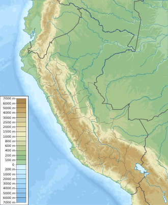
Peru physical map.svg
Red pog.svg
Quyllur Urmana
Location Peru
Cusco Region, Urubamba Province
Coordinates 13°41′20″S71°37′50″W / 13.68889°S 71.63056°W / -13.68889; -71.63056 Coordinates: 13°41′20″S71°37′50″W / 13.68889°S 71.63056°W / -13.68889; -71.63056

Quyllur Urmana (Quechua quyllur star, urmana trap [1] / urmay to fall, -na a suffix, hispanicized and mixed spellings Coyllor Urmana, Qoillur Urmana, Qoyllor Urmana, Qoyllur Urmana) is a lake in Peru located in the Cusco Region, Quispicanchi Province, Urcos District. [2] [3] [4] It lies west of Willkanuta River, between the towns Huaro (Waru) and Urcos, at the foot of the mountain Wiraqucha..
Related Research Articles

Department of Cuzco Departments of Peru

Cusco, also spelled Cuzco, is a department in Peru and is the fourth largest department in the country, after Madre de Dios, Ucayali, and Loreto. It borders the departments of Ucayali on the north; Madre de Dios and Puno on the east; Arequipa on the south; and Apurímac, Ayacucho and Junín on the west. Its capital is Cusco, the historical capital of the Inca Empire.

Quispicanchi Province Province in Cusco, Peru

Quispicanchi Province is one of thirteen provinces in the Cusco Region in the southern highlands of Peru.

Urcos District District in Cusco, Peru

The Urcos District is one of the twelve districts in the Quispicanchi Province in Peru. Created on January 2, 1857, its capital is the town of Urcos. The closest airport is the TBP Airport which is located about 13.4 km north-east of Urcos. Urcos is southeast of the former Inca capital, Cusco, in the southern Andes, and it is at an altitude of 3,180 meters.

Jomercocha (Camanti)

Jomercocha is a lake in Peru located in the Cusco Region, Quispicanchi Province, Camanti District. It is situated at a height of about 3,900 metres (12,795 ft). Jomercocha lies north of the mountain Vizcachani, near the Ajocunca.

Jolljepunco (mountain)

Jolljepunco, Colquepunco or Sasahui (sasawi) local name for Leucheria daucifolia, -ni an Aymara suffix to indicate ownership, "the one with the sasawi plant", Hispanicized Sasahuini) is a mountain in the Andes of Peru and the name of a lake near the peak. The mountain is about 5,522 metres (18,117 ft) high. It is situated in the northern extensions of the Vilcanota mountain range in the Cusco Region, Quispicanchi Province, in the districts Ccarhuayo and Ocongate and in the Paucartambo Province, Kosñipata District. Jolljepunco lies northwest of the lake Singrenacocha, southeast of Minasnioc. The lake named Jolljepunco is situated south of the mountain at 13°32′04″S71°12′29″W.

Comercocha (Ocongate)

Comercocha is a lake in Peru located in the Cusco Region, Quispicanchi Province, Ocongate District. Comercocha lies southwest of the mountain Callangate of the Vilcanota mountain range.

Jatun Pucacocha

Jatun Pucacocha is a lake in Peru located in the Cusco Region, Quispicanchi Province, Ocongate District. It is about 0.9 km long and 0.58 km at its widest point. Jatun Pucacocha lies southwest of the mountain Ausangate of the Vilcanota mountain range, between the lakes Uchuy Pucacocha in the northwest and Pucacocha in the southeast.

Cinajara

Cinajara or Sinaqara is a mountain in the Vilcanota mountain range in the Andes of Peru, about 5,471 metres (17,949 ft) high. It is situated in the Cusco Region, Quispicanchi Province, in the districts Ccarhuayo and Ocongate. Cinajara lies southwest of the Jolljepunco. The annual religious Quyllur Rit'i festival takes place at the foot of the mountains Cinajara and Jolljepunco.

Ancahuachana (Quispicanchi)

Ancahuachana or Mama Rosa is a mountain in the Vilcanota mountain range in the Andes of Peru, about 5,100 metres (16,732 ft) high. It is situated in the Cusco Region, Quispicanchi Province, in the districts of Camanti and Marcapata. Ancahuachana lies northeast of Singrenacocha and east of Colquepunco.

Waqwaqucha is a lake in Peru located in the Cusco Region, Quispicanchi Province, Quiquijana District. Waqwaqucha is situated about 10 km northeast of the town Acomayo near the villages Waqwapata and Qucha K'uchu.

Wiraqucha (Cusco)

Wiraqucha or Wiraquchan is a mountain in the Andes of Peru, about 3,600 metres (11,811 ft) high. It is situated in the Cusco Region, Quispicanchi Province, in the districts Andahuaylillas, Huaro and Urcos, south-east of the higher mountain named Quri and north-west of Huaro (Waru). The Willkanuta River flows along the mountain. The lake Quyllur Urmana lies at its feet.

Parorjo

Parorjo is a mountain in the Urubamba mountain range in the Andes of Peru. It is situated in the Cusco Region, Calca Province, Lares District. Its summit is 4,891 m (16,047 ft) high. Parorjo is situated at the Lares trek north of Chicón and Sirihuani and west of Pucaorjo. One of the nearest populated places is Quishuarani. There is a small lake at its feet named Parococha.

Huarurumicocha

Huarurumicocha is a lake in the Vilcanota mountain range in Peru. It is situated in the Cusco Region, Quispicanchi Province, Ocongate District. The lake lies north-east of the mountain Hatunuma and west of the mountain Chumpe.

Lake Armaccocha

Lake Armaccocha is a lake in the Vilcanota mountain range in Peru. It is situated in the Cusco Region, Quispicanchi Province, Ocongate District. Lake Armaccocha lies south-west of Lake Singrenacocha and north-west of Mount Callangate.

Curi (Paucartambo)

Curi is a mountain in the Cusco Region in Peru, about 4,200 metres (13,780 ft) high. It is situated in the Paucartambo Province, Caicay District, and in the Quispicanchi Province, in the districts Andahuaylillas and Urcos. Curi lies on the right bank of the Vilcanota River, north of the mountain Wiraqucha.

Minasnioc (Cusco)

Minasnioc is a 5,248-metre-high (17,218 ft) mountain in the north of the Vilcanota mountain range in the Andes of Peru. It is situated in the Cusco Region, Quispicanchi Province, in the districts Ccarhuayo and Ocongate, and in the Paucartambo Province, Kosñipata District. Minasnioc lies southeast of the lake Minascocha and northwest of the mountains Cinajara and Jolljepunco where the annual Quyllur Rit'i festival takes place.

Anta Punco

Anta Punco is mountain in the northern extensions of the Vilcanota mountain range in the Andes of Peru, about 5,000 metres (16,404 ft) high. It is located in the Cusco Region, Quispicanchi Province, Ocongate District. Anta Punco lies west of Jarjapata and southeast of Jolljepunco where the annual Quyllur Rit'i festival takes place.

Vilacirca (Peru)

Vilacirca is mountain in the northern extensions of the Vilcanota mountain range in the Andes of Peru, about 4,800 metres (15,748 ft) high. It is located in the Cusco Region, Quispicanchi Province, Ocongate District. Vilacirca lies south of Jolljepunco where the annual Quyllur Rit'i festival takes place.

Jajachaca

Jajachaca is mountain in the northern extensions of the Vilcanota mountain range in the Andes of Peru, about 4,800 metres (15,748 ft) high. It is located in the Cusco Region, Quispicanchi Province, Ocongate District. Jajachaca lies southwest of Jolljepunco and Cinajara where the annual Quyllur Rit'i festival takes place.

Yuracjaja (Cusco)

Yuracjaja is mountain in the northern extensions of the Vilcanota mountain range in the Andes of Peru, about 4,600 metres (15,092 ft) high. It is located in the Cusco Region, Quispicanchi Province, Ocongate District. Yuracjaja lies southwest of Jolljepunco and Cinajara where the annual Quyllur Rit'i festival takes place and southeast of Condorsenja and Jajachaca. Vilacirca is in the east beyond the Cinajara valley.

References

  1. Teofilo Laime Acopa, Diccionario Bilingüe, Iskay simipi yuyay k'ancha, Quechua – Castellano, Castellano – Quechua (Quechua-Spanish dictionary)
  2. escale.minedu.gob.pe - UGEL map of the Quispicanchi Province 1 (Cusco Region)
  3. mincetur.gob.pe Archived 2014-02-28 at the Wayback Machine "Laguna de Urcos" (in Spanish)
  4. Gobierno Regional del Cusco, Año de la Inversión para el Desarrollo Rural y la Seguridad Alimentaria