 | ||||
|---|---|---|---|---|
| Location | ||||
| Country | South Africa | |||
| Highway system | ||||
| ||||
The R405 is a Regional Route in South Africa. Its southern terminus is the N2 at Mount Frere in the Eastern Cape. It runs north-west to meet the R56 midway between Mount Fletcher and Matatiele. [1]
| | ||||
|---|---|---|---|---|
| Location | ||||
| Country | South Africa | |||
| Highway system | ||||
| ||||
The R405 is a Regional Route in South Africa. Its southern terminus is the N2 at Mount Frere in the Eastern Cape. It runs north-west to meet the R56 midway between Mount Fletcher and Matatiele. [1]

Mount Everest(also Mount Sagarmatha or Mount Qomolangma) is Earth's highest mountain above sea level, located in the Mahalangur Himal sub-range of the Himalayas. The China–Nepal border runs across its summit point. Its elevation of 8,848.86 m was most recently established in 2020 by the Chinese and Nepali authorities.

Washington County is a county located in the western part of the U.S. state of Maryland. The population was 154,705 as of the 2020 census, making it the most populous county in the Western Maryland region. Its county seat and largest city is Hagerstown.
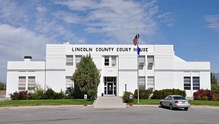
Lincoln County is a county in the U.S. state of Nevada. As of the 2020 census, the population was 4,499, making it the fourth-least populous county in Nevada. Its county seat is Pioche. Like many counties in Nevada, it is dry and sparsely populated, though notable for containing the Area 51 government Air Force base.

Mount Kilimanjaro is a dormant volcano in Tanzania. With three volcanic cones — Kibo, Mawenzi and Shira — it is the highest mountain in Africa and the highest single free-standing mountain above sea level in the world: 5,895 m (19,341 ft) above sea level and 4,900 m (16,100 ft) above its plateau base. It is also the highest volcano in the Eastern Hemisphere.

Reinhold Andreas Messner is an Italian climber, explorer, and author from the German-speaking province of South Tyrol. He made the first solo ascent of Mount Everest and, along with Peter Habeler, the first ascent of Everest without supplemental oxygen. He was the first person to climb all 14 eight-thousanders, doing so without supplementary oxygen. Messner was the first to cross Antarctica and Greenland with neither snowmobiles nor dog sleds and also crossed the Gobi Desert alone. He is widely considered to be the greatest mountaineer of all time.

Arusha City is a Tanzanian city, with a population of 617,631, and the regional capital of the Arusha Region, with a population of 2,356,255.
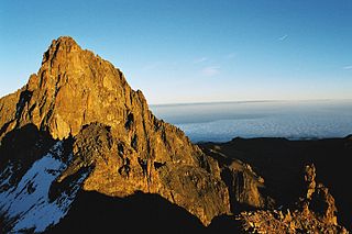
Mount Kenya is an extinct volcano in Kenya and the second-highest peak in Africa, after Kilimanjaro. The highest peaks of the mountain are Batian, Nelion and Point Lenana. Mount Kenya is located in the former Eastern and Central provinces of Kenya; its peak is now the intersection of Meru, Embu, Kirinyaga, Nyeri and Tharaka Nithi counties, about 16.5 kilometres south of the equator, around 150 km (90 mi) north-northeast of the capital Nairobi. Mount Kenya is the source of the name of the Republic of Kenya.

Mount Adams, elevation 5,793 feet (1,766 m) above sea level, is a mountain in New Hampshire, the second highest peak in the Northeast United States after its nearby neighbor, Mount Washington. Located in the northern Presidential Range, Mount Adams was named after John Adams, the second President of the United States. It was given this name on July 31, 1820. To the northeast is Mount Madison and to the southwest is Mount Jefferson. From the summit, Mount Washington can be seen directly to the south.

Mount Edgecombe or Mt Edgecombe is a town in KwaZulu-Natal, South Africa, situated just north of Durban, which forms part of eThekwini, the Greater Durban Metropolitan area. Much of the suburb is cordoned off as a gated settlement comprising resorts, golf courses and a retirement home. It was previously a sugar growing area. The population increased by 89% between 2001 and 2011 from 3,874 to 7,323. Its name is derived from Mount Edgcumbe House in Cornwall, England, the family seat of the Earls of Mount Edgcumbe.

The R102 is a Regional Route in South Africa. It is the route designation for all old sections of the N2, thus it is a discontinuous road that resumes in areas where a new N2 has been constructed.

The N2 is a national route in South Africa that runs from Cape Town through George, Gqeberha, East London, Mthatha, Port Shepstone and Durban to Ermelo. It is the main highway along the Indian Ocean coast of the country. Its current length of 2,255 kilometres (1,401 mi) makes it the longest numbered route in South Africa.

The Umvoti Mounted Rifles is an armoured regiment of the South African Army. As a reserve unit, it has a status roughly equivalent to that of a British Army Reserve or United States Army National Guard unit. It is part of the South African Army Armour Formation and is based in the town of Pinetown.
Mount Gambier Regional Airport is an airport in the Limestone Coast, South Australia.

Gardens is an affluent inner-city suburb of Cape Town located just to the south of the city centre located in the higher elevations of the "City Bowl" and directly beneath Table Mountain and Lion's Head. It is home to several national museums such as Iziko South African National Gallery and the Iziko South African Museum. The University of Cape Town also houses its Fine Arts department in the suburb, at Michaelis School of Fine Art. Company's Garden, South Africa's oldest garden, a public park and heritage site is a focal point of the suburb. The area is also home to the oldest synagogue in Southern Africa, the Old Shul and its successor, the Gardens Shul, "The Mother Synagogue of South Africa."

Mount Elsay is a mountain in southwestern British Columbia, Canada, located near the middle of Mount Seymour Provincial Park in the District of North Vancouver. It is a part of the North Shore Mountains, rising from the shores of Indian Arm to a summit of 1,419 m (4,656 ft). It is named after nearby Elsay Lake and Creek. These names are thought to derive from a Scottish settler, probably after a place name in Scotland.

The South African Railways Class 11E of 1985 is an electric locomotive.
Mount Ayliff, officially eMaxesibeni, is a small town in the Eastern Cape province of South Africa, near that province's border with KwaZulu-Natal.
Ogies is a settlement in Nkangala District Municipality in the Mpumalanga province of South Africa. It is a coal-mining town 29 km south-west of Witbank and 70 km north-east of Springs.

Belmond Mount Nelson Hotel is a luxury hotel situated in the Gardens neighbourhood in inner-city Cape Town in a garden estate overlooked by Table Mountain.

84 Motorised Brigade was a formation of 8 South African Armoured Division, a combined arms force consisting of infantry, armour and artillery.
| | This South African road or road transport-related article is a stub. You can help Wikipedia by expanding it. |