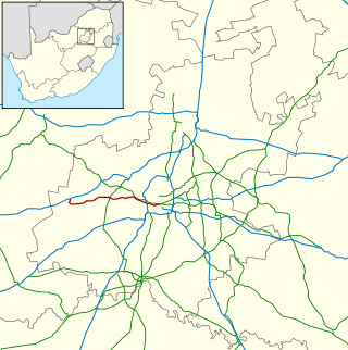
The R534 is a Regional Route in South Africa. [1]
 | ||||
|---|---|---|---|---|
| Location | ||||
| Country | South Africa | |||
| Highway system | ||||
| ||||
The R534 is a Regional Route in South Africa. [1]
| | ||||
|---|---|---|---|---|
| Location | ||||
| Country | South Africa | |||
| Highway system | ||||
| ||||
It is a scenic detour of the north-south R532 to God's Window in Mpumalanga near the town of Graskop. [1]

Cape Town is the legislative capital of South Africa. It is the country's oldest city and the seat of the Parliament of South Africa. It is the country's second-largest city, after Johannesburg, and the largest in the Western Cape. The city is part of the City of Cape Town metropolitan municipality.

South Africa is divided into nine provinces. On the eve of the 1994 general election, South Africa's former homelands, known as Bantustans, were reintegrated into the country, and the four provinces were increased to nine. The borders of Natal and the Orange Free State were retained, while the Cape Province and Transvaal were divided into three provinces each, plus North West Province which straddles the border of and contains territory from both these two former provinces. The twelfth, thirteenth and sixteenth amendments to the Constitution of South Africa changed the borders of seven of the provinces.
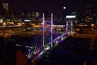
Johannesburg is the most populous city in South Africa with 4,803,262 people, and is classified as a megacity; it is one of the 100 largest urban areas in the world. It is the provincial capital of Gauteng, the wealthiest province in South Africa. Johannesburg is the seat of the Constitutional Court, the highest court in South Africa. Most of the major South African companies and banks have their head offices in Johannesburg. The city is located within the mineral-rich Witwatersrand hills, the epicentre of the international-scale mineral, gold and (specifically) diamond trade.
South African Airways (SAA) is the flag carrier of South Africa. Founded in 1934, the airline is headquartered in Airways Park at O. R. Tambo International Airport in Johannesburg and operates a hub-and-spoke network, serving 13 destinations in Africa and two intercontinental destinations to Perth, Australia and São Paulo, Brazil. The carrier joined Star Alliance in April 2006, making it the first African carrier to sign with one of the three major airline alliances.

Mount Kilimanjaro is a dormant volcano in Tanzania. With three volcanic cones — Kibo, Mawenzi and Shira — it is the highest mountain in Africa and the highest single free-standing mountain above sea level in the world: 5,895 m (19,341 ft) above sea level and 4,900 m (16,100 ft) above its plateau base. It is also the highest volcano in the Eastern Hemisphere.

The Western Cape is a province of South Africa, situated on the south-western coast of the country. It is the fourth largest of the nine provinces with an area of 129,449 square kilometres (49,981 sq mi), and the third most populous, with an estimated 7 million inhabitants in 2020. About two-thirds of these inhabitants live in the metropolitan area of Cape Town, which is also the provincial capital. The Western Cape was created in 1994 from part of the former Cape Province. The two largest cities are Cape Town and George.

Mbombela, formerly Nelspruit, is a city in northeastern South Africa. It is the capital of the Mpumalanga province. Located on the Crocodile River, the city lies about 110 km (68 mi) by road west of the Mozambique border, 330 km (210 mi) east of Johannesburg and 82 km (51 mi) north of the Eswatini border. Mbombela was one of the host cities of the 2010 FIFA World Cup.

National routes in South Africa are a class of trunk roads and freeways which connect major cities. They form the highest category in the South African route numbering scheme, and are designated with route numbers beginning with "N", from N1 to N18. Most segments of the national route network are officially proclaimed National Roads that are maintained by the South African National Roads Agency (SANRAL), but some segments are maintained by provincial or local road authorities.

The N1 is a national route in South Africa that runs from Cape Town through Bloemfontein, Johannesburg, Pretoria and Polokwane to Beit Bridge on the border with Zimbabwe. It forms the first section of the famed Cape to Cairo Road.
Inter Aviation Services (Pty) Ltd, which traded as Interair South Africa, was a privately owned airline based in Johannesburg, South Africa. It operated scheduled passenger services from Johannesburg to regional destinations in Africa. Its main base was O. R. Tambo International Airport, Johannesburg.

The R24 is a major East-West provincial route in the Gauteng and North West provinces that links OR Tambo International Airport with Rustenburg via Johannesburg, Krugersdorp and Magaliesburg. The section of the route from OR Tambo International westwards up to a point in Roodepoort is has been named Albertina Sisulu Road since 2013, named after anti-apartheid stalwart Albertina Sisulu.

The R25 is a provincial route in South Africa that connects Johannesburg with Groblersdal via Kempton Park, Bapsfontein and Bronkhorstspruit.
Regional routes are the third category of road in the South African route numbering scheme. They are designated with the letter "R" followed by a three-digit number. They serve as feeders connecting smaller towns to the national and provincial routes. Designation as a regional road does not necessarily imply any particular size of road; they range from gravel roads to multi-lane freeways.
The R41 is a provincial route in Gauteng, South Africa, that connects Johannesburg with Randfontein via Roodepoort.

The R82 is a provincial route in South Africa that connects Johannesburg with Kroonstad via Vereeniging and Sasolburg. It starts just south of the M1 Johannesburg Municipal Highway's interchange with the N12 Southern Bypass, going south, meeting the R59, R54, R42 & R28 routes at Vereeniging before crossing the Vaal River into the Free State & proceeding to Kroonstad. It is an alternative, but longer route to the N1 national route between Johannesburg & Kroonstad.

.
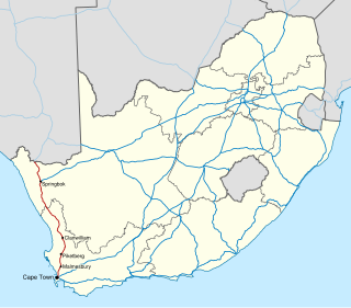
The N7 is a national route in South Africa that runs from Cape Town northwards through the West Coast and Namaqualand regions to the Namibian border at Vioolsdrif. It is known as the Cape Namibia Road. After crossing the border, it changes designation to B1 and runs north through Windhoek and the north of Namibia.

Sani Pass is a mountain pass located in the West of KwaZulu-Natal, South Africa on the road between Himeville, KwaZulu-Natal and Mokhotlong, Lesotho. The pass traverses the Great Escarpment of southern Africa in its highest region, the Drakensberg Mountains, which reach an elevation of over 3,000 meters.
Airlink, is a regional airline based in Johannesburg, South Africa. Its main business is to provide services between smaller, under-served towns and larger hub airports. It has since expanded to offer flights on larger, mainline routes. The airline has a network of more than 60 routes to over 45 destinations in Southern Africa. In January 2021, it became the second-largest carrier within Africa by number of flights, and third-largest by number of seats.

Provincial routes are the second category of road in the South African route-numbering scheme. They are designated with the letter "R" followed by a number from 21 to 82, formerly with the letter "P" followed by a number from 66. They serve as feeders to the national routes and as trunk roads in areas where there is no national route.
| | This South African road or road transport-related article is a stub. You can help Wikipedia by expanding it. |